While the work week ended with seasonal temperatures, heaters will soon be working overtime across the Washington metro area.
If you think the month has been off to a mild start, you are right. The average temperature at Reagan National Airport so far this month is 1.6 degrees above average. The warmest day was Dec. 3, topping out at 62 degrees.
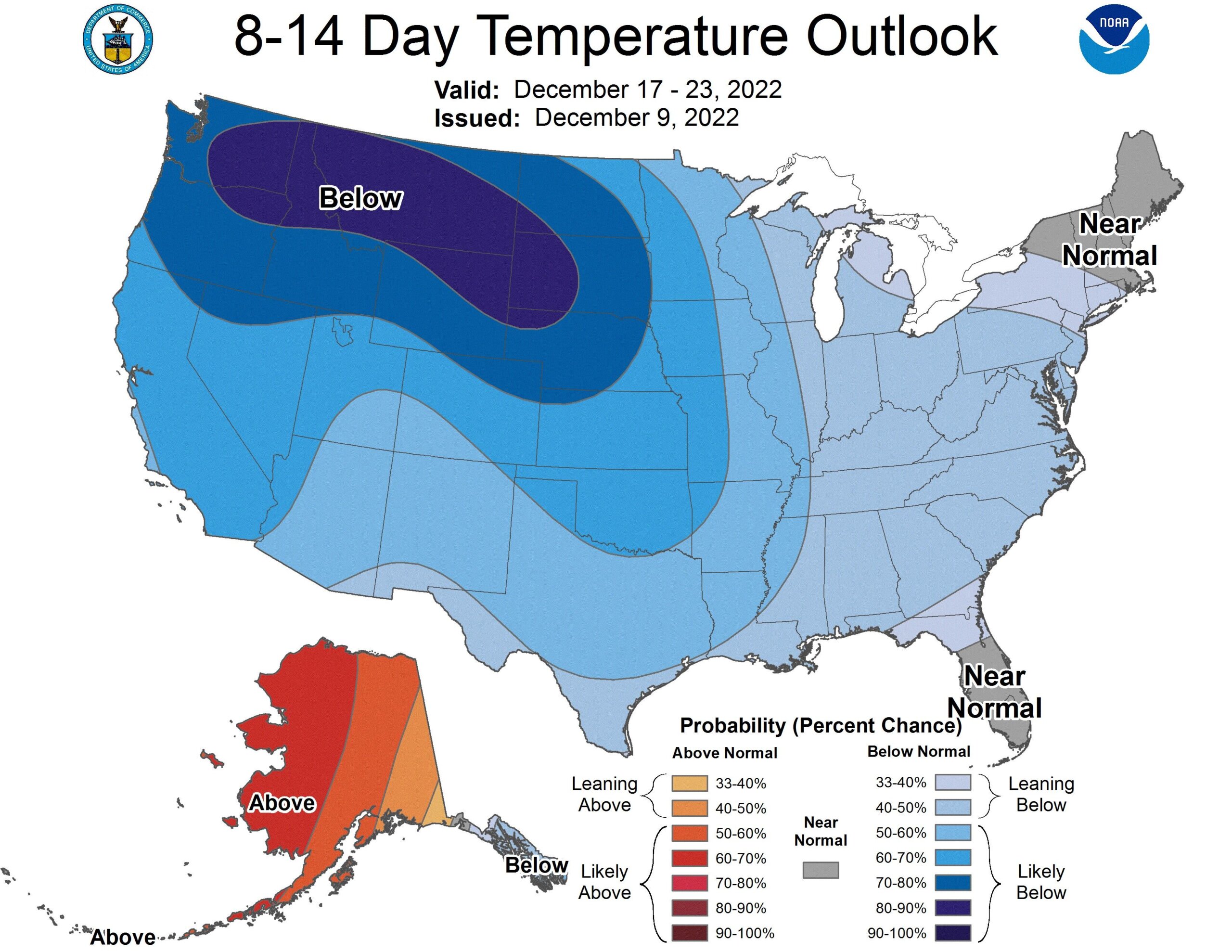
A big change in the U.S. weather pattern will unfold going into next week. The cold weather is already gripping the western U.S., and high pressure building from Greenland to Alaska will send Arctic air south and east into much of the eastern third of the nation.

The onset of the coldest weather will be marked by a late-week storm system that will chug across the U.S. and promises at least minor snow accumulation in D.C.’s suburbs late in the week, perhaps the first snow in the area.
- Listen to WTOP online and on the radio at 103.5 FM or 107.7 FM.
- Weather forecast
- Sign up for WTOP alerts
The storm will mark the change for much of the remainder of December. Temperatures in Washington will stay below average. The cold air mass in place will increase the odds for a White Christmas in many spots around the D.C. region, depending on the exact storm track.
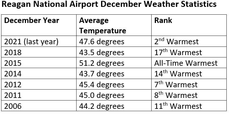
The cold second half of December is a far cry from recent very mild Decembers in Washington. Below is a list of the warmest Decembers on record, many of them occurring in the last 20 years.

In order to rank even remotely close to the coldest December on record, Washington’s average temperature will have to drop a whopping 17.9 degrees between now and New Year’s Eve. December 1989 was the coldest final month of the year in Washington, and D.C. measured 9 inches of snow that month.


