This video is no longer available.
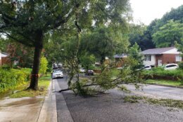
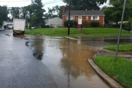
Between 1 to 4 inches of rain fell, and most of it in Prince George’s County, Maryland, causing flooding on roadways just as the D.C. area was heading home. Here’s what you need to know.
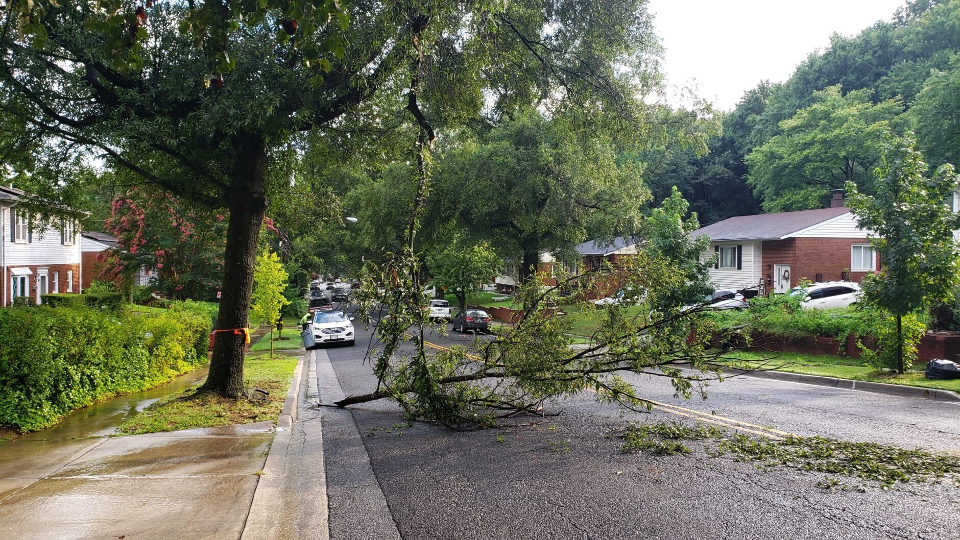
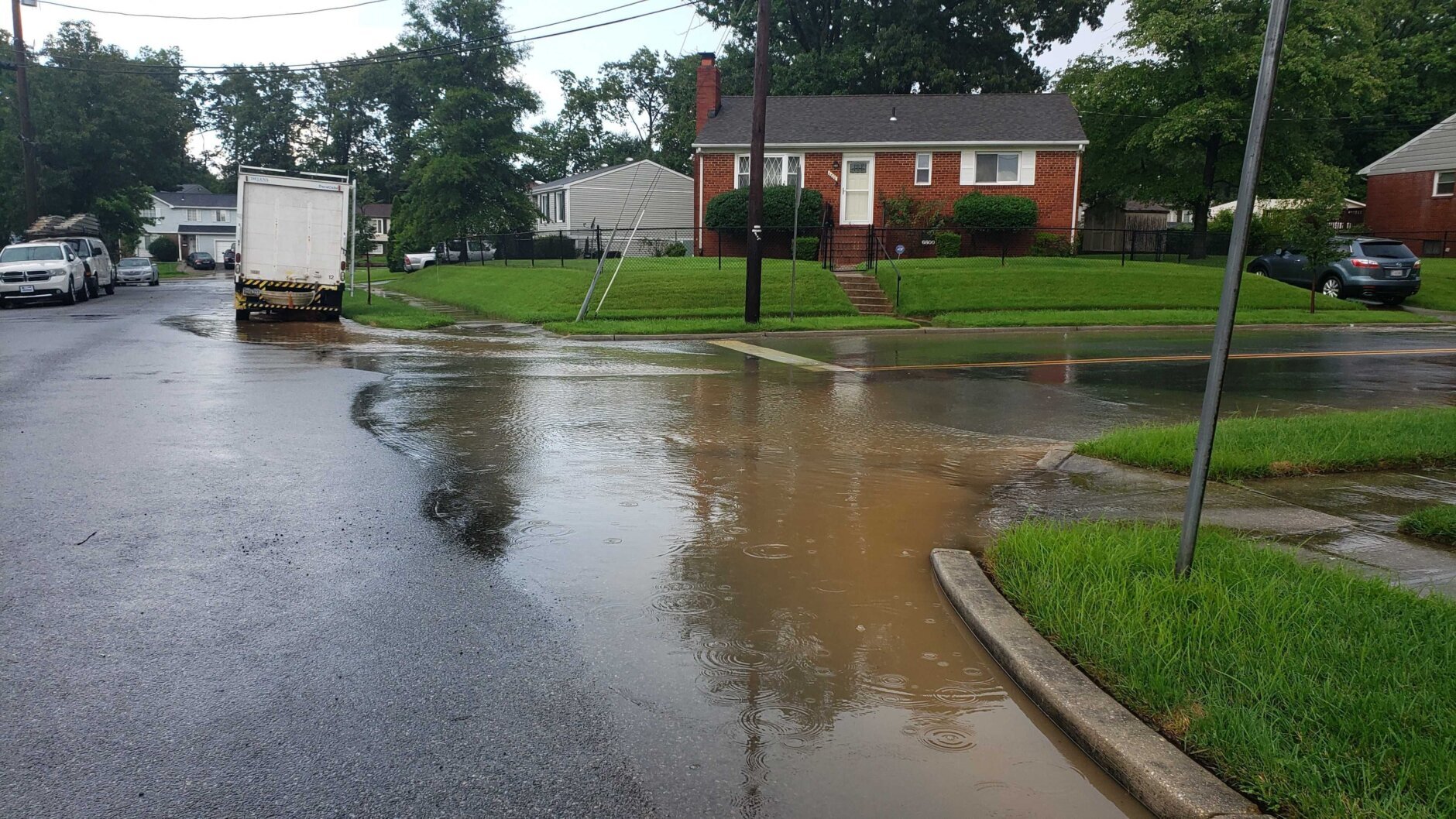
There was flash flooding reported in the Riverdale area, with rapidly rising water making the roads impassable, Storm Team4 meteorologist Ryan Miller said. The heaviest rain has moved out and flash flood warning in Prince George’s county has expired.
However earlier Monday, flash flooding was reported in east Riverdale on Kenilworth Avenue near Md. 410 and Riverdale Road.
Part of Kenilworth Avenue was flooded and impassable, WTOP Traffic Reporter Dave Dildine said. As waters receded by 6:30 p.m., the roads are now passable on Kenilworth Avenue to east Riverdale and Riverdale Park.
#PGFD units are currently responding to 2 Water Rescue calls, the first at Annapolis Rd & 71st Ave in Landover Hills & the 2nd at Kenilworth Ave & East/West HWY in Riverdale. Please do not drive your vehicle into standing or flood water. #TurnAroundDontDrown pic.twitter.com/Ee3m5HS4GW
— Prince George’s County Fire/EMS Department (@PGFDNews) August 8, 2022
Prince George’s County Fire/EMS reported several water rescues Monday afternoon. Prince George’s County police were on the scene for traffic control.
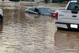
WTOP’s Kyle Cooper spoke to a woman who tried to move her car in a parking lot, which had started to flood, near the Crestwood Medical Building in Riverdale. She got stuck, but luckily, another person pulled her out. Then, she and her rescuer rescued another person who also got stuck inside her car.
Cooper said the water in the parking lot reached some 4 to 5 feet, submerging some vehicles and making some of them float away.
The earlier forecast of sizzling weather also prompted D.C. to activate its Heat Emergency Plan, and residents were encouraged to stay indoors during the afternoon. They could also head down to District cooling centers.


- Listen to WTOP online and on the radio at 103.5 FM or 107.7 FM.
- Current traffic conditions
- Weather forecast
- Sign up for WTOP alerts
Highs for Monday sat around 88 to 94 degrees.
Showers continue to slowly move eastward across our area but will dissipate as we go into tonight. Low temperatures across the area will range from the upper 60s in the mountains to the upper 70s for the metro areas and along the bay. #VAwx #MDwx #WVwx #DCwx pic.twitter.com/mHNDss0xUG
— NWS Baltimore-Washington (@NWS_BaltWash) August 7, 2022
Storm Team4 meteorologist Chuck Bell said he expects the hot weather and storm chances to linger through the middle of the week.
“Widespread severe weather is not expected but … it’s important to remember that every thunderstorm poses at least some risk,” Bell said.
Though Tuesday also provides for high temperatures and storm chances, Wednesday will bring storms with the potential for heavy rain.
Bell said some areas may see between an inch and an inch-and-a-half of rain, that could lead to some flooding, Bell said.
A stretch of cooler, less humid weather is expected to make its way to the D.C. area by Thursday, however, but it isn’t expected to stay stable for too long.
“It’s getting to be ‘that’ time of the year. The statistical peak of hurricane season is around Sept. 10, so there is a long time left in hurricane season,” Bell said.
Forecast:
TUESDAY: Hot and humid with a heat index near 100. Strong afternoon storms possible. Highs in the low to mid 90s.
WEDNESDAY: Mostly cloudy and cooler with rain and thunder likely. Localized heavy rain possible. Highs in the 80s.
THURSDAY: Morning clouds and showers clearing by the afternoon, turning less humid. Highs in the 80s.