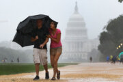
Calls to seek shelter were issued to the D.C. area Thursday following strong storms that brought damaging wind gusts, hail and the risk of tornadoes. Here’s what you need to know.
The National Weather Service issued tornado warnings for parts of D.C., Maryland and Virginia. A tornado has not been confirmed, but a video shows strong swirling winds in the Tysons Corner area. (Editor’s note: The video contains profanity.)
If you like in Fairfax County, there is a likely tornado moving from fair oaks almost along VALE ROAD and will impact VIENNA WOLF TRAP AND TYSONS CORNER. Seek shelter pic.twitter.com/typfMuvAOd
— Ryan Miller (@RyanMiller_WX) April 1, 2022
Metrorail was single-tracking Thursday night between the McLean and Tysons Corner stations due to a track obstruction. A Metro spokesperson said a ceiling tile blew off and is on the track. The spokesperson said there were minimal delays expected.
Reports of damages to two gas stations on Chain Bridge Road showed damage on the roof and some debris.
Tysons Mobil and Sunoco on Chain Bridge Rd. took a direct hit. No injuries. Roof of Sunoco was partially unmoored. pic.twitter.com/AHumJYTk5d
— Christopher (@RealPotatus) April 1, 2022
There have been no reports of injuries, so far, NBC Washington reported.
On Thursday afternoon, storms created challenges for motorists, as well.
“Fallen trees have blocked several roads today, including Georgetown Pike near Scotts Run, River Road east of Goldsboro Road, and the Clara Barton Parkway near the Chain Bridge,” WTOP traffic reporter Dave Dildine said.
- Listen to WTOP online and on the radio at 103.5 FM or 107.7 FM.
- Current traffic conditions
- Weather forecast
- Closings and Delays
- Sign up for WTOP alerts
A line of thunderstorms started along the Interstate 81 corridor starting around 3 p.m. and slowly move eastward, nearing Interstate 95 over the following hours. As of midday, the National Weather Service had raised much of the region to an “enhanced” risk for severe weather, its third-highest of five risk levels.
Storms cleared to the east after dusk Thursday, but periods of light rain will continue into the Friday commute. Friday will be blustery and cooler before winds diminish and skies clear tomorrow evening.
For the latest road and traffic conditions, see WTOP’s traffic page or listen to updates every 10 minutes online or on the air at 103.5 FM. Download the free WTOP News app for Android and Apple phones to sign up for custom traffic and weather alerts.
Forecast
FRIDAY: Mostly cloudy, windy and cooler with an isolated shower chance. Highs in the mid 50s to 60.
SATURDAY: Sunny and cool with highs in the upper 50s to low 60s.
SUNDAY: Breezy day with early clouds, some sprinkles and showers clearing to mostly sunny skies. Highs in the low 60s.