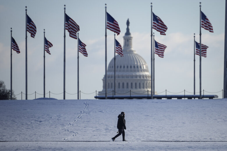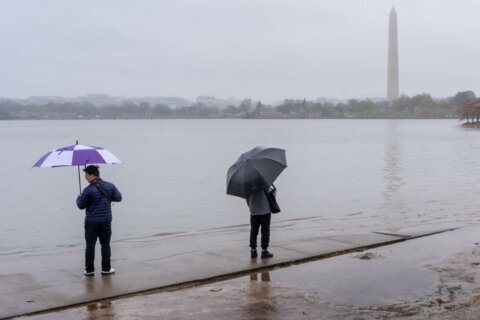
Snow is falling in the D.C. region, and the area is under a winter weather advisory until Saturday morning. As temperatures drop, snow will begin accumulating at a faster rate and will continue overnight.
Key points:
- A winter weather advisory is in the D.C. region through Saturday morning.
- Accumulation for much of the area is expected to be between 1 and 4 inches.
- Weekend travel between the D.C. region and regions to the northeast could become treacherous.
- Virginia and Maryland each declared a state of emergency ahead of the winter storm.
The National Weather Service issued a winter weather advisory for D.C. that is effect until 4 a.m. on Saturday.
Areas of Prince George’s and Howard counties in Maryland, and Stafford County in Virginia are under a winter weather advisory until 10 a.m.; areas of Anne Arundel, St. Mary’s and Calvert counties in Maryland until 1 p.m.
A light snow fell across the D.C. region on Friday morning into the early afternoon. That snow mostly dissipated as another system moved into the region, one that carries a higher potential for accumulation.
D.C.-area residents can expect steep temperature drops and hazardous travel conditions through the weekend as the significant storm grazes the region’s easternmost areas.
As for snow totals, winter weather lovers are in for a manageable treat — if storm paths remain the same.
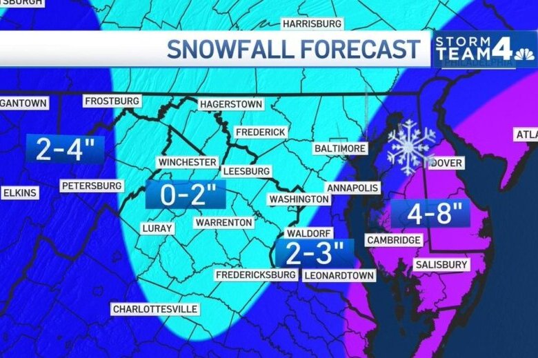
Updated models expect the storm to most heavily impact Maryland’s Eastern Shore, Delaware and coastal New England. They include the potential for several inches of snow and blizzard-esque temperatures. D.C. and Baltimore, on the other hand, are expected to see a much more manageable blanket of snow, topping out at about 4 inches.
Storm Team4 meteorologist Steve Prinzivalli said the greater D.C. area could see about 1 to 2 inches, with Southern Maryland up to 3 to 4 inches.
Impact to commutes
Winds will be a big hazard causing blowing snow that lowers visibility and also temperature. Expect plummeting wind chills and 15 to 25 mph winds, Prinzivalli said. This could lead to some slippery road conditions before the snow ends by dawn.
WTOP’s Mary DePompa: Weather will dictate traffic this weekend
Charlie Gischlar, with the Maryland State Highway Administration, says drivers should stay off the roads if they can once the snow starts coming down steadily.
“Best practice we always tell people is if you can avoid it, reduce travel,” Gischlar said.
But for those who do have to go out, he said to check out the MDOT website for information on what roads have and haven’t been plowed.
States prepare for another round of snow
Virginia Gov. Glenn Youngkin declared a state of emergency due to the severe winter weather, and D.C. has dispatched its snow team.
On Friday, Maryland Gov. Larry Hogan declared a state of emergency and mobilized the National Guard in preparation for the storm.
The emergency declaration includes Caroline, Cecil, Dorchester, Kent, Queen Anne’s, Somerset, Talbot, Wicomico and Worcester Counties. A blizzard warning is in effect for Somerset, Wicomico and Worcester Counties.
The governor directed the Maryland National Guard to station 125 soldiers on state active duty in order to assist state and local agencies in responding to the storm’s impact.
“We urge Marylanders to take this winter storm seriously, especially residents on the Eastern Shore, where we are anticipating blizzard-like conditions,” Hogan said in a statement. “Stay off the roads tonight for your own safety, and so that the crews and first responders can do their jobs. We will continue to monitor this winter storm closely, and provide updates as it progresses.”
Some areas of the Eastern Shore are expected to get up to 12 inches of snow.
In Maryland, Charles, Calvert, Prince George’s, Montgomery, Baltimore and Anne Arundel counties are under a winter weather advisory. Stafford County in Virginia is also under a winter weather advisory.
Gischlar said crews started anti-icing the roadways in advance of the storm.
“Our crews are now going into the active operations,” Gischlar said. “We’re closely monitoring how the storms going to come together.”
On Saturday morning, Gischlar said because it’s a “two-phase storm,” they need to watch and see where crews are needed the most once the storm transitions.
- Listen to WTOP online and on the radio at 103.5 FM or 107.7 FM.
- Current traffic conditions
- Weather forecast
- Closings and Delays
- Sign up for WTOP alerts
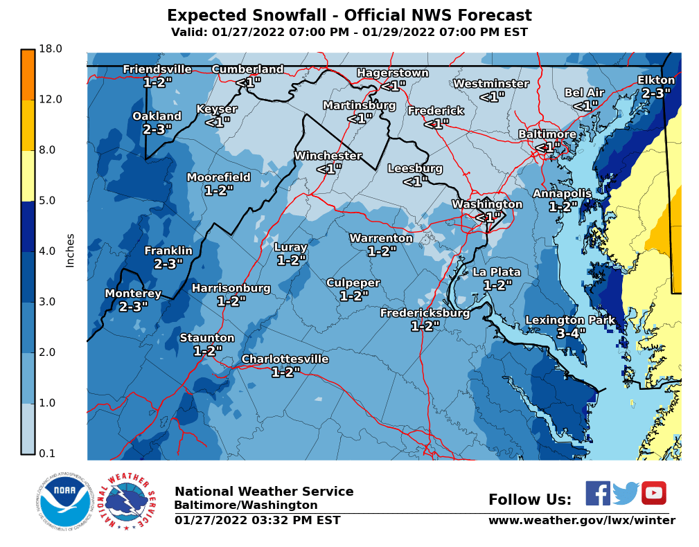
A Winter Storm Watch along the Eastern Shore shows a different challenge in gusts up to 40 mph that could reduce visibility on roadways.
Saturday will bring bitter cold as snow departs the metro area. Wind chills can drop far below zero through Sunday morning across the Blue Ridge and Northern Maryland.
Forecast:
Saturday: Light snow ending in the early morning. Total accumulations of 1” to 4”. Windy and very cold the rest of the day with a mix of clouds and sun and scattered flurries. Highs: mid 20s to near 30. Wind chills in the single digits and teens.
Sunday: Mostly sunny. Cold but not as windy. Highs: upper 20s to low 30s.
Monday: Mostly cloudy. More seasonably chilly. Highs: low 40s.
Current conditions:
Power outages:
WTOP’s Ivy Lyons contributed to this report.

