This video is no longer available.
If you are a fan of snow, get ready for a bit more of it this winter compared to last, but that doesn’t mean you’ll be sledding down your neighborhood hill a lot this time around.
“This is not going to be a very big winter,” said NBC4’s Chief Meteorologist Doug Kammerer.
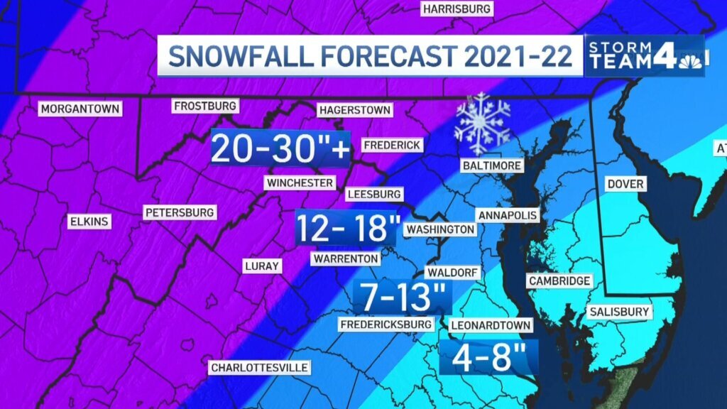
Kammerer is out with his predictions for the 2021-2022 winter season, and he’s only expecting 7 to 13 inches of snow all season along the I-95 corridor. Areas that include Loudoun County, Warrenton and Culpeper in Virginia, as well as western Montgomery County and Howard County in Maryland, could see 12 to 18 inches.
“As a snow lover, I’d love to see more, but I don’t think we are going to see any of the big storms this year,” Kammerer said.
Toward the Blue Ridge Mountains, the snow totals he expects will exceed 20 inches, with areas west of the mountains possibly seeing up to 100 inches, which he said is typical in the ski resort areas.

“Could be a very good season for them, based upon lake effect snow that they may be able to get,” Kammerer said.
Finally, close to the Atlantic, the snowfall is expected to be the least, with 4 to 8 inches.
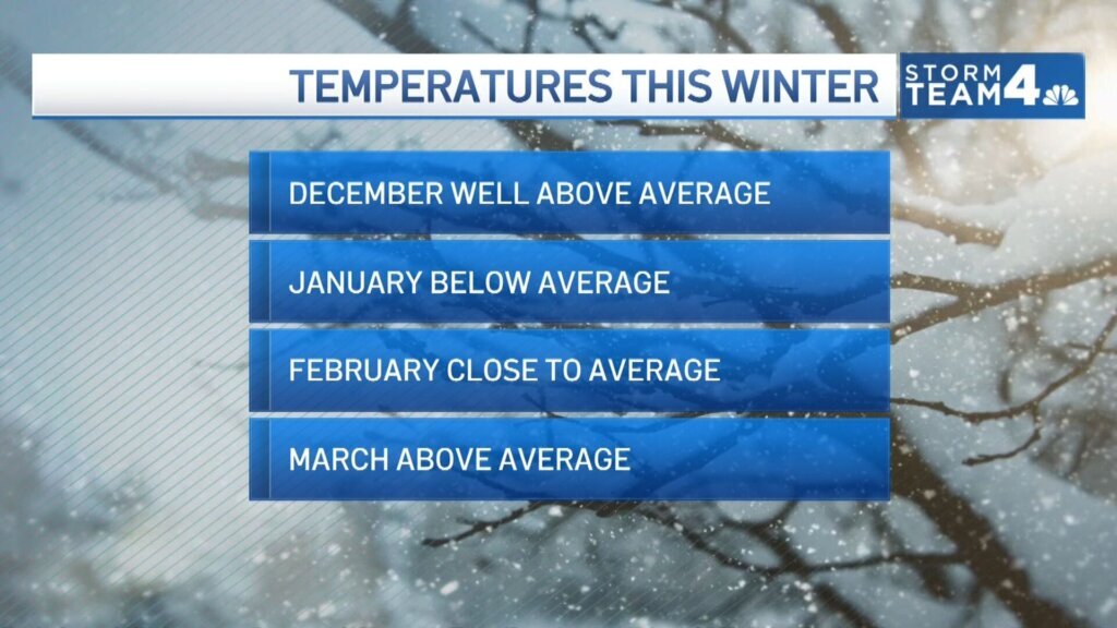
Kammerer said that like December of last year, the region could see milder conditions, with temperatures in the 70s possible.
“If we see any snow at all in the month of December, that would be a bonus, because I really don’t think we’re going to see much,” Kammerer said.
Come January and February, that’s when Kammerer said the area will see the most winter weather, although it may not result in a lot of snow on the ground.
“We’re going to be seeing a lot of storms, but they are going to be very marginal storms,” he said.
Most of the accumulation he believes will happen from late January into early February.

Then come March, things warm up, with above average temperatures expected.
Kammerer said his prediction does not normally stretch into April, but this year he included it because the D.C. region could see record-breaking warmth.
“If you’re one that’s ready for spring, looks like we can get some really warm temperatures,” he said.
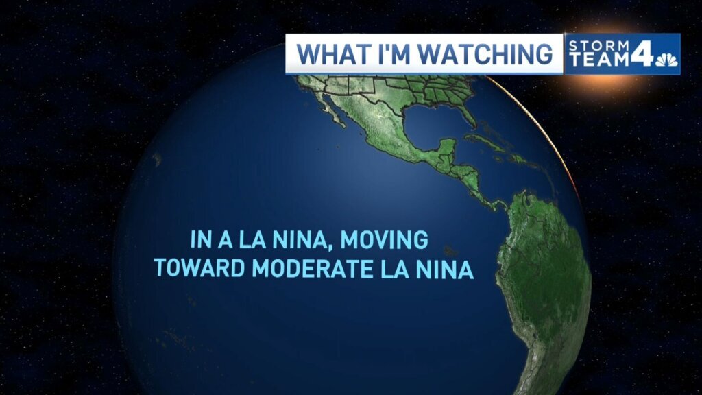
Kammerer said some of the factors playing into his winter forecast are a moderate La Niña weather pattern and climate change. He said climate change in particular is triggering “back-loaded winters,” in which the storms and colder temperatures come in January, February and March.

“We used to be so cold in the month of December, but December has really risen temperature-wise because of climate change,” Kammerer said.
When looking for a previous year that best lines up with his current forecast, Kammerer said his “analog year” is the 1984-1985 winter season. That’s when the region saw six small storms, with the biggest storm putting down 3.9 inches of snow at the airports. The entire season saw 10.3 inches.
The season also saw a polar vortex in January, and Kammerer believes that is possible this year. Also, when looking back at the season almost 40 years ago, the area saw temperatures in the 90s during April.

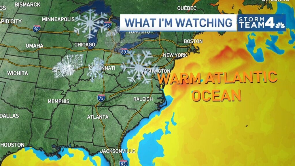
Kammerer said that when coming up with his forecast, he looks at everything from Siberian snow cover, to ice cover north of the Arctic Circle, to how warm the waters are in the Atlantic Ocean. He said having so much data to turn to has led to accurate predictions of snowfall, including his calling of the big storm of 2016.
“In October on WTOP, I said watch out in late January, I’m gonna be throwing my 8-year-old son into 2 feet of snow — and that’s exactly what we were doing,” Kammerer said.


