Spring doesn’t officially start until the weekend — and we’ve got one at least one more round of a wintry mix to make it through. Here’s hoping it’s the last one.
Rain and snow are in the forecast from late Monday night into Tuesday afternoon as an area of low pressure moves from the Great Plains over the Ohio River Valley. Even though it probably won’t total much, the chance of a wintry mix during morning rush means a risk of difficult driving conditions.
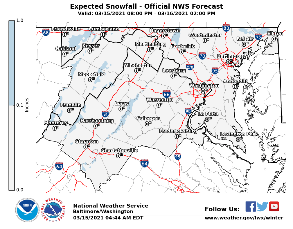
Expect a frigid rainfall to arrive from the west after midnight, when temperatures will be low enough for some wet snowflakes to mix in. The National Weather Service has called for no accumulation outside the higher elevations of the Blue Ridge and far Western Maryland — and even there, less than an inch.
“No significant accumulations are expected, but some slushiness on grassy areas is possible; for the D.C. Metro area, this will be just a cold, cold rain,” Storm Team4 meteorologist Chuck Bell said.
- Listen to WTOP online and on the radio at 103.5 FM or 107.7 FM.
- Current traffic conditions
- Weather forecast
- Closings and Delays
- Sign up for WTOP alerts
Tuesday morning’s foul weather has a silver lining: It’ll be the first significant rainfall in well over a week for the D.C. region, parched and coming off three consecutive days of near-record temperatures.
Weather service forecasters have been warning of an unusually dangerous wildfire threat throughout the Northeast this weekend due to low humidity and gusty northwesterly winds — conditions which will remain in place Monday.
“Residents are urged to exercise caution handling any potential ignition source, including machinery, cigarettes and matches,” the weather service said. “Be sure to properly discard all smoking materials. Any dry grasses and tree litter that ignite will have the potential to spread quickly.”
Montgomery County fire personnel responded to a brush fire on a Poolesville farm Sunday, which burned through hay bales and dry underbrush:
IAO Poolesville, MD, Centurion Farm, White’s Ferry Road and Edwards Ferry Road, fire contained, firefighters working on hotspots, including numerous large round hay bales, fire contained, pic.twitter.com/XolzNlsY0u
— Pete Piringer (@mcfrsPIO) March 14, 2021
While no fires spread unchecked in the immediate D.C. region, a wildfire in a central New Jersey town forced the evacuation of about 100 residents and destroyed more than 170 acres of forest on Sunday afternoon.
Skies remain cloudy and conditions breezy Tuesday afternoon and Wednesday, with a lull in precipitation before another round of rain moves in Thursday. That round could be more soaking than Monday night’s, with Bell noting the potential for up to an inch of rainfall.
A warmer pattern returns this weekend. Spring officially begins with the vernal equinox at 5:37 a.m. Sunday, March 20.
Forecast:
- Monday night: Light rain with wet snowflakes mixed in, cloudy. Lows in the 30s.
- Tuesday: Cloudy, with spotty light rain. Highs in the low to mid 40s.
- Wednesday: Partly sunny and nice, with highs in the mid to upper 50s.
- Thursday: Cloudy with rain, heavy at times. Highs in the low to mid 50s.