

Monday has been much colder than normal, with an unseasonably cool breeze adding to an already dreary forecast, and drizzle along with lows in the 40s continuing well into the night.
The region should brace for more of the same Tuesday.
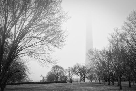
Though the worst of this rain pattern has passed, the D.C. area has already endured its wettest 365-day period in the 148 years since record-keeping began, according to the Washington Post.
“It will be a bit drier on Tuesday, but it will continue to feel chilly with a gusty northwesterly wind and even a passing shower,” NBC Washington meteorologist Mike Stinneford said.
What NBC Washington meteorologist Chuck Bell calls a “ridiculously cold pattern” compared to what would be expected for mid-May will have D.C. feeling damp and chilly through Wednesday.
“According to Appalachian weather lore, we are experiencing ‘blackberry winter,’ a cold snap when the blackberry bushes are blooming,” said Stinneford. He added that some patchy fog will develop late Monday night into Tuesday morning.
In a nutshell: Keep the umbrella handy for Tuesday, and have some warmer clothes on hand for the next few days — typical May weather won’t make a return until Thursday, at the earliest.
- Listen to WTOP online and on the radio at 103.5 FM or 107.7 FM.
- Current traffic conditions
- Weather forecast
- Sign up for WTOP alerts
Like Monday, expect overcast skies and a light breeze to cause daytime highs to struggle to get out of the 50s in the immediate D.C. area on Tuesday.
Tuesday night into Wednesday will be especially cold for this time of year, with nighttime lows in the mid to upper 40s making spring momentarily lapse back to late winter.
“The overall pattern would be one heckuva snowy pattern for us if it was two to three months earlier in the year,” Bell said. “But, as it is, we will be stuck with rainy periods and temperatures running 15 to 20 degrees colder than average.”
Higher elevations of Western Maryland and portions of interior Virginia, particularly in the Shenandoah Valley, could even see frost early Wednesday.
Farther north, forecast models were even highlighting the possibility of records being set throughout New York and New Jersey for lowest high temperatures for this day in May:
Lots of record cool max temperatures are possible for May 13. NYC’s is 50°F set in 1931. @NWSNewYorkNY is forecasting a high of 49°F. Note that it was only 48° on 5/12/2010. As for record lows, NYC’s low of 42°F this morning was 3° shy of the record low set in 1895. #nycweather pic.twitter.com/Hdu4zkNgFw
— Tom Downs (@ThomasDownsV) May 13, 2019
Temperatures will bounce back on Wednesday afternoon and Thursday, when sunnier skies will make way for milder highs in the upper 60s to low 70s.
A dry pattern will move into place, with only isolated showers possible Wednesday night and a sunny weekend in the works.
“The overall pattern looks dry enough to keep rain chances out of the weekend for now but we will need to keep our fingers crossed if we want to break out of this ‘rainy weekend’ rut we’ve been stuck in for so long,” Bell said.
“Stay warm and dry today. Summer heat and humidity are less than a month away.”
Forecast:
Tuesday: Mostly cloudy. Breezy and cool, with an isolated shower possible. Highs in the upper 50s to low 60s.
Wednesday: Morning sunshine with afternoon clouds. A slight chance of rain after sunset. Highs in the mid 60s to low 70s.
Thursday: Partly cloudy and a bit milder. Isolated showers possible. Highs in the upper 60s to low 70s.
WTOP’s Rob Woodfork contributed to this report.