
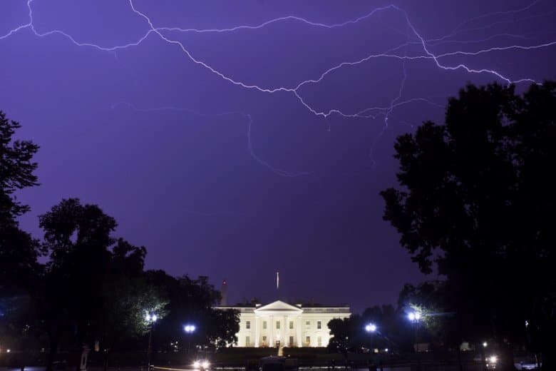
Severe weather pummeled the D.C. area overnight, leaving thousands without power throughout Maryland and Virginia — and possibly spawning tornadoes.
After the South was rattled with deadly storms over the weekend, a double volley of severe weather brought strong winds, torrential rainfall and hail to the capital region, toppling trees and downing power lines. In Virginia, widespread outages forced all Spotsylvania public schools to close Monday.
Winds are forecast to pick up again on Monday. “Strong winds may blow down limbs, trees, and power lines,” the National Weather Service said. Additional power outages are expected.
- Listen to WTOP online and on the radio at 103.5 FM or 107.7 FM.
- Current traffic conditions
- Weather forecast
- Closings and Delays
- Sign up for WTOP alerts
In Virginia, Dominion Power said storms left more than 3,000 customers in the dark in Spotsylvania County, most near Fredericksburg. Another 1,100 customers are without power in Crystal City, impacting some traffic signals:
County emergency services are aware of dark traffic signals and other power outages in the Crystal City area. Travel with caution. #VaTraffic @ReadyArlington @ArlingtonVaPD https://t.co/q5BUWCnkU4
— Arlington Department of Environmental Services (@ArlingtonDES) April 15, 2019
Crews in both states are working to restore power and clear damaged power lines.
High winds, heavy rain — and maybe even tornadoes
Reagan National Airport recorded a 55 mph gust in a thunderstorm just before 1:30 a.m. Monday, while coastal areas of Southern Maryland saw gusts near 70 mph as a squall crossed the Chesapeake Bay.
In Maryland, parts of Prince George’s, Calvert, Charles, Frederick and Carroll counties found themselves in the path of rotating supercells, with the weather service issuing tornado warnings and urging residents to seek shelter.
“We issue a tornado warning based upon radar rotation,” NWS meteorologist James Lee told WTOP. “We saw the rotation, and that’s what prompted the warnings. We’re pretty certain that there is significant damage in the area.”
Lee said the agency will reach out to emergency officials and survey damage to determine whether a tornado touched down anywhere in the warned areas.
More strong gusts in store for Monday
With last night’s storms moving out to sea, skies will be clear again on Monday — albeit breezy. As a cool air mass rushes eastward over the Ohio River Valley between two areas of low pressure, winds in Maryland, northern Virginia and D.C. will pick up.
“The rain has pushed out of the region, but winds will begin to filter into the region between competing pressure systems,” NBC Washington meteorologist Lauryn Ricketts said. “Westerly winds will have the potential to gust up to 50 mph throughout the daylight hours today, which could bring us some additional power outages.”
A Wind Advisory has been issued for portions of the region today. Maximum wind gusts up to 50 mph are expected in those areas, with 30 to 40 mph elsewhere. pic.twitter.com/kIl5ojfoYz
— NWS DC/Baltimore (@NWS_BaltWash) April 15, 2019
The chance for more damaging winds prompted the weather service to post a wind advisory for much of the area from 8 a.m. to 8 p.m. Monday.
More trees and wires could be brought down, and Monday commuters should keep a watchful eye on the road. Drivers of high profile vehicles should use extra caution, especially on bridges.
Watches, warnings and advisories:
A wind advisory has been issued for the following parts of the WTOP listening area:
Washington, D.C. from 8 a.m. to 8 p.m. Monday.
In Maryland: Prince George’s, Anne Arundel, Montgomery, Howard, Baltimore, Frederick, Carroll and Harford counties from 8 a.m. to 8 p.m. Monday.
In Virginia: Arlington, Fairfax, Loudoun, Prince William, northern Fauquier and Clarke counties, as well as the cities of Alexandria, Fairfax, Manassas and Manassas Park from 8 a.m. to 8 p.m. Monday.
A wind advisory means that winds of 45 to 55 mph are expected. Winds this strong can make driving difficult, especially for high profile vehicles.
Forecast:
Monday: A few leftover light showers or sprinkles early Monday, then a mix of clouds and sun. Windy, but seasonably mild and much less humid. Highs in the low to mid 60s. Wind advisory in effect until 8 p.m.
Monday night: Mostly clear, winds diminishing. Cool, less humid. Lows in the upper 30s to mid 40s.
Tuesday: Sun with increasing clouds. Seasonably mild. Highs in the mid to upper 60s.
Wednesday: Mostly cloudy. Pleasant. Highs in the mid to upper 60s.
Thursday: Partly sunny, warmer. Highs in the mid to upper 70s.
Current conditions:
WTOP’s Nick Iannelli contributed to this report.