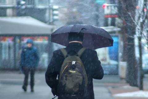
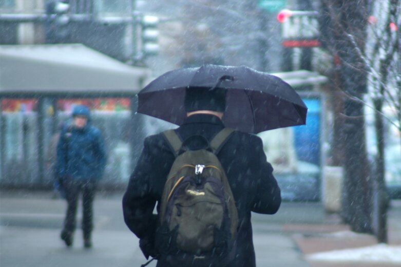
WASHINGTON — As winter approaches, so do the first traces of snow in Thursday’s forecast for the D.C. region, and the wet misery will arrive just in time for the morning commute. School systems around the region are already announcing delays and closures ahead of the slippery weather.
School systems in Loudoun, Prince William and Fauquier counties are closed Thursday. School systems in Fairfax County, Manassas City and Manassas Park City are on a two-hour delay. See WTOP’s Closings and Delays page for the latest updates.
The mix of winter weather and steady rain will impact the entire D.C. area throughout the day. Slippery roads with a few icy patches are expected.
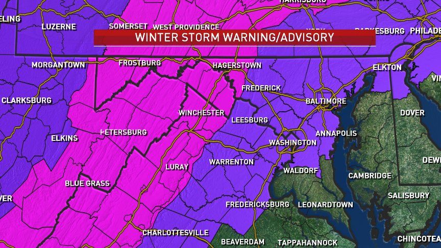
A winter storm advisory has been issued for much of the D.C. area through Thursday afternoon. A winter storm warning is in effect along the Shenandoah Valley, which could get up to 5 inches of snow.
- Get the latest weather forecasts
- Area closings and delays
- Get the latest traffic conditions
- Sign up for WTOP alerts
“A wintry mix of precipitation will overspread the area late tonight and Thursday morning, continuing through the day,” the National Weather Service tweeted Wednesday evening.
A wintry mix of precipitation will overspread the area late tonight and Thursday morning, continuing through the day. A changeover to rain will occur across areas east of the Blue Ridge during the midday hours. See images for more details. Use caution if driving or venturing out. pic.twitter.com/pUX1w3ISKi
— NWS DC/Baltimore (@NWS_BaltWash) November 14, 2018
High pressure will push cold air into the region Wednesday and then dam it up against the front of the Appalachian Mountains on Thursday, as moisture from the Gulf of Mexico rides up over the top of it, according to Storm Team 4 meteorologist Chuck Bell.
Thursday’s precipitation will start as snow in the Shenandoah Valley, Bell said. However, warmer air aloft that will be coming along with the moisture — and the daytime heating — will likely cause the snow to become a brief period of freezing rain and sleet before becoming mostly rain by late afternoon.
The D.C. area, especially the western and northern suburbs, will most likely start out as sleet, with some snow mixed in, before changing to all rain by late Thursday morning. There’s also, unfortunately, the potential for some freezing rain.
Southern Maryland and the Eastern Shore can expect just rain.
Travel impacts are most likely along Interstate 81. If you have travel plans to drive out of the area, Bell said, use I-95 instead.
On Thursday night, there will be a chance that the rain will briefly change back over to snow for the Shenandoah Valley and northern Maryland before ending very early Friday morning.
“By the afternoon and evening hours, most of us are just going to be dealing with wet roads,” said Storm Team 4 meteorologist Amelia Draper.
The change back to snow is unlikely for the D.C. area, so the Friday morning commute is more likely to be slow than slippery.
The weekend and much of next week is expected to be chilly but without all the precipitation this Thursday is bringing.
Current conditions
Forecast
Thursday A.M.
- Rain D.C./south/east. Chance of a wintry mix.
- Snow/sleet/rain/freezing rain to the north and west, with snow accumulations generally 2 inches or less, mainly on grass.
Thursday P.M.
- Rain, chance wintry mix well north and to the west. Cloudy and cold otherwise.
Highs: D.C. area, around 40; north and west of D.C. area, low to mid-30s; south and east of D.C. area, 40s.
Friday: Rain ends before 7 a.m. Increasing sun and breezy with highs in the mid-40s to low 50s.
Saturday: Partly sunny. Highs in the mid-40s to low 50s.
WTOP’s Teta Alim and Jack Pointer contributed to this report.