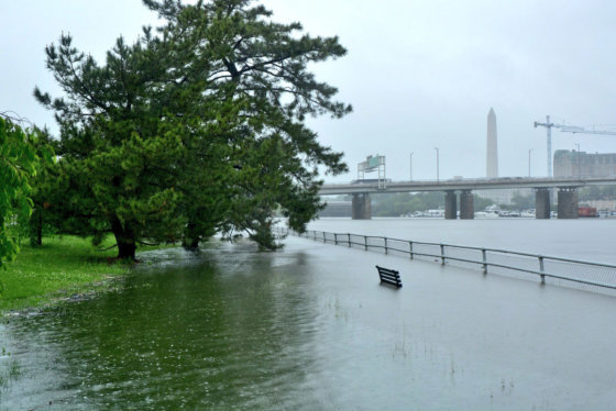
WASHINGTON — There’s no doubt this year has been one of the rainiest in recent memory.
But how rainy was it?
If normal precipitation totals hold up for November and December, 2018 will become one of the top five wettest years on record, which goes back almost 150 years.
With the precipitation over the weekend and on Monday, 2018 moved into the top 10.
The National Oceanic and Atmospheric Administration, known as NOAA, has precipitation data for the D.C. area going back to 1871.
With one day remaining in October, 2018 is now tied with 1877 for the ninth-rainiest and snowiest year on record, with 52.89 inches.
In the first 100 years of record keeping, any year that totaled over 50 inches of precipitation was well above normal. Based on almost 150 years of data, a normal amount of wet weather for the WTOP area is just under 40 inches.
This year’s data come from Reagan National Airport, but other parts of the D.C. region received plenty of rain this summer, too. Dulles International Airport, for example, received 12 inches more rain than usual.
And you’re absolutely right if you think the summer of 2018 was extremely wet. The summer months of June, July and August produced over 20 inches of rain (20.13 inches). The last time the summer was so wet was in 1933, when the area received 20.5 inches.
The National Weather Service’s Climate Prediction Center’s outlook for the mid-Atlantic’s next three months does not anticipate a greater than usual amount of precipitation. But even with the normal amount of rain and snow in November and December — a total of about six inches — 2018 will likely clock in as the fourth-wettest on record, falling just behind 1878 (60.09 inches) and just ahead of 1886 (58.17 inches).
The last time the Washington area received over 50 inches of precipitation was in 2003, when the year’s total was 60.83 inches.


