Photos: Sunday’s heavy rainfall brings floods to Beltway and beyond

Flooding on the beltway near the Baltimore-Washington Parkway. (Courtesy @ScottOverland via Twitter)

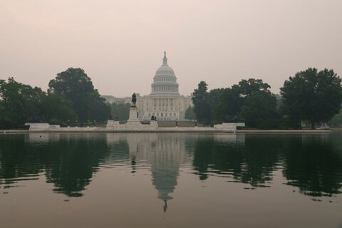
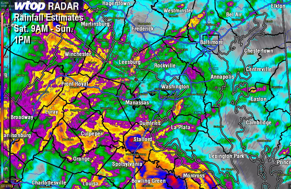
WASHINGTON — Sunday afternoon brought steady rain once again into the  D.C. area.

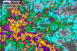
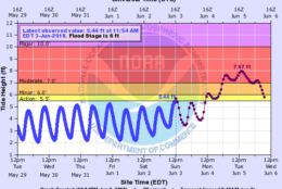
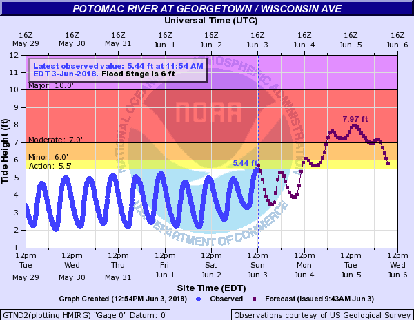
Many reports came in of rivers getting close to flood stage, along with flood watches and warnings for the Potomac River in Maryland and Virginia, and the Rappahannock River in Virginia.

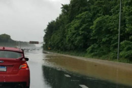
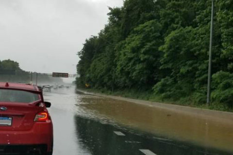
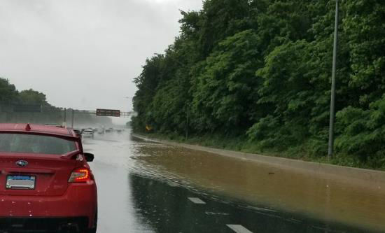
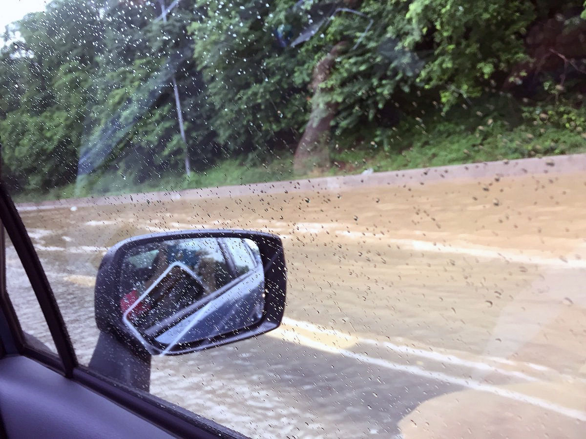
Traffic on the Capital Beltway slowed in Prince George’s county due to flooding close to the Baltimore-Washington Parkway.

See photos in the gallery below.

Flooding Incident Sunnyside Road between Edmonston Road and Rhode Island Avenue in Beltsville. 7 people from several autos were assisted to high ground by PGFD Tech Rescue – Swift Water Team. Occupants OK – cars not so much. Video by AFC Wargo. (Twitter/Mark Brady, Prince George’s County Fire/EMS Department)
An arborist from the U.S. National Arboretum says that trees falling down, like this one that fell into a home in D.C. in the 3400 block of Texas Avenue in June, could happen even more frequently. (Courtesy DC Fire and EMS via Twitter)
A tree fell into a home in D.C. on the 3400 block of Texas Ave, SE. No injuries were reported. (Courtesy DC Fire and EMS via Twitter)
Flooding on the beltway near the Baltimore-Washington Parkway. (Courtesy @ScottOverland via Twitter)
WTOP radar forecasts 1.5 to 2 inches of rain for most communities on the west side of the Washington, D.C. area.
WTOP radar forecasts 1.5 to 2 inches of rain for most communities on the west side of the D.C. area. (WTOP/Matt Ritter)
One woman sent in this image of the Capital Beltway's outer loop near Exit 19. The entire right lane was flooded. (Courtesy @Brindisi via Twitter)
One woman sent in this image of the Capital Beltway’s Outer Loop near Exit 19. The entire right lane was flooded. (Courtesy @Brindisi via Twitter)
(Courtesy @Brindisi via Twitter)
The forecast hydrograph for Georgetown has a forecast crest just under 8 feet occurring Tuesday late morning. According to past flooding, at 8 feet, backwater flooding of Rock Creek in Georgetown begins at this level. (Courtesy Matt Ritter)
(Courtesy Matt Ritter)
(1/11)
An arborist from the U.S. National Arboretum says that trees falling down, like this one that fell into a home in D.C. in the 3400 block of Texas Avenue in June, could happen even more frequently. (Courtesy DC Fire and EMS via Twitter)
Flooding on the beltway near the Baltimore-Washington Parkway. (Courtesy @ScottOverland via Twitter)
WTOP radar forecasts 1.5 to 2 inches of rain for most communities on the west side of the Washington, D.C. area.
One woman sent in this image of the Capital Beltway's outer loop near Exit 19. The entire right lane was flooded. (Courtesy @Brindisi via Twitter)
The forecast hydrograph for Georgetown has a forecast crest just under 8 feet occurring Tuesday late morning. According to past flooding, at 8 feet, backwater flooding of Rock Creek in Georgetown begins at this level. (Courtesy Matt Ritter)

Federal News Network Logo
Log in to your WTOP account for notifications and alerts customized for you.

Sign up