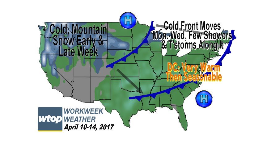
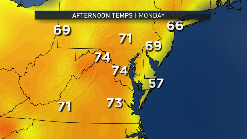
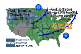
WASHINGTON — The new week starts under the influence of the same dome of high pressure that provided the D.C. area with Sunday’s spectacular weather.
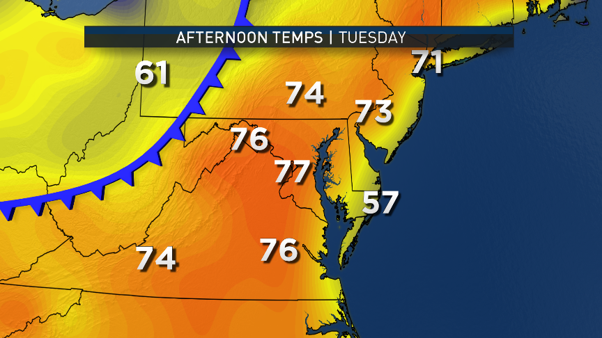
This time, however, it will be offshore and southwesterly winds, and the surface and aloft will be pumping in some unseasonably warm temperatures, feeling almost like summer during Monday afternoon. High pressure over central Canada is also taking aim at us, pushing a cold front our way. That front will get here midweek, not until after we have another very warm afternoon on Tuesday. Then, the changes will start.
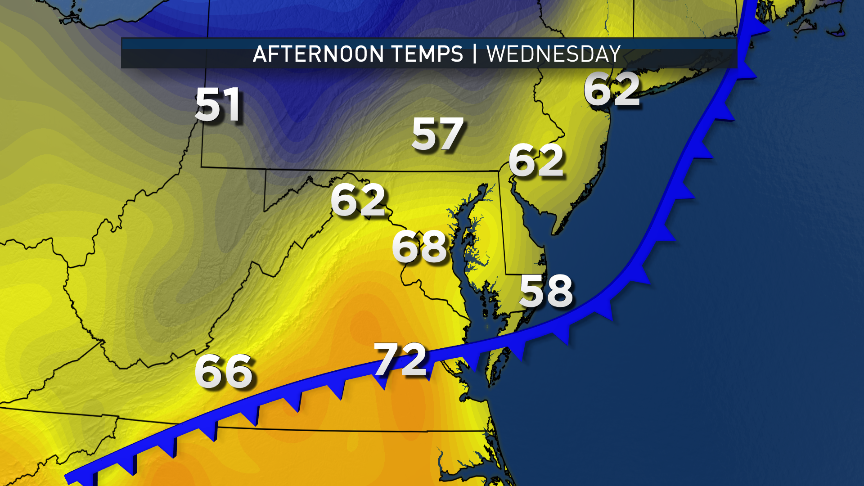
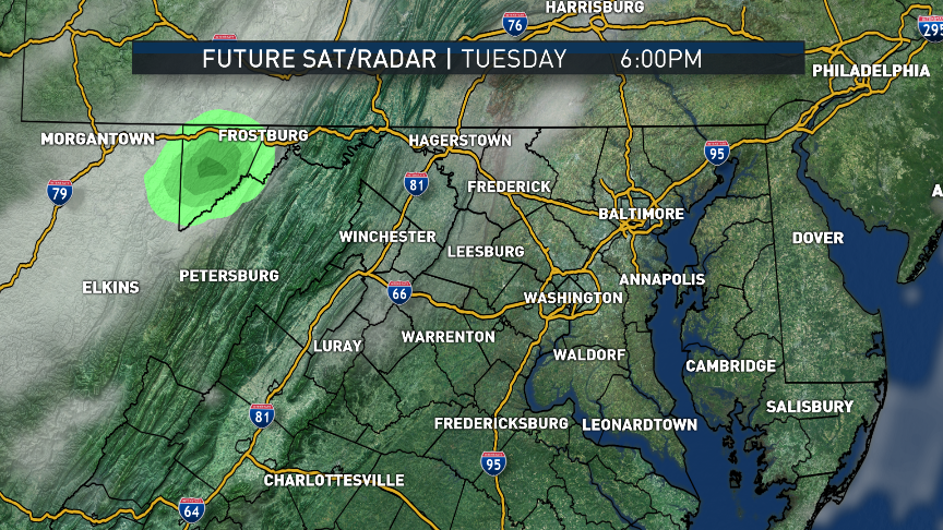
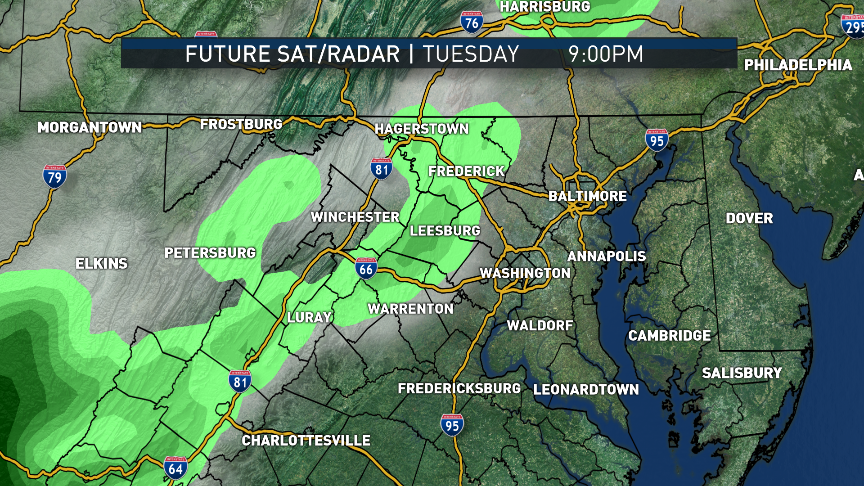
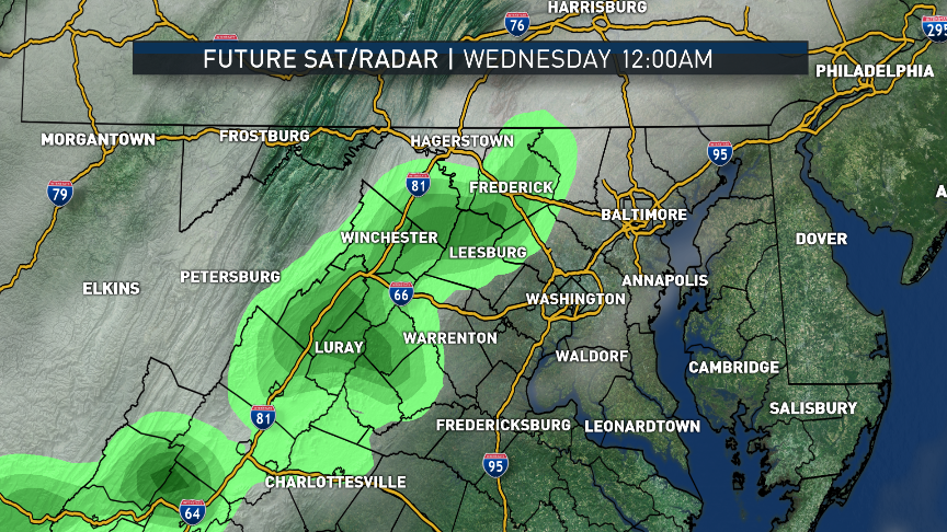
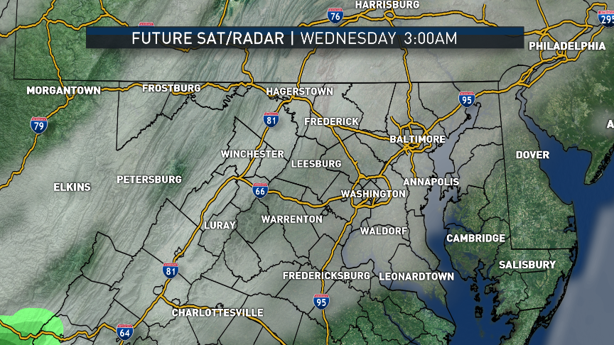
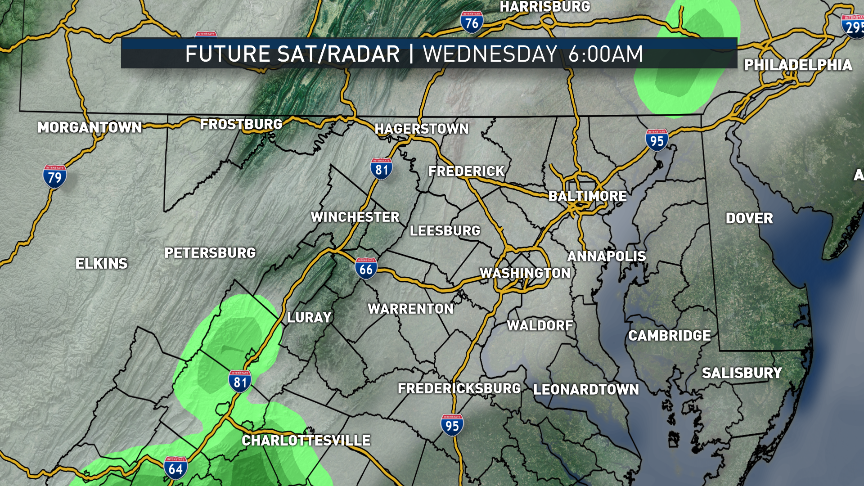
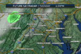
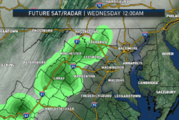
Likely just toward the end of the typical commute Tuesday evening, a line of showers and possible thunderstorms will be heading our way from the Ohio Valley along the cold front. The showers and storms will weaken and fall apart a bit before they get here, so we are not looking at a lot of soaking rain with this system. But it will slowly move through with its showers and a wind shift to out of the northwest Tuesday night and early Wednesday, and then just like that — it’s gone. Drier air and relatively cooler air will take over during the day Wednesday.
The cool-down will be modest. We’ll be heading back to closer to average temperatures the rest of the week. The front will attempt to return north as a warm front Thursday and Friday, but it may not make it all the way. An area of rain and cooler temperatures along that warm front will have to be watched to see if it will affect us on Friday, because that would also have a temperature impact.
All things considered, this looks like a very good week for outdoor plans, whether work or play: dry during the daytime, temperatures above average to average and no freezes at night.

Daily weather highlights
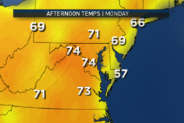
MONDAY
- Abundant sunshine
- Temperatures at least 10 degrees warmer than Sunday
- Dry and very pleasant
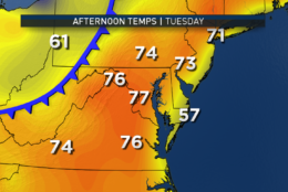
TUESDAY
- Sunshine fading behind increasing clouds
- Very warm and breezy
- Mostly dry, but showers may impact Nationals/Cardinals evening game
- Turning a bit cooler at night
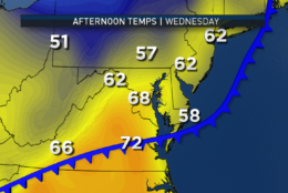
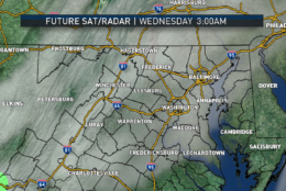
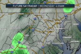
WEDNESDAY
- A few lingering showers and drizzle possible in the morning
- Clearing skies all day
- Noticeably cooler than Tuesday, but just closer to averages for early April
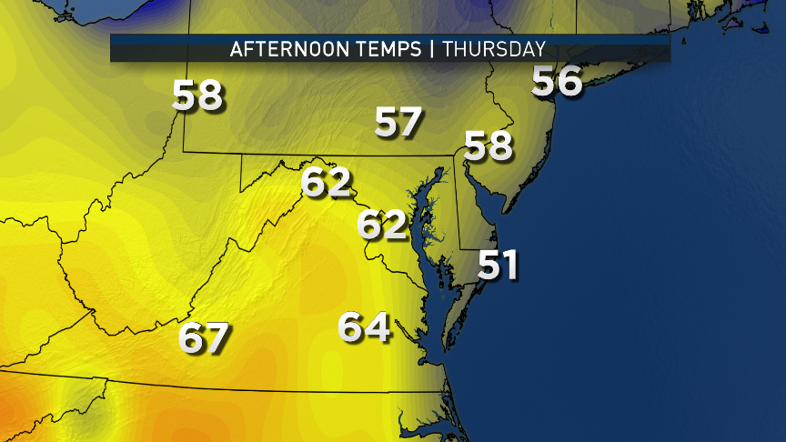
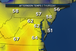
THURSDAY
- Mostly sunny skies
- Seasonable and pleasant
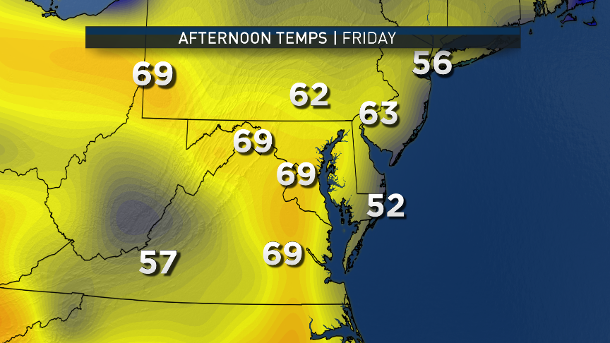
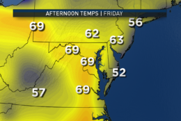
FRIDAY
- Mostly to partly sunny, high-level clouds
- Seasonable and pleasant
- Keeping an eye on small batch of rain just to the south
Editor’s Note: The WTOP Workweek Weather Blog is intended as an in-depth yet plain language summary of the business week’s weather potential in the D.C. area along with an explanation of the contingencies and uncertainties that exist at the time of publication. For the latest actual Storm Team 4 forecast, check out the main WTOP Weather Page.