This video is no longer available.
Listen live to WTOP for traffic and weather updates on the 8s.
The National Weather Service has confirmed seven tornadoes touched down during Wednesday’s storms in the D.C. area, a handful of which caused damage, toppling trees, yanking down power lines and injuring at least five people.
The NWS released a report Thursday night with findings from its surveys and said more confirmations could come as crews continue to investigate.
“Seven tornadoes, that qualifies as a tornado outbreak,” said WTOP storm chaser Dave Dildine.
The NWS sent out different survey teams to investigate storm damage in nine counties across West Virginia, Maryland and Virginia.
Crews determined the number of tornadoes that touched down, their strength and their exact path. The surveying includes looking at the tree damage, whether they were uprooted or snapped and whether there is structural damage.
Across the region, the weather service issued 22 tornado warnings Wednesday, which is the fourth most in one day since 1986, according to 7News First Alert Meteorologist Brian van de Graaff.
Tornado series started in Leesburg before causing wreckage in Montgomery County
An EF-0 tornado was recorded in Inwood, West Virginia, at around 4 p.m. NWS estimated peak winds of 75 mph. EF-0 is the weakest on the five-point Enhanced Fujita scale.
“That was the opening act,” Dildine said. “The main story was the big supercell that developed over northern Loudoun County, north of Leesburg, and crossed the Potomac River and went through Montgomery County.”
NWS crews determined an EF-1 tornado — with EF-0 being the weakest and EF-5 being the strongest severity — touched down in a wooded area north of Leesburg, Virginia, just before 6:45 p.m. and traveled northeast. It uprooted several trees and ripped the plastic roof off a shelter.
That tornado was one mile long, 125 yards wide with peak winds at 95 mph.
A “mini-supercell thunderstorm” formed southeast of that Leesburg tornado nearby Poolesville, according to the report. The tornado ended up making a 12-mile trek through Montgomery County.
Another EF-1 tornado was confirmed by NWS in central Montgomery County. It started in Poolesville at around 7:15 p.m. and moved toward Gaithersburg, ending just before 7:45 p.m. It was 12 miles long, 125 yards wide and reached an 105 mph peak wind.
About two dozen pine trees, each with a trunk diameter two feet or more, were uprooted or snapped near Tudor Farm along Whites Ferry Road, according to the report.
The tornado lifted before coming back down and traveling around 0.5 miles on the ground, uprooting another dozen or so trees along the way.
Central Montgomery County, Maryland Tornado pic.twitter.com/r7VOGkL01T
— NWS Baltimore-Washington (@NWS_BaltWash) June 7, 2024
Employees with the Washington Suburban Sanitary Commission told NWS that power lines were snapped and large branches fell onto Great Seneca Highway, causing a partial blockage on the road.
“It mainly was over agricultural and park land areas, thankfully, the structural damage could have been worse,” said Dildine. “But the tail end of that tornado went right through Olde Towne Gaithersburg.”
Mostly trees were damaged, but a housing development east of Gaithersburg City Hall suffered significant damage: seven homes were condemned from damage caused by fallen trees and branches, according to the report.
A large oak tree fell onto a house on Dogwood Drive, causing five people who were inside to be injured, according to NWS and Montgomery County fire officials. Firefighters responded to dozens of emergencies related to the storm, including collisions and downed wires, the county fire department said in a news release.
Outside of DC area
Exiting the D.C. area, a tornado also touched down in southern Baltimore County nearby the Interstate 95 and Interstate 195 interchange at around 7:45 p.m. It was 2.4 miles long, 175 yards wide and peaked at 105 mph wind.
Trees were twisted and snapped, power and phones lines also went down. NWS recorded damage along Robert A. Young Way, where four overhead doors were blown out of a distribution warehouse.
Another EF-1 tornado touched down in Middle River just before 8 p.m.; it was 0.2 miles long, 110 yards wide with peak wind gusts at 105 mph. Multiple mobile homes were damaged, according to the report.
One of those homes had its underpinning removed from two sides and the windows were blown out, NWS said. A shed was also tossed 50 yards away.
A final tornado touched down in Eldersburg around 8 p.m., this one less severe, at EF-0. It was 4.4 miles long, 100 yards wide and had an estimated peak wind of 85 mph.
‘Do I die?’: Harrowing moments when tornado hit Gaithersburg
The Deer Park neighborhood in Gaithersburg bore the brunt of Wednesday’s sprawling supercell that produced the tornadic activity. A twister confirmed by trained NWS spotters hit Gaithersburg around 7:35 p.m. and left a trail of debris, structural damage and power outages in its wake.
Seven houses in Gaithersburg have been condemned, Gaithersburg Mayor Jud Ashman told WTOP, and the Red Cross is in the city assisting families. Ashman said the cleanup started last night and crews have been working overnight: “It’s literally night and day. A lot has been cleaned up.”
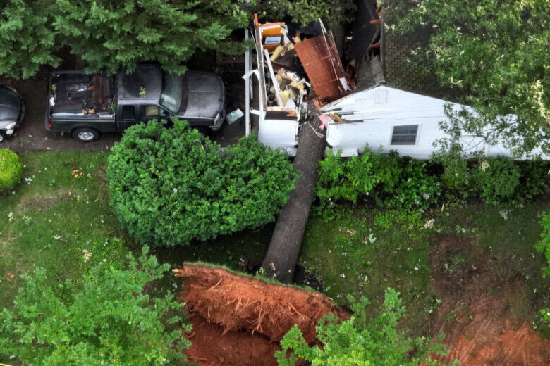
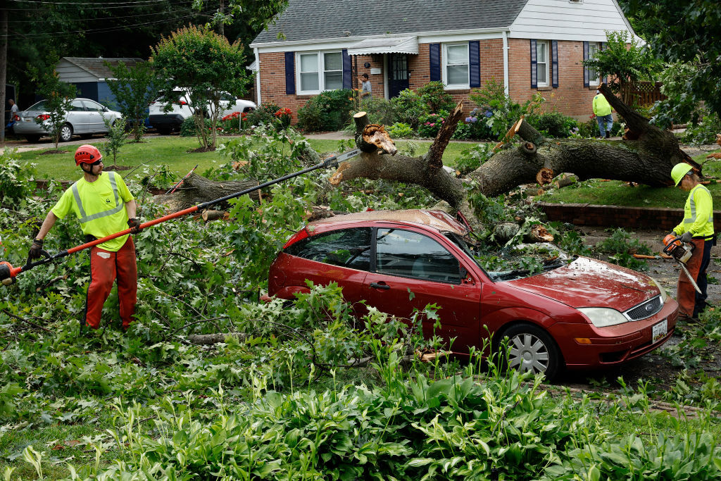

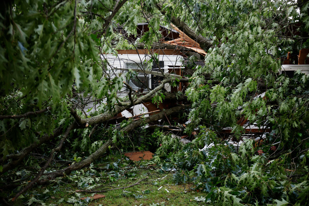
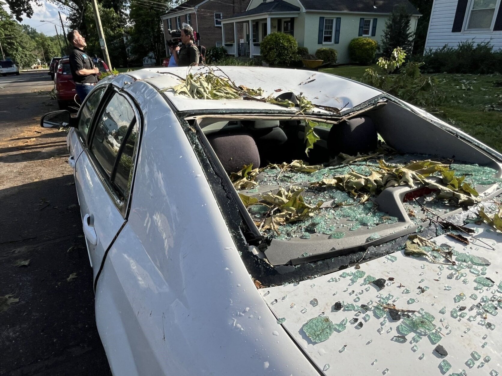
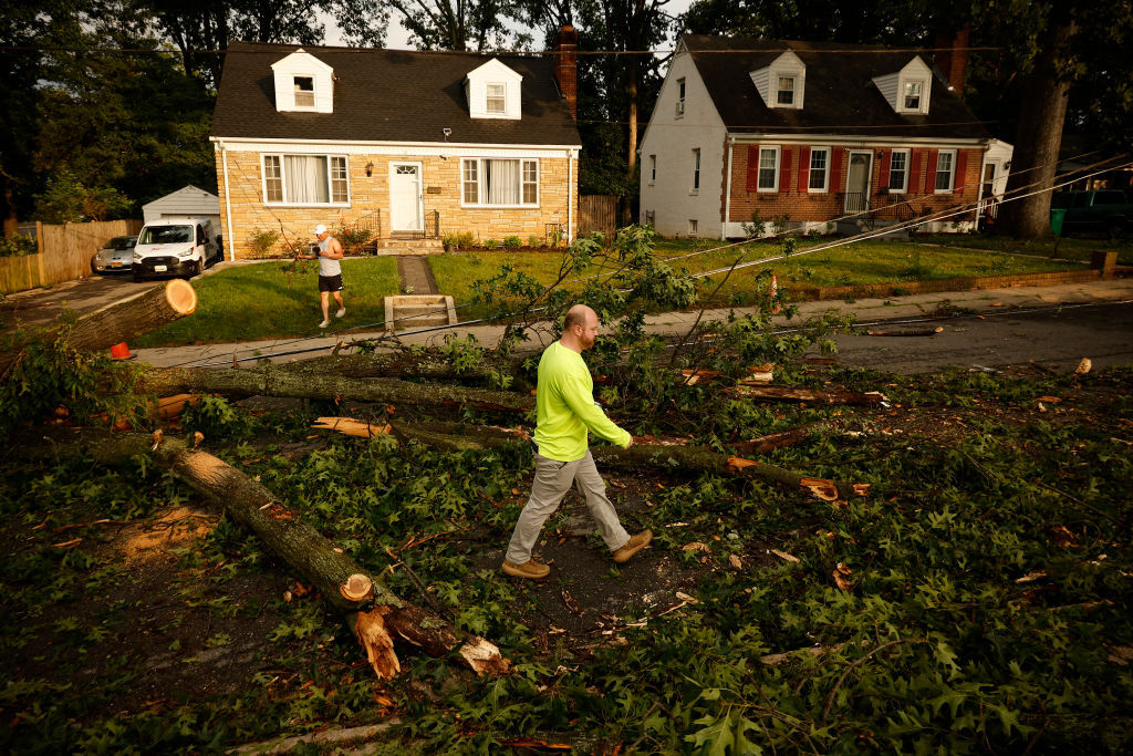
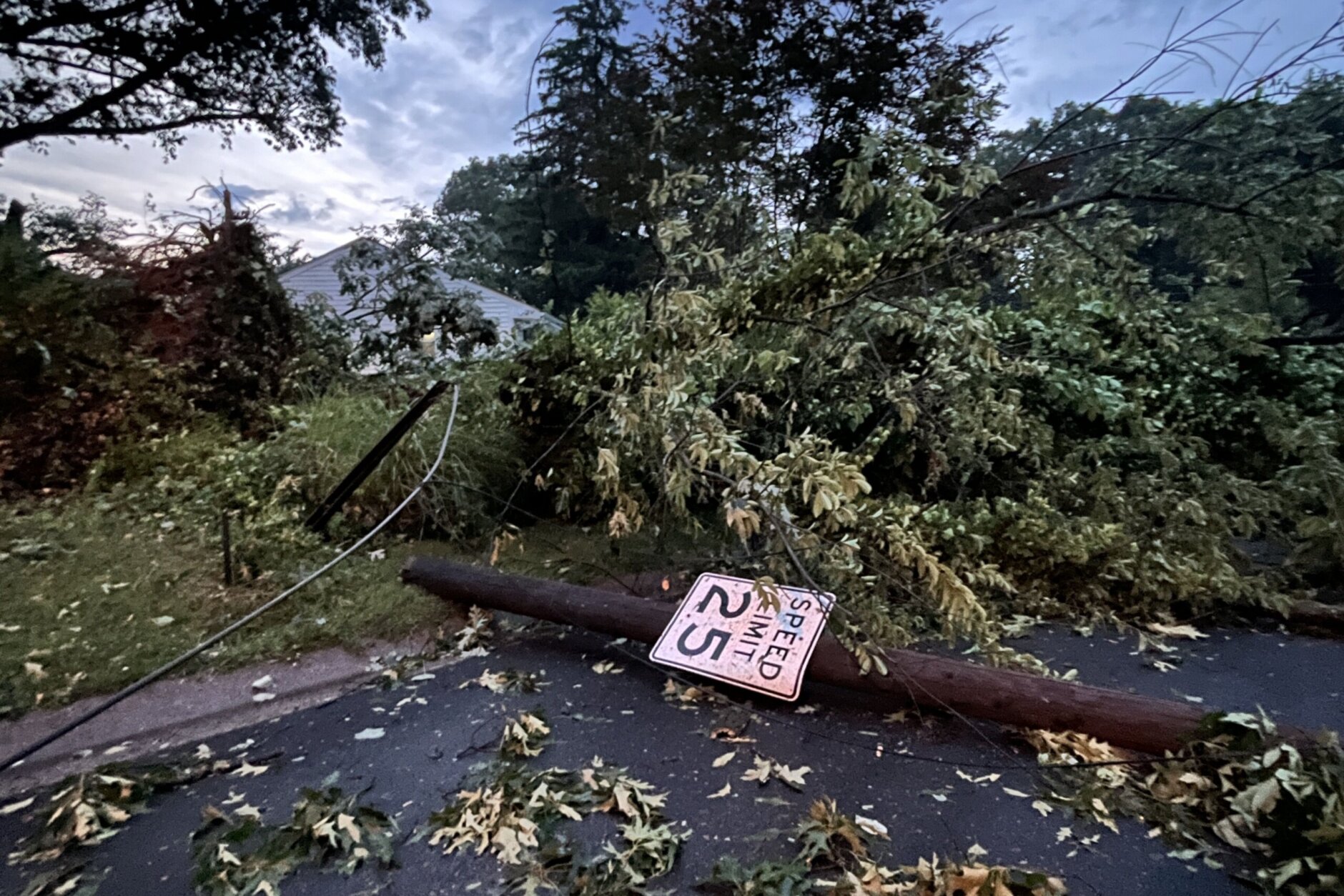
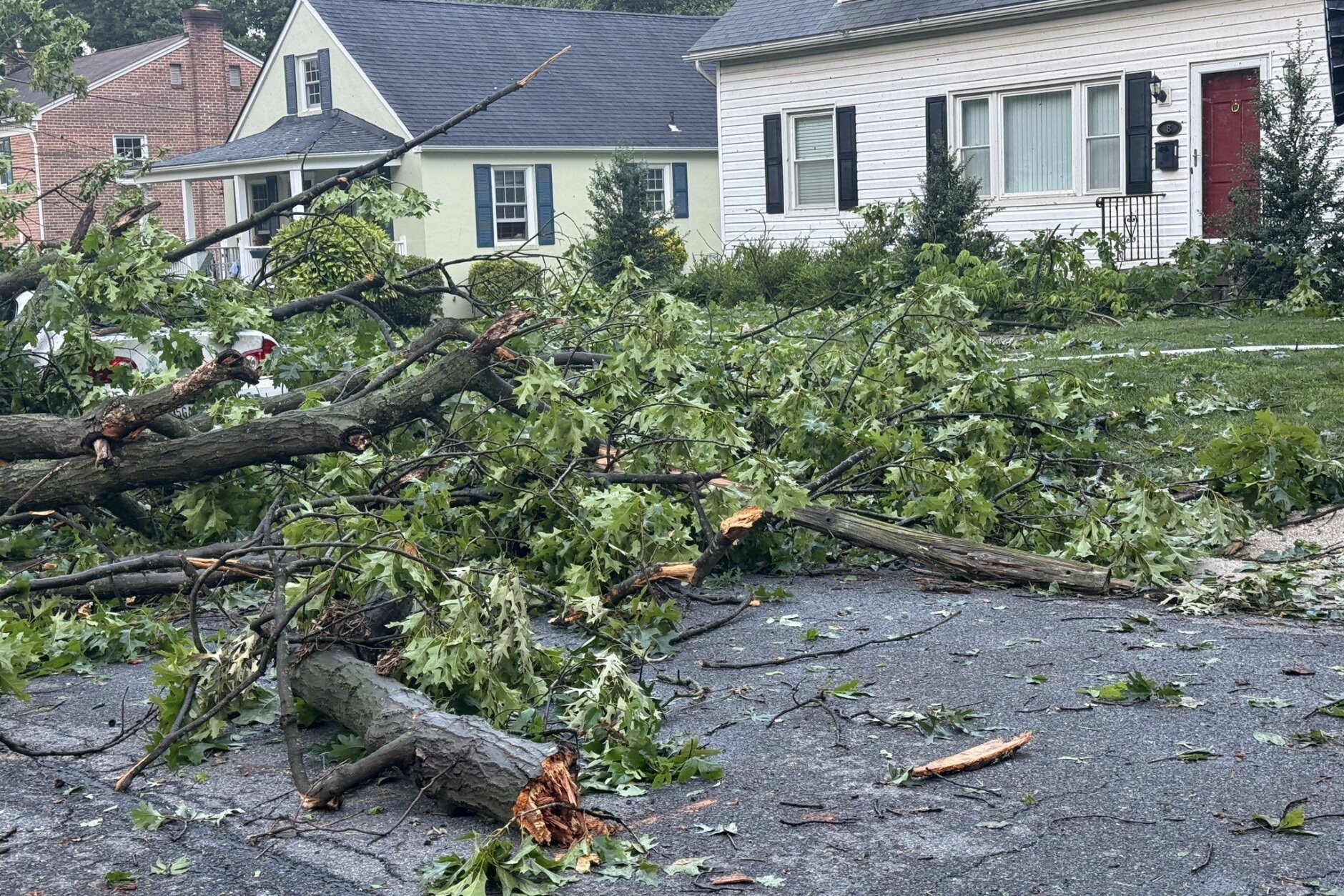
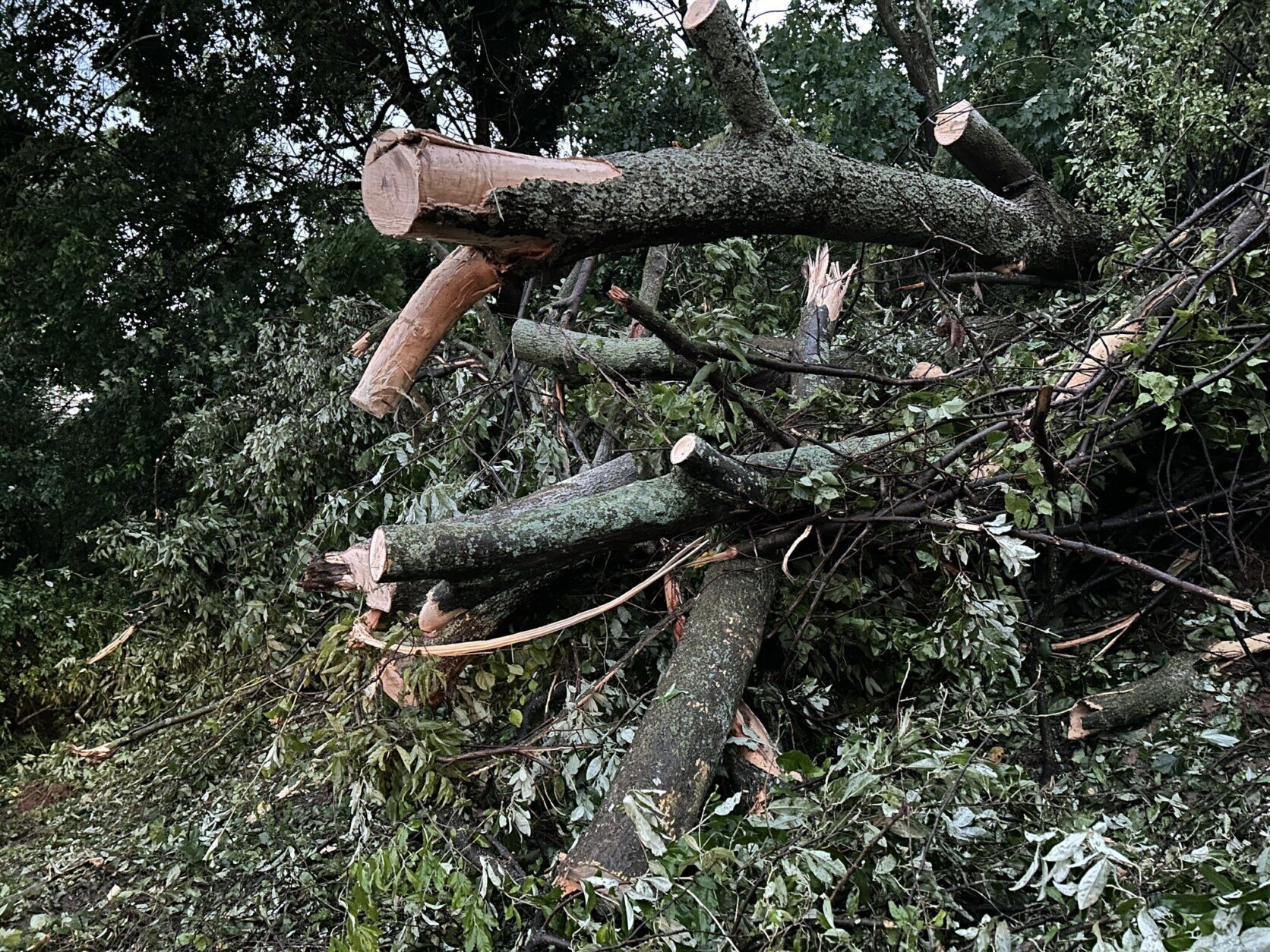
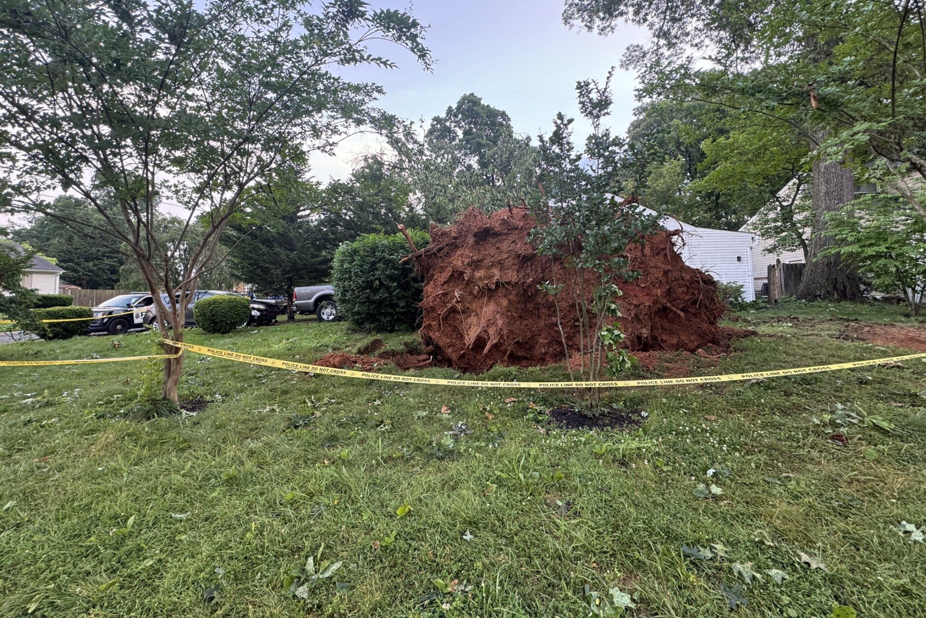
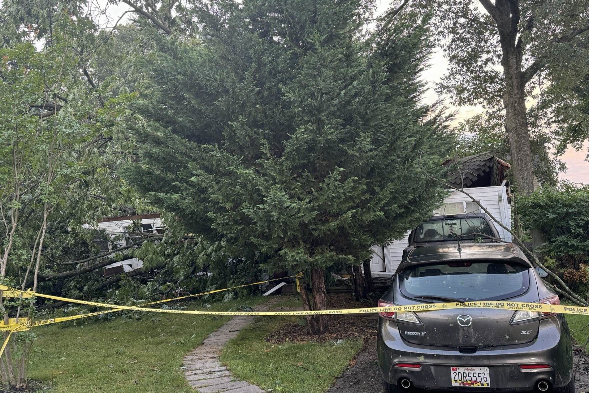
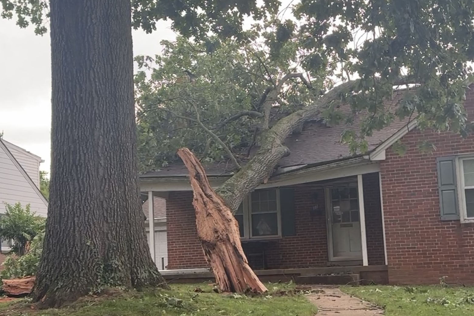

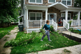
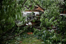
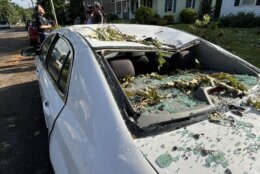


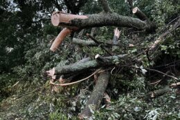
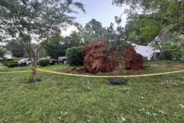
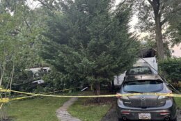
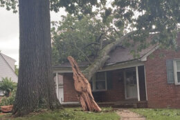
On Holly Drive in Deer Park, trees slammed into multiple homes, including Jorge Majano’s.
“I heard the hard rain. I was like, ‘Wow, that’s pretty rough.’ And then once I hear everything flying around, and then I hear stuff banging on my window, I’m like, ‘Oh my gosh.’ And then a tree hit my roof, and then I hear a loud pop, a big thud, like boom!”
Majano said that boom was the sound of another tree hitting the front of his house.
“I was kind of terrified, because I was like, ‘What do I do now? Do I die?'” Majano told WTOP’s Dave Dildine. “I stayed inside and then the firefighters knocked in and they told me to get out right away, and I did.”
Majano was uninjured, but just blocks away, on Dogwood Drive near Tulip Drive, the occupants of another home weren’t as lucky.
Montgomery County Fire and Rescue Service personnel responded to that location for the report of a downed tree that caused a building collapse, trapping five people in the home, according to Assistant Chief David Pazos.
“An enormous hardwood tree, I mean the root ball on this has got to be over eight, nine feet tall. And this tree collapsed on the house during the height of the storm,” WTOP’s Dick Uliano reported from the scene of the home in the 400 block of Dogwood Drive.
All five were successfully removed from the home, Pazos said. Four were taken to the hospital with injuries described as non-life-threatening and the other occupant had more serious, traumatic injuries, according to Pazos. All five occupants were adults. Three of them live there and two were visiting.
This enormous hardwood tree came down on the roof of this house on Dogwood Lane. The 400 block near Tulip. Five people were trapped one person has traumatic injuries all five taken to the hospital. @WTOP pic.twitter.com/X1CUPBNteC
— Dick Uliano (@DickUliano) June 6, 2024
It took crews about 20 minutes to work around “pretty significant damage” and rescue the occupants of the home, fire department spokesperson Pete Piringer said.
“They were trapped under a lot of debris and a large tree on top of them,” he said.
Firefighters also assisted people out of homes on nearby Rolling Road. Power was knocked out in the area and the destruction extended beyond houses.
“There is a lot of damage in this part of Gaithersburg, specifically on the east side of town. A number of streets are impassable. It took a while just to get over here — twisted wires, large trees down and, again, some structural damage,” WTOP’s Dave Dildine reported from the scene.
Cleaning up after historic storm system
During Thursday morning’s news conference, director of the Office of Emergency Management and Homeland Security Earl Stoddard said the damage could have been worse.
“At peak, we had about 1,000 power outages across the county. We’re down to a couple 100 at this point and those will come back online,” Stoddard said. “There are a number of crews out this morning doing work removing trees from roadways, and from power lines as well. So that work will continue.”
Pete Piringer, a spokesperson for Montgomery County Fire & Rescue, told WTOP while there is still a lot of debris and wires from the tornadoes, nearly all the roads in Gaithersburg and Poolesville had been opened by Thursday morning.
The first severe weather alerts came from Loudoun County, where a severe storm capable of producing a tornado started and headed toward Maryland. While the exact route and the strength of the tornadoes is still being determined, the damage was severe in Poolesville, Maryland.
Here’s the apparent path of the tornado at this farm along Whites Ferry Road, in Poolesville. Several trees were knocked down and sheared off. Investigators will be on scene to make official determination of storm’s strength. @WTOP @WTOPtraffic pic.twitter.com/lXjgXmOTzC
— Neal Augenstein (@AugensteinWTOP) June 6, 2024
On Thursday morning, standing in his driveway of Tudor Farm along White’s Ferry Road, Milton Andrews said he saw immediate damage Wednesday evening after emerging from a safe room in his basement.
“I had at least a half a dozen trees that had fallen across White’s Ferry Road, and had blocked it off,” Andrews said. “And four or five telephone poles were down.”
He said he’s still surveying the damage.
“I don’t know how much house damage there is,” he said. “I want to have somebody come out and look at the roof — I’m pretty sure I lost some slate off the roof.”
He’s realizing many full grown trees have been ripped out, sheared off and knocked over.
“There’s a row of white pine in back, roughly 10 of them — there’s one that’s standing,” Andrews said. “One lonesome pine.”
Andrews said his orchard has sustained damage: “My two best trees are both down.”
After he finishes surveying his property, he expects to spend a good part of his day on the phone: “I haven’t called my insurance agent yet, but I certainly will.”
WTOP’s Neal Augenstein, Cheyenne Corin and Dick Uliano contributed to this report.
Get breaking news and daily headlines delivered to your email inbox by signing up here.
© 2024 WTOP. All Rights Reserved. This website is not intended for users located within the European Economic Area.


