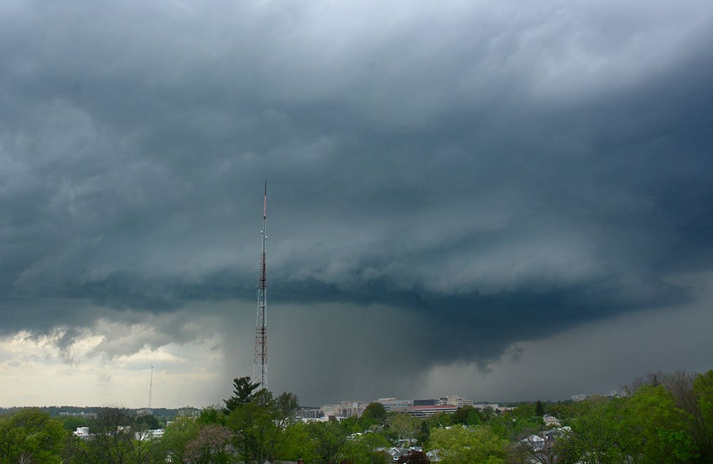
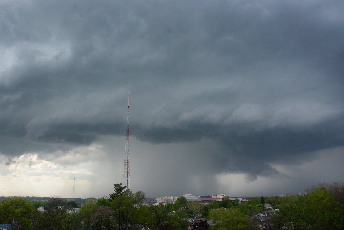
Friday supercell surprise. Boosted the brightness of time lapse. #DCWX #MDWX pic.twitter.com/9ubsnqvGEu
— Dave Dildine (@DildineWTOP) April 22, 2017
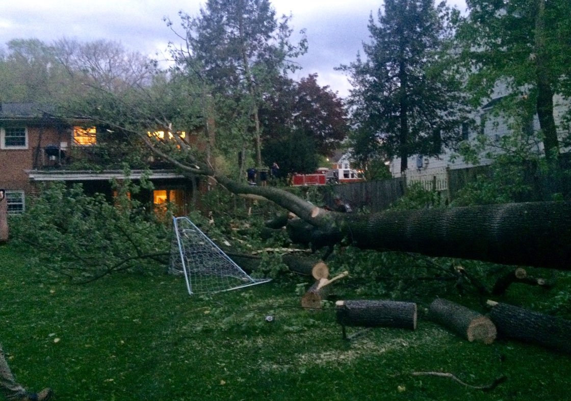
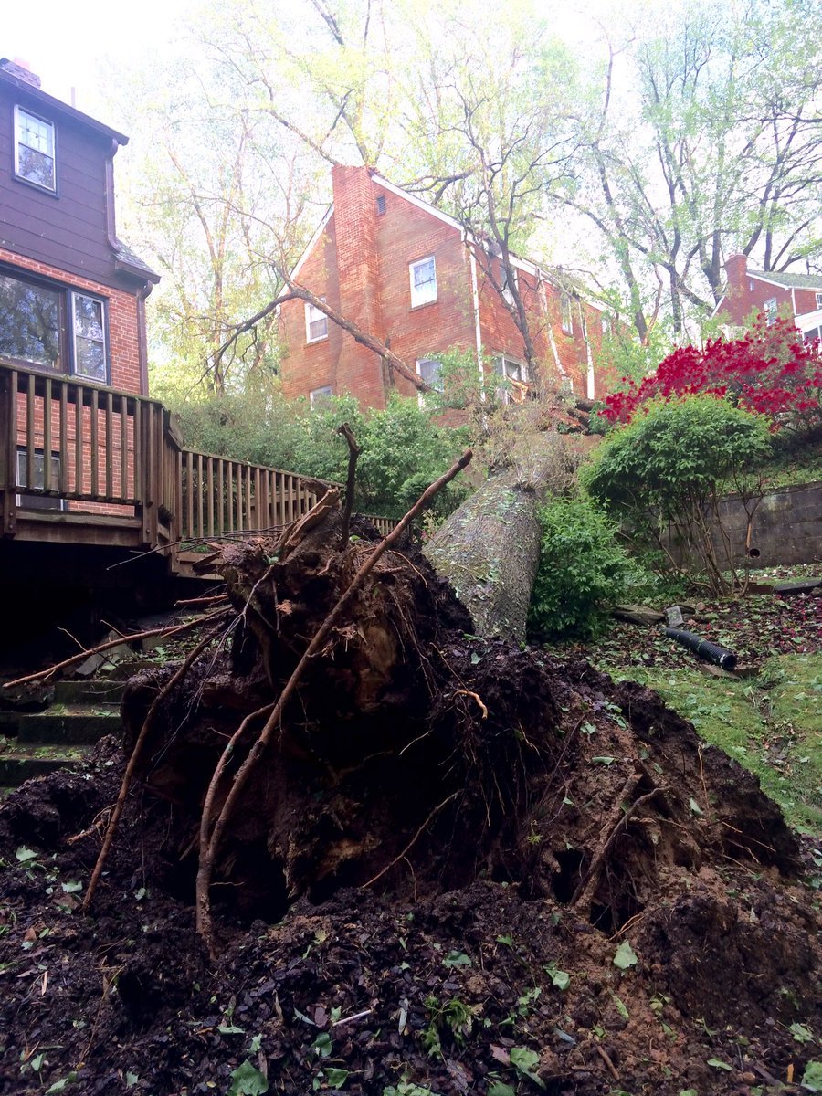
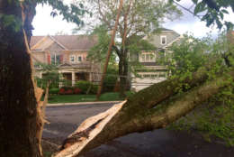
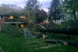
Manor Rd & Lynwood Pl, Bethesda, large tree on house occupants escaped without injury, 1 family displaced,wires down & streets closed pic.twitter.com/z5bQ5pAO8k
— Pete Piringer (@mcfrsPIO) April 21, 2017
Fri. HH beer on ice? Sure. Courtesy of Mother Nature. @wtop @weatherchannel @capitalweather #takoma #DC pic.twitter.com/79WWxYIYn3
— Clinton Britt (@clintonbritt) April 21, 2017
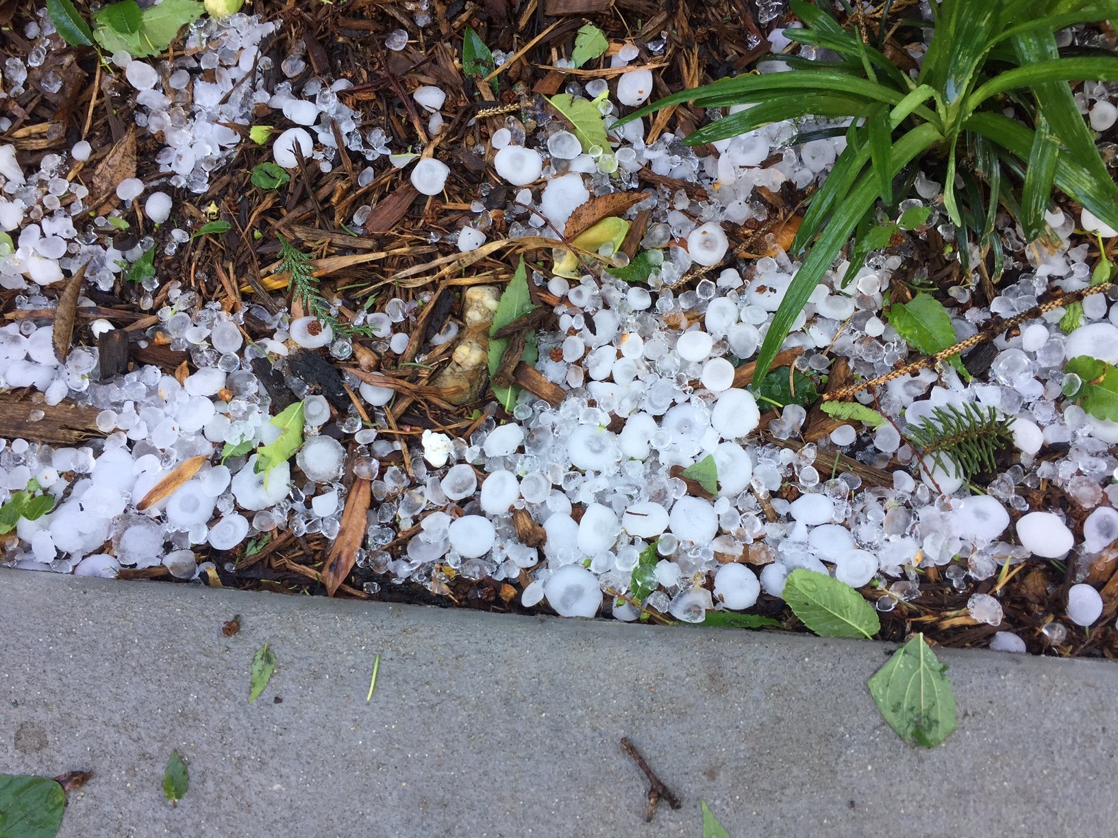
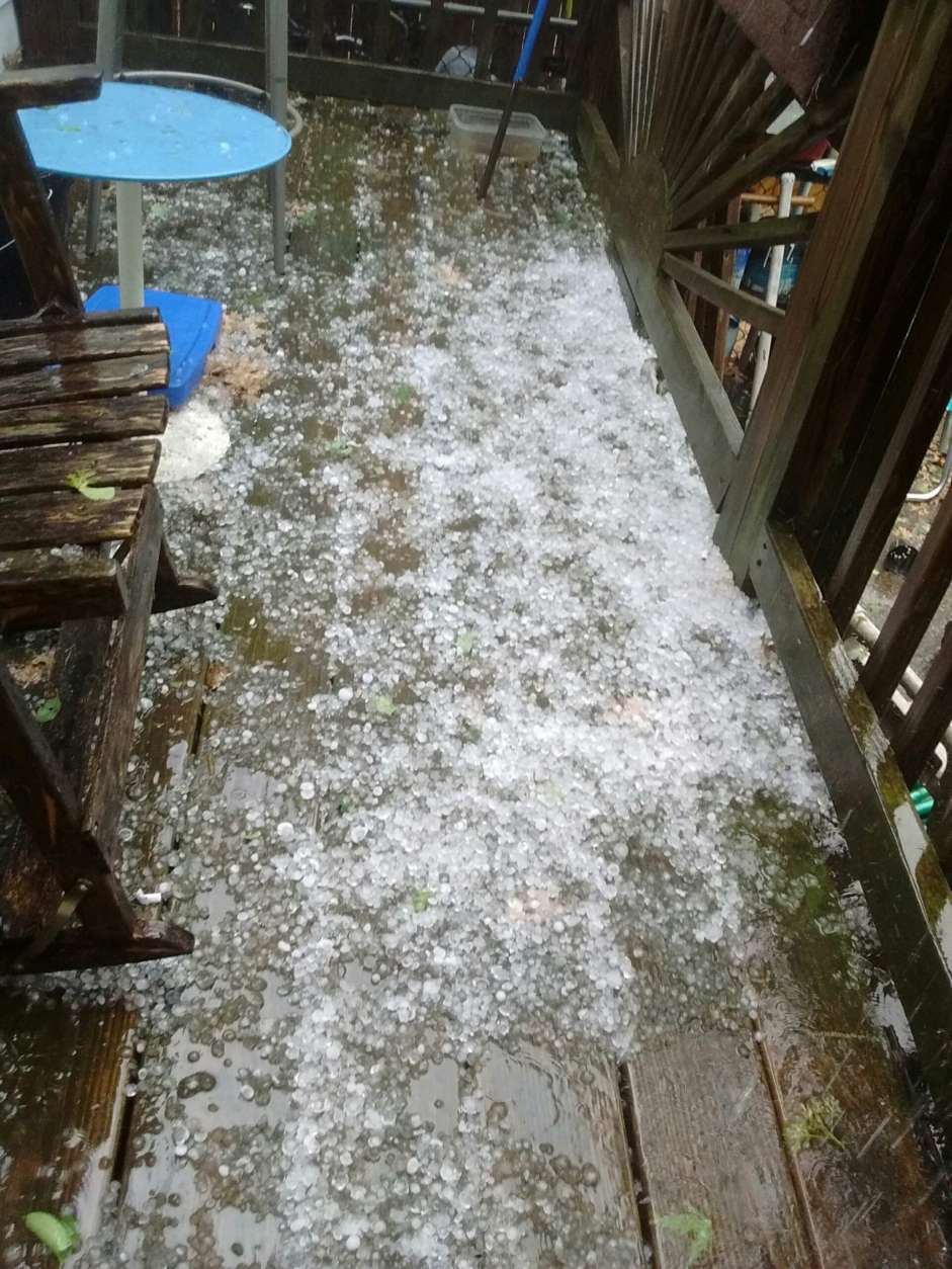
@WTOP @washdcnews @nbcwashington @TenaciousTopper April hail in Silver Spring, MD pic.twitter.com/X2FpaX0Nt8
— FentonGroupLLC (@FentonGroupLLC) April 21, 2017
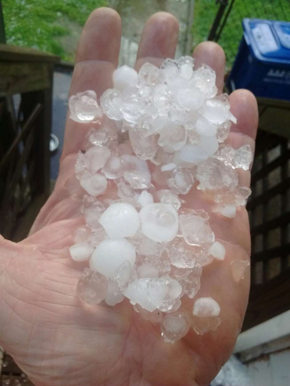
#silverspringMD right now @WTOP @weatherchannel heavy rock size hail coming down. pic.twitter.com/pwNnYO1DFD
— cprjr (@cprjr) April 21, 2017
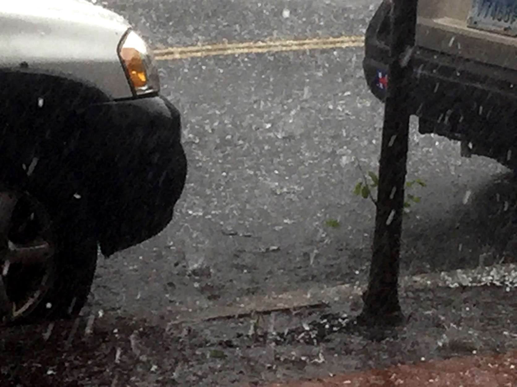
Heavy rain in #Rockville #Maryland @capitalweather @camdenwalker @ABC7Alex @ABC7Brian @mymcmedia @WTOP @MdWeather @ReadyMontgomery @spann pic.twitter.com/gyRLLyseU1
— MARIA (@MMMaryluna) April 21, 2017
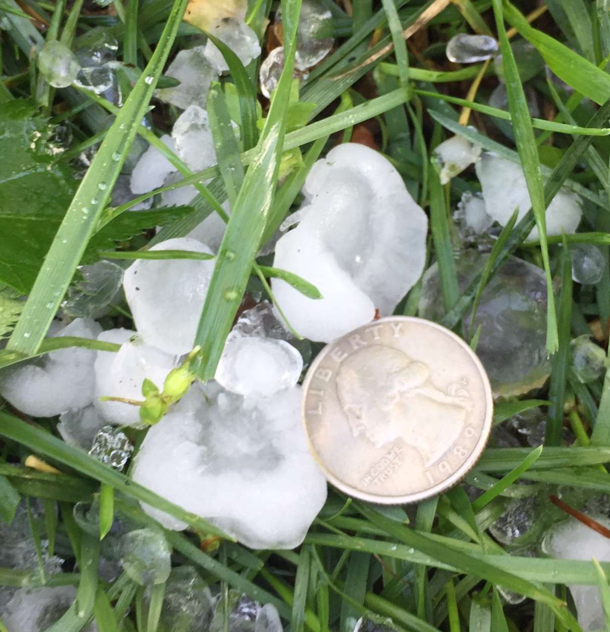
@wbaltv11 @WTOP @JustinWeather @ttasselWBAL #cheverly #washingtondc #hail #thunderstorm pic.twitter.com/37MZ7HkHrU
— Baltimore Berserk (@BaltimoreBRSRK) April 21, 2017
After T-storm, we saw a #rainbow over #Rockville #Maryland #MdinFocus @capitalweather @camdenwalker @spann @StormHour @JustinWeather @WTOP pic.twitter.com/xK7eWjBNHo
— MARIA (@MMMaryluna) April 21, 2017
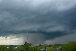
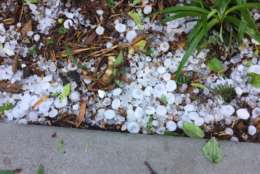
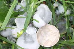
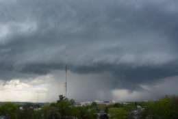
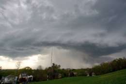


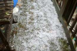


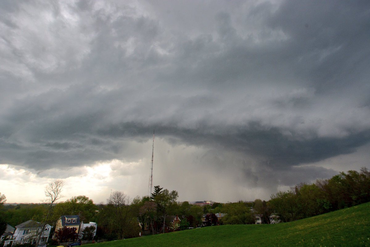
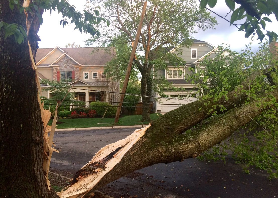
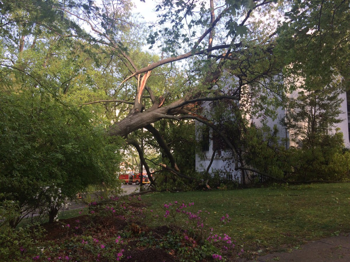
WASHINGTON — A powerful thunderstorm raced across the region Friday, April 21, 2017, downing trees and dropping hail up to the size of ping pong balls.
The thunderstorm formed in the panhandle of West Virginia and quickly intensified as it tracked into Montgomery County, Md. around 4 p.m. The storm produced large hail that stripped leaves from branches and winds that felled trees along a path through Bethesda, Chevy Chase, Silver Spring and Takoma Park.
No injuries were reported.
Hail up to the size of quarters was also reported in Prince George’s and Anne Arundel counties.
Friday supercell surprise. Boosted the brightness of time lapse. #DCWX #MDWX pic.twitter.com/9ubsnqvGEu
— Dave Dildine (@DildineWTOP) April 22, 2017
The storm was a supercell, an intense, rotating weather system, that tracked over 70 miles from West Virginia to the Chesapeake Bay.