WASHINGTON — Well if you have plans this weekend, you are going to want to pay attention to the forecast as we continue to watch the moisture from what was Tropical Storm Bill take aim at the Mid-Atlantic.
Saturday
Most of Saturday looks dry. After a weak cold front moves south of the WTOP listening area on Friday, high pressure will push in north and east of our area as the front stalls south. We will start off with a little sunshine in the morning. However, clouds will move in throughout the day and temperatures will rise into the mid-80s. One thing to note is going to be the humidity. It will be another extremely humid day around the region so be mindful of that when out and about (although it will be difficult not to notice it).
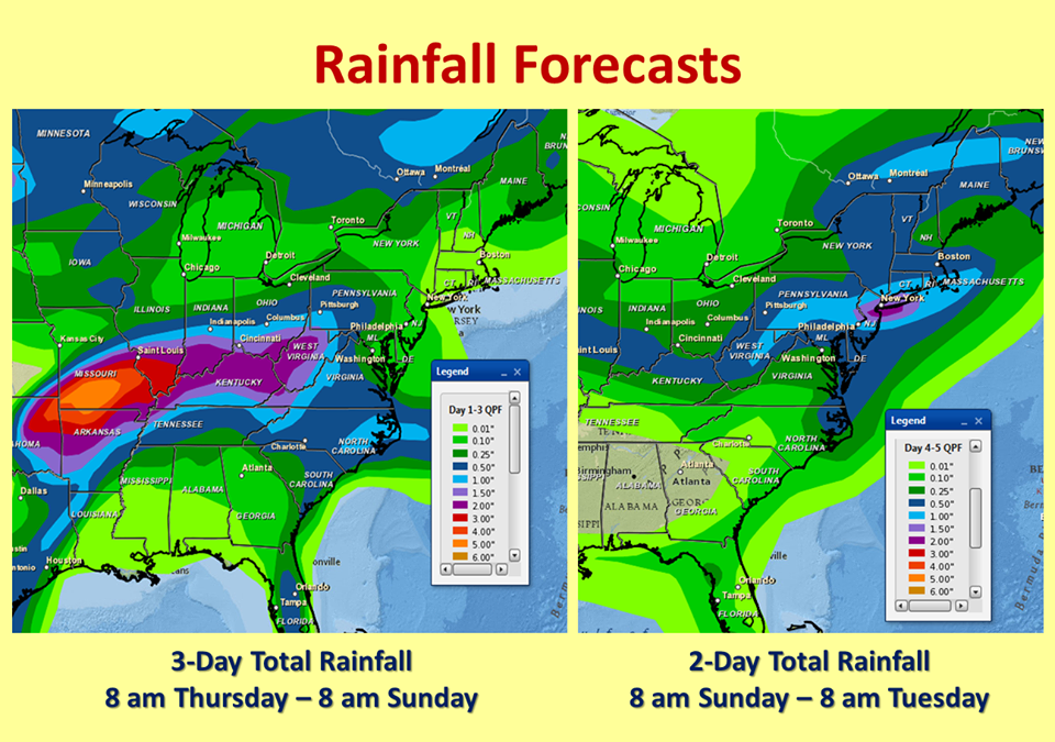
Moisture from Bill will interact with the frontal boundary draped across our area. As of this Thursday update, it continues to look like most of the activity will start streaming in by Saturday evening or even later. So whether you are at the FireFly Festival, Jimmy Buffet, WolfTrap, Nats Park or just out and about – that is when you are going to want to keep an eye to the sky.
Saturday overnight
Rain showers (with some heavy rain at times) as well as some embedded thunderstorms will move through the region late Saturday night into Sunday morning. It will be very muggy with temperatures in the 70s overnight. The weak cold front that passed through the region on Friday and stalled to the south will start to retreat northward on Saturday night into Sunday morning as a warm front.
Sunday
The moisture leftover from Bill looks to move pretty quickly through the region. It will clear from the west to the northeast. Therefore, areas south and east may not see quite as much rain and for a shorter period of time.
It will rain for a good portion of our area, along with area beaches through at least the first park of Sunday (it could be out earlier). I am keeping temperatures in the 80s due to extensive cloud cover – even after the rain ends. But if we do get some peeks of sunshine in the afternoon then we could see that temperature push 90. Unfortunately, we will have another chance of some storms on Sunday afternoon as a cold front edges towards the area- eventually passing through on Monday. This could kick off a few of those storms on Sunday afternoon.
It is still too early to tell where the heaviest rain will set up and if there could be a flood/severe threat. Also there are still a few timing issues but for the most part you can count on the humidity and high chances of rain.
Keep it here and we’ll keep you updated!