WASHINGTON — Whiteout conditions and dangerous cold are punctuating a historic snowstorm that continues to pound the Mid-Atlantic Saturday night.
The storm has dropped about 2 feet of snow throughout the region with totals nearing records in some spots and officials continue to warn that the storm still bring the threat of widespread power outages.
Blizzard warnings remain in effect and intense winds are whipping up the feet of snow, re-coating plowed roads and compounding already perilous travel conditions. Maryland Gov. Larry Hogan ordered all of Interstate 270 and a portion of Interstate 70 closed until 7 a.m. Sunday to remove snow.
One storm-related death has been reported, the roof collapsed on a condominium building in Montgomery County and, further east, coastal flooding is hitting Ocean City, Maryland.
The massive storm is expected to last through midnight when it will wind down and pull north of the area, according to NBC Storm Team 4 meteorologist Steve Prinzivalli.
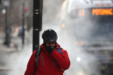
Anyone who ventures out tonight should dress in multiple layers to guard against the single-digit windchills, he said.
Local leaders implored residents to stay off the roads, which are treacherous as snow drifts reach 5 and 6 feet and plows struggle to keep up with the pace of the rapidly falling snow. Sidewalks remain impassible and cars are buried to their roofs ensuring a long dig out.
Virginia and Maryland’s governors warned that it could take days to clear away all the snow once the storm ends and urged residents to plan to spend Sunday at home too.
D.C. Mayor Muriel Bowser admonished pedestrians for walking in the street. She said they are better off staying home until sidewalks can be cleared.
District public schools and Metro both expect to decide by Sunday afternoon what the plans are for Monday morning.
“We have approximately 388 crew members, that’s including contractors, that are working 12-hour shifts,” Marisol Peralta, with the Prince George’s County Department of Public Works, told NBC 4 Saturday.
“We’re just going to continue until the snow stops and we can make the roads safe for everyone.”
All area airports — BWI, Reagan National and Dulles — have grounded planes until further notice. Amtrak says it is running trains but they are running on a modified scheduled for its Northeast line. No trains are traveling south.
Some parts of the region could see 3 feet of snow by sunrise Sunday.
Snow totals as of 11 a.m. Saturday were at least a foot or more in the greater Washington area. Winchester, Virginia, had already reached the predicted 30 inches. The storm was reaching one-day storm records set more than 90 years ago.
According to WTOP’s Dave Dildine, the last time Reagan National saw a 22-inch accumulation in one day was in 1922. Dulles International Airport hit a new daily snowfall record on Saturday at 15.2 inches and counting. As of 11 a.m. the Capitol already had 16 inches. There were already two feet of snowfall at that time in Manassas, Virginia.
Stay with WTOP for updates throughout the weekend storm.
Quick Links
- Storm Forecast
- Closings and Delays
- Commuting/Travel issues
- States of Emergency/911 Service
- Power outages
- Listen Live
Storm Forecast
Heavy snow and howling winds with gusts up to 50 mph continue to pummel the region. Wind chills are in the single digits and teens, making this a dangerous storm, says Storm Team 4 meteorologist Steve Prinzivalli.
He cautioned that snow shoveling should wait until the morning. Anyone who needs to venture out for emergencies should dress in layers tonight as windchills are in the single digits. Snow shoveling conditions will improve Sunday when the sun returns.
Snowfall will continue to drop at a rate of 1 to 2 inches per hour through 8 p.m. and then gradually taper to flurries between 10 p.m. and midnight. Overnight, the storm will push out of the region and skies will clear. Winds will drop to 10 to 20 mph by the morning. Temperatures will be in the low to mid 30s with sunshine for the great dig out.
Baltimore-Washington International Airport with 26 inches was 1 inch shy of the three-day record set in February 2003, Prinzivalli said.
Dulles International Airport surpassed the one-day record from February 1983 by lunchtime.
As much as 30 inches of snow, and even more for communities to the north and west, could be on the ground by Sunday morning.
Southern Maryland should expect smaller snow totals as sleet and freezing rain will mix with the snow. However that wetter weather could make roads slippery and even more dangerous to drive or walk on.
Blizzard Warnings from the National Weather Service remain in effect until early Sunday morning for the entire D.C. region.
However the winds have not been quite strong enough for the storm to actually met the technical definition of a blizzard, says Prinzivalli.
Sustained winds must be at least 35 mph and visibility must be less than 1/4 of a mile for three or more hours. Although gusts have exceeded 35 mph, sustained winds have ranged between 26 and 29 mph, he said.
Visibility at Reagan National did meet the 1/4 mile threshold, he said.
The powerful storm is expected to impact the eastern third of the country and roughly 50 million people. It threatened to bring tornadoes in Texas and ice storms in Kentucky and North Carolina. Coastal flooding is a threat in New Jersey. National Guard units have been activated in 12 states.
Travel/Commuting
Road conditions continue to deteriorate. Around the region, interstates, main roads, and neighborhood streets are snow covered despite constant plowing by road crews.
Saturday morning, massive snow plows and even Humvees became stuck in drifts and road ruts inches deep. Pedestrians were seen walking in D.C. streets even though sidewalks in some commercial corridors were cleared.
By the afternoon, visibility decreased dramatically as the snow began to blow. Traction continued to be a problem and vehicles were struggling to break through tall snow berms at the intersections of primary to secondary streets. Northbound lanes of Interstate 270 were blocked for about three hours after several tractor trailers became mired in the snow. Traffic behind them were routed off the highway at Route 109 in Hyattstown.
And two heavy-duty wreckers needed an hour to clear a tractor trailer from Interstate 95 in Lorton.
Any sleet that hits Southern Maryland could coat snow making roads extra slippery and dangerous.
Both Maryland and Virginia’s governor said it could take days to clear all of the snow and that residents will not be able to venture out even once the snow starts. D.C. Mayor Muriel Bowser asked pedestrians to get out of the street and to stay home.
Since a snow emergency took effect in D.C. Friday morning, the Department of Public Works has issued more than 2,800 tickets and towed 409 vehicles for parking on snow emergency routes.
Wind restrictions are in effect on the Chesapeake Bay Bridge.
Metro expects to decide by Sunday afternoon what the plans will be for Monday morning.
Metrobus and DC Circulator have both suspended service. Metrorail closed down for the weekend late Friday night. Trains were parked inside the tunnels to protect them from the snow. Find out more about the transit situation here.
Metro is allowing drivers to leave cars parked overnight in Metro garages and lots, which are always free on weekend. The free overnight parking ends Monday morning.
No flights are expected to take off from three of our local airports Saturday and Sunday. Runways are closed at Dulles. No flights are anticipated at Reagan National. And the last departure from Baltimore-Washington International was Friday night. Airport officials say some flights could begin Sunday but that will depend on the conditions.
American, United and Southwest Airlines all canceled flights into the D.C. area’s three major airports — Reagan National, Baltimore-Washington and Dulles International — before the storm’s arrival. American Airlines has cancelled all Sunday flights with service expected to resume on Monday.
Amtrak has canceled all services south of D.C. this weekend. Passengers who have reservations that will be affected by these changes will be contacted by the company.
Car2Go, the car-sharing service, suspended service as of Thursday night.
The D.C. Taxicab Commission has enacted a Snow Emergency Fare as of 9:30 a.m. Friday. The fare authorizes taxis to add a flat fee of $15 to the metered charge.
Capital Bikeshare shutdown 2 p.m. Friday, lasting through Saturday. They’ll make a decision on Sunday later.
MARC’s Penn Line will not operate Sunday. A decision regarding Monday service should be made by 9 p.m. Sunday.
Get the latest traffic updates on the WTOP traffic page, by following @WTOPTraffic on Twitter and by listening to 103.5 FM on-air or online. You can also follow along with the latest traffic conditions, in our live blog.
Power Outages
As of Saturday evening about 1,000 customers were without power region wide. However, with wind, utility companies are warning customers to brace for outages — some of which could last for multiple days. They’re giving the same advice they give at the beginning of every storm: Don’t assume they know your power is out — report it.
Pepco — About 300 customers are without power, mostly in Southeast D.C. Restoration is expected early Sunday morning.
BGE – About 300 outages in Howard County
Only a few Dominion Virginia customers in Fairfax are still without power.
Find phone numbers and links to report an outage over the phone or online, as well as what else the power companies are doing to prepare for the storm, here. Or text the word POWER to 91035 and WTOP will text the number back to you.
Closings and Delays
School districts around the region have canceled activities scheduled through the weekend and Frederick County, Maryland, schools will be closed Monday.
D.C. Public Schools expects to decide by Sunday afternoon what the plans are for Monday morning.
Many college and professional sporting events in the area have been moved or rescheduled. See the list here.
The Smithsonian closed D.C. museums, as well as the National Zoo, at noon, except for the National Museum of American Art and the National Portrait Gallery, which didn’t open at all.
The National Park Service says the National Mall and Memorial Parks are closed through at least Sunday.
The U.S. Postal Service closed all post offices in the D.C. metro by 3 p.m. Friday. Mail had to be in collection boxes by noon.
The Rev. Paul Loverde, the bishop of Arlington, said in a statement Thursday that Catholics in the diocese aren’t obligated to attend Mass on Sunday. The archdioceses of Washington, Baltimore and Wilmington, Delaware, are reminding worshippers that dangerous travel conditions are a legitimate excuse from fulfilling their Sunday Mass obligation, The Associated Press reports.
Find a full list of closings and delays here.
States of Emergency/911 Service
Virginia Gov. Terry McAuliffe, Maryland Gov. Larry Hogan and D.C. Mayor Muriel Bowser have all declared states of emergency. Bowser has also declared a snow emergency.
Metropolitan Police Chief Cathy Lanier says that if motorists are involved in a minor accident with no injuries during the storm, they should just exchange information and not call police for assistance.
Lanier says that police will respond to emergencies throughout the duration of the storm, however should expect to wait longer for help. Learn more about the District’s public safety plans for the weekend here.
Sledding
Is there a bright side? Well, for those who can make it to Capitol Hill, you can sled down it legally now.
Listen Live
Listen live on WTOP.com, on the WTOP app or tune in to 103.5 FM.


