Workweek weather: High wind ushers in new week

(WTOP/Storm Team 4)
A major wind event gives the new workweek a blustery start thanks to two different low pressure systems, which will have already combined (or “phased”) near the coast of New England. (WTOP/Storm Team 4)
(Warnings: National Weather Service/ Graphics: Storm Team 4)
(Data: The Weather Company/Graphics: Storm Team 4)
These following four images are the future satellite and future precipitation-type radar as simulated by the RPM computer model, run with Sunday evening’s data. (Data: The Weather Company/Graphics: Storm Team 4)
(Data: The Weather Company/Graphics: Storm Team 4)
The lines are called “isobars,” lines of equal pressure. (Data: The Weather Company/Graphics: Storm Team 4)
(Data: The Weather Company/Graphics: Storm Team 4)
The closer the lines, the more the pressure is changing across the area and the stronger the winds. (Data: The Weather Company/Graphics: Storm Team 4)
(Data: The Weather Company/Graphics: Storm Team 4)
Note that they are more tightly packed on Monday and they relax quite a bit for Tuesday. The next system is already waiting in the wings to come down from Canada for Wednesday. (Data: The Weather Company/Graphics: Storm Team 4)
(Data: The Weather Company/Graphics: Storm Team 4)
These images show the average wind speed and direction at the same times predicted by the RPM computer model. The second image for each snapshot in time is the gust speed. Some of the gust numbers may be too low, hence the “High Wind Warning.” And note the brutal wind chills for the Monday morning rush. Wind speeds will diminish greatly between Monday and Tuesday. (Data: The Weather Company/Graphics: Storm Team 4)
(Data: The Weather Company/Graphics: Storm Team 4)
Lastly, the forecast from the Weather Prediction Center for the entire country for the week shows that we will be bypassed by all the major precipitation makers. Amounts shown are in inches and are either rainfall or the equivalent of snow/ice melt. All in all, a very dry week for us. (Weather Prediction Center/NOAA)
(1/16)
(WTOP/Storm Team 4)
(Warnings: National Weather Service/ Graphics: Storm Team 4)
(Data: The Weather Company/Graphics: Storm Team 4)
Lastly, the forecast from the Weather Prediction Center for the entire country for the week shows that we will be bypassed by all the major precipitation makers. Amounts shown are in inches and are either rainfall or the equivalent of snow/ice melt. All in all, a very dry week for us. (Weather Prediction Center/NOAA)

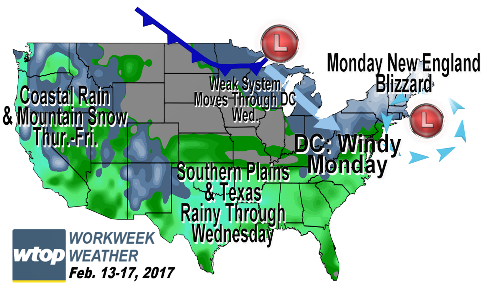
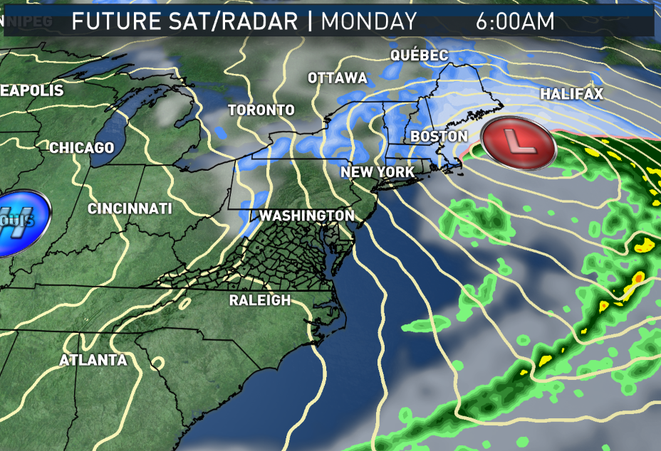
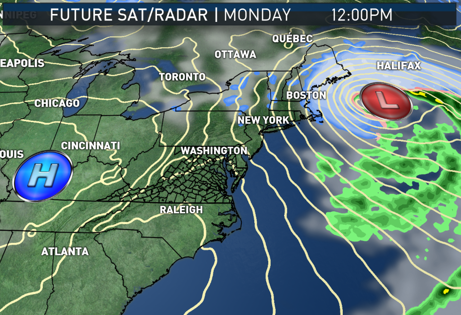
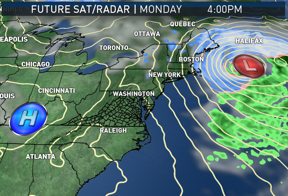
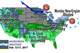
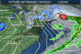
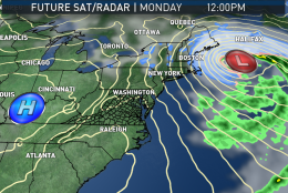
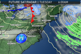
WASHINGTON — A major wind event gives the new workweek a blustery start thanks to two different low pressure systems, which will have already combined (or “phased”) near the coast of New England.

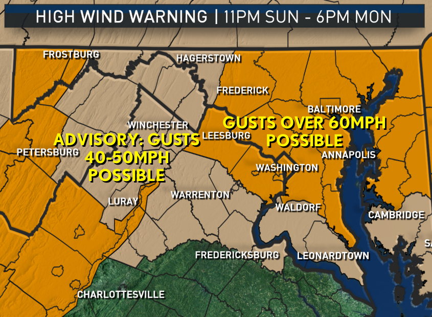
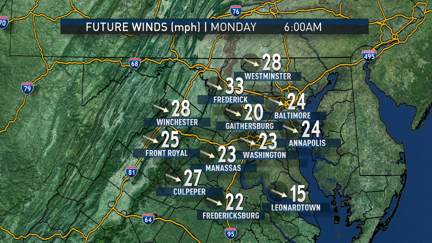
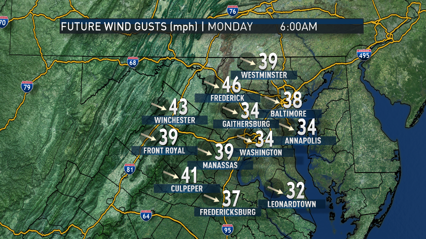
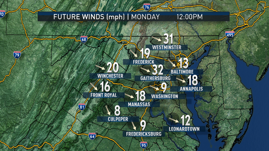
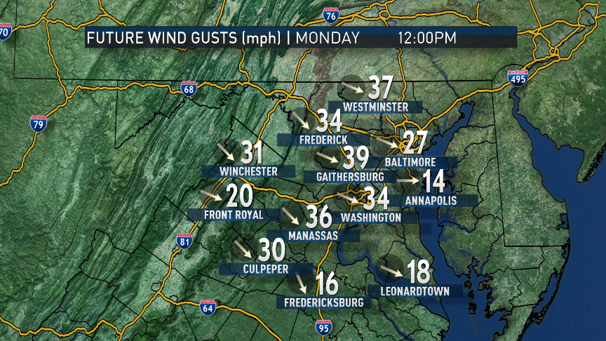
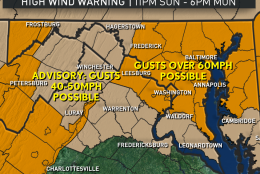
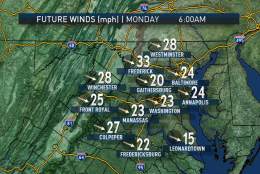
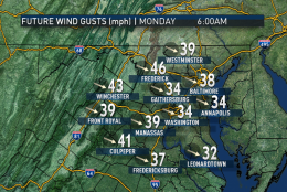
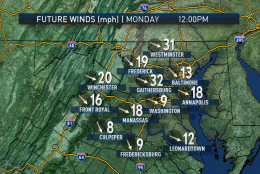
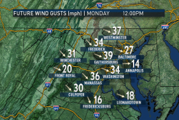
Wind gusts Monday could be as high as 60 mph in most of the area, so the National Weather Service posted a fairly rare High Wind Warning because of the serious wind-damage potential. Other surrounding areas have a more common Wind Advisory for more minor disruptions caused by the wind gusts of up to 40 or 50 mph.

Even though we will not get any precipitation out of that storm, it will be directly responsible for our winds as a result of the intense gradient in atmospheric pressure — that is, the difference in pressures across the area.

You can think of low pressure as an “absence” of air whereas high pressure has an “excess.” Air from high pressure in the middle of the country is rushing to fill the “void” in the low pressure center near New England. And the air in low pressure areas is rising, also, resulting in all the clouds and precipitation. The air in the high pressure center is sinking, keeping it relatively cloud-free, and we are in-between with strong winds and mainly dry weather.

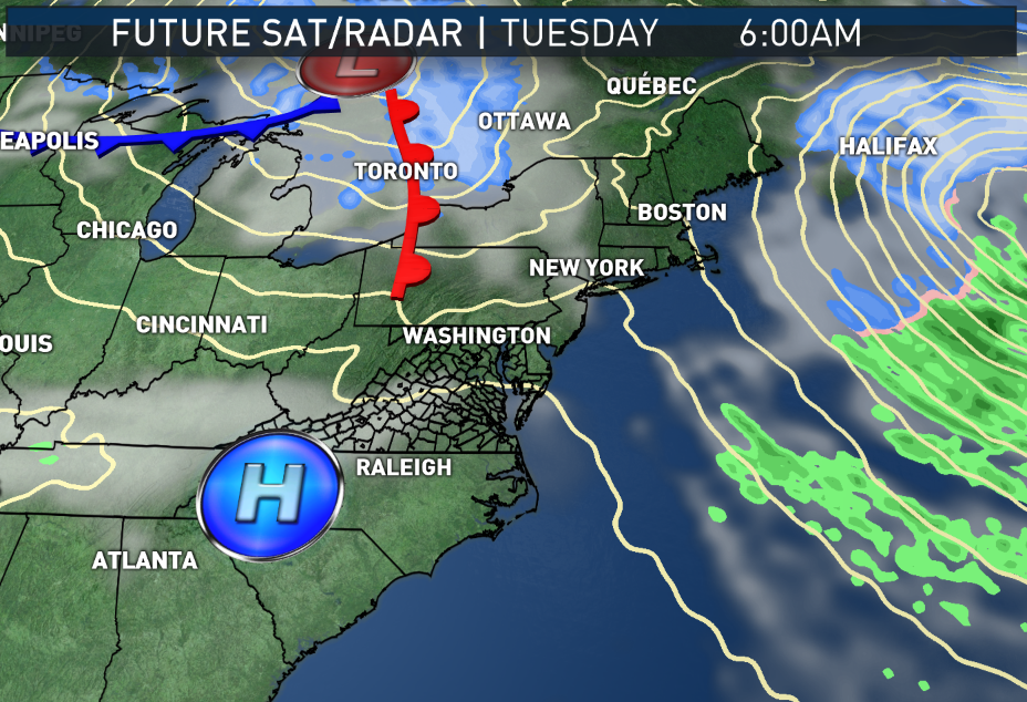
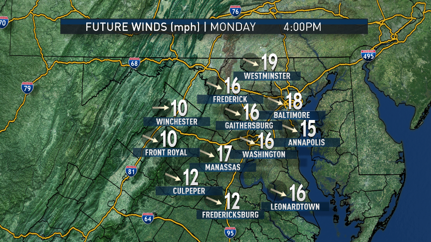
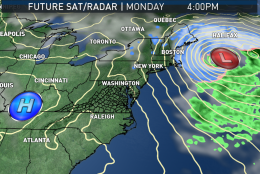
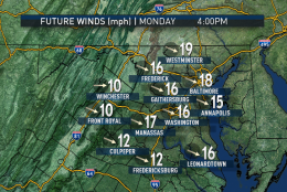
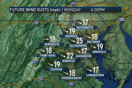
The storm is New England’s second blizzard in just a few days, but it will be heading out to sea late Monday, and our pressure gradient will not be as strong, so the winds will start dying down though not completely. The winds will keep the cold flow of air into early Tuesday morning, though just enough wind will keep the temperatures from bottoming out as low as they otherwise would go under these circumstances. High pressure will build in to our south and our wind direction will change to more westerly and southwesterly, which, combined with the sunshine, will make for a fairly pleasant Valentine’s Day on Tuesday.

A cold front will pass through the area Wednesday without much fanfare other than stirring up some more wind, once the system phases with a disturbance riding the Gulf Coast and forming another deep low pressure system near, yep, New England again. Even though we won’t get much, if any, precipitation out of the process, we will get another gusty day with some colder temperatures. Right now, it does not look like it will be as windy as Monday.

Daily weather highlights 

MONDAY
• Very strong winds with possible tree damage and power outages
• Gusts occasionally on the order of 60 mph
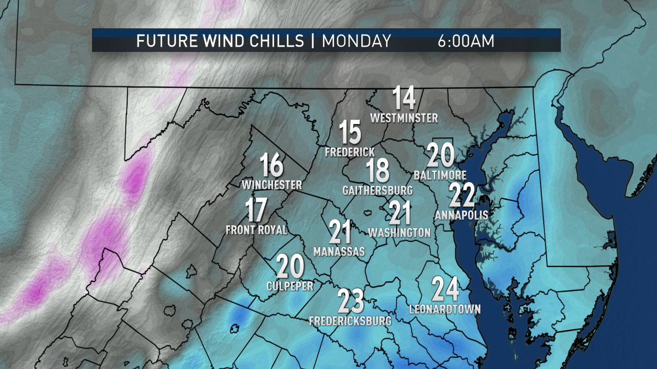
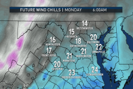
• Temperatures by themselves not that cold, but wind chills in the low 20s to near freezing
• Sun going in and out of fair weather clouds, most clouds near the Blue Ridge
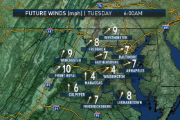
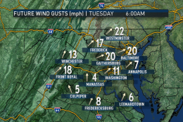
TUESDAY
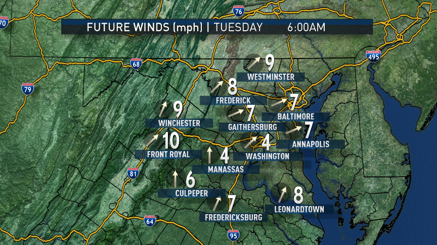
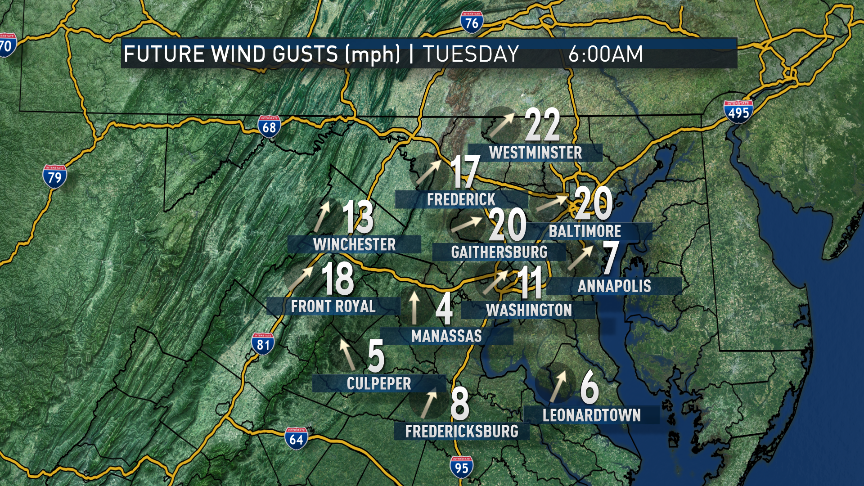
• Winds nowhere near as strong, but still a little breezy
• Temperatures milder and wind chills not a factor
• Weather not a factor in Valentine’s Day dinner plans

WEDNESDAY
• Increasing cloud cover
• Slight chance of some light showers and sprinkles
• Temperatures a bit closer to seasonable

THURSDAY
• Mostly cloudy
• Strong breezes
• Colder-than-average temperatures

FRIDAY
• Lots of sunshine
• Not as windy
• Still unseasonably chilly

Federal News Network Logo
Log in to your WTOP account for notifications and alerts customized for you.

Sign up