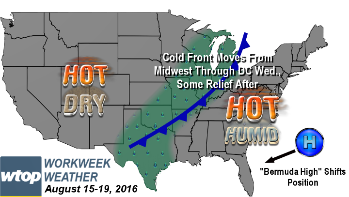

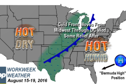

WASHINGTON — The latest heat wave provided by the “Bermuda High” will continue this week, but the pattern will lessen somewhat. You will be saying goodbye to the dangerous, record-setting temperatures and the oppressive levels of humidity, which will be replaced by more typical heat and humidity levels. So, indeed, the improvement will just be a matter of comparison.
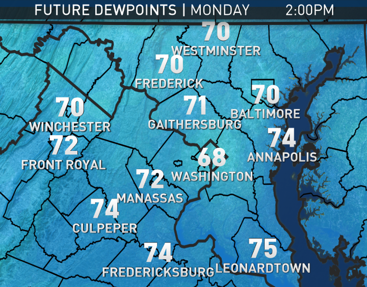
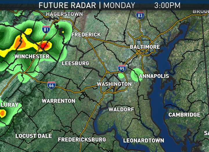
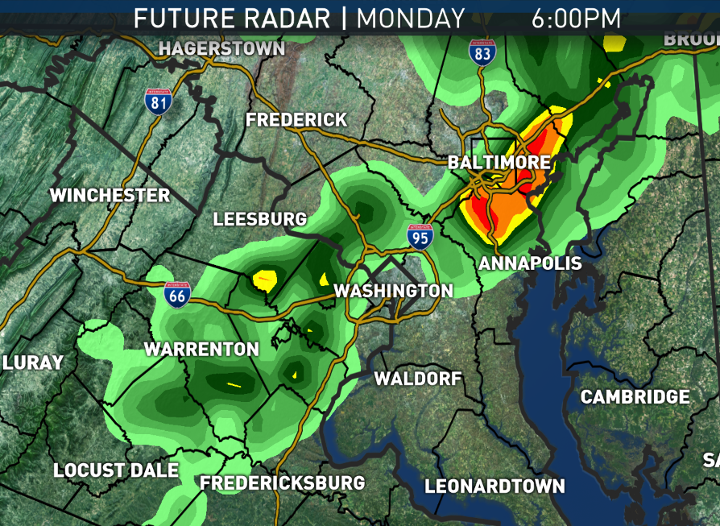
On Monday, a weak cold front will be hung up from southern Pennsylvania into northern Maryland. The presence of the front will keep as much cloud cover around, like on Sunday, if not a little more. Winds will be a bit more southeasterly instead of westerly, which means the winds won’t be sloping down the mountains. That process adds heat to the atmosphere, so without that process, temperatures will be just a little cooler than they would be otherwise.
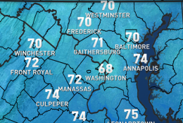
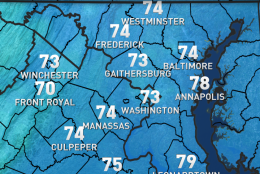
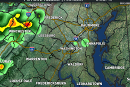
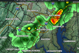
Scattered thunderstorms will more easily form in the afternoon, further blocking more sunshine. So, all those elements will keep high temperatures in the low-to-mid 90s, and they won’t be pushing the century mark or challenging any records. It will, however, still be just as humid as it was over the weekend.
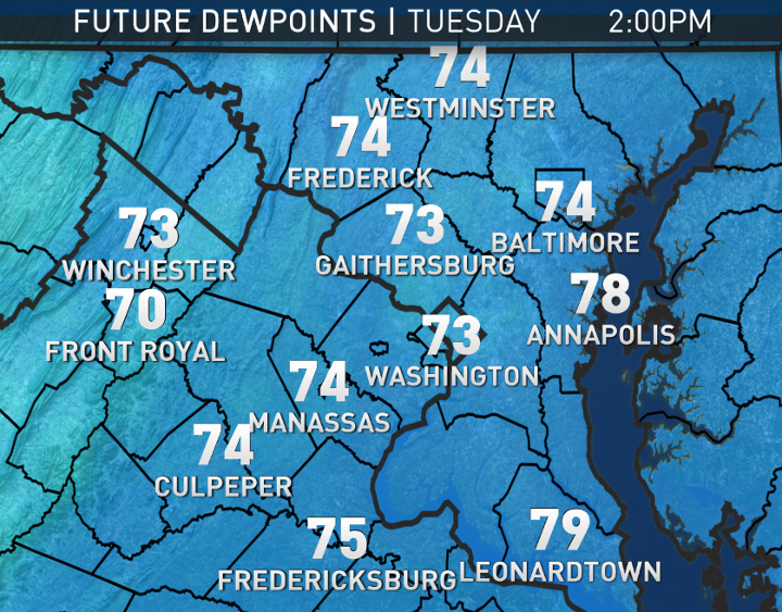
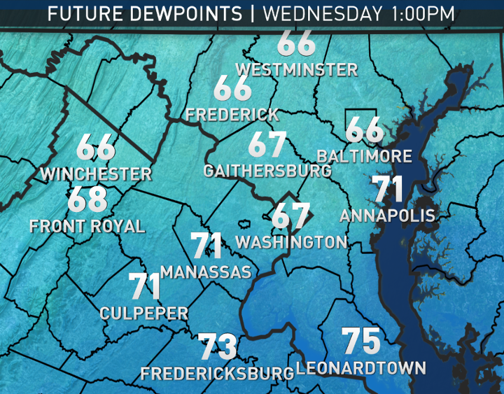
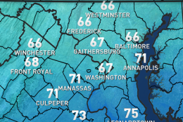
The front will drift back north into Pennsylvania on Tuesday, allowing for a hotter day and just as much humidity. Then, on Wednesday, the front will finally pass through the area, possibly without much storm activity. The humidity will start falling Wednesday night into Thursday on northerly winds. But the improvement will just be modest: Dew points dropping into the mid 60s are more comfortable than the oppressive mid 70s dew points experienced during this heat wave, but it will still be the low end of muggy.
DAILY WEATHER HIGHLIGHTS
MONDAY
- More clouds than sun
- Less blistering heat, but still hot
- Still muggy
- Better chance of scattered late-day thunderstorms, forming near the mountains then moving east
TUESDAY
- Slightly hotter than Monday
- Still muggy
- Only a slight chance for scattered thunderstorms
WEDNESDAY
- Increasing cloud cover
- Still hot and humid
- A stray thunderstorm or two along the front
- Humidity starts dropping that night
THURSDAY
- Mostly cloudy and a bit breezy
- Just feels sticky instead of tropical
- Some indications there may be showers, especially in the morning, and that we may not reach 90, breaking the official heat wave
FRIDAY
- Sun mixed with fair weather clouds
- Very warm, but most spots stay in the upper 80s
- The big cities could be back up near 90
NOTE: The WTOP Workweek Weather Blog is intended as an in-depth yet plain language summary of the business week’s weather potential in the D.C. area along with an explanation of the contingencies and uncertainties that exist at the time of publication. For the latest actual Storm Team 4 Forecast, check out WTOP’s weather page.