WASHINGTON — Spring officially arrives at 12:30 a.m. Eastern Daylight Time Sunday, and at that time the WTOP listening area will be in the middle of another coastal storm, one that will have the potential for some wintry weather.
The impact from this weather, however, won’t be as bad as if it came in the middle of winter. In fact, not only is the time of year coming into play with this storm, the time of day will also be a factor.
Key points:
- Temperatures will be above freezing for most of the area for most of the storm.
- Accumulation potential — regardless of numbers — is mostly on the grassy areas, and mostly in the higher elevations of the northern and western suburbs.
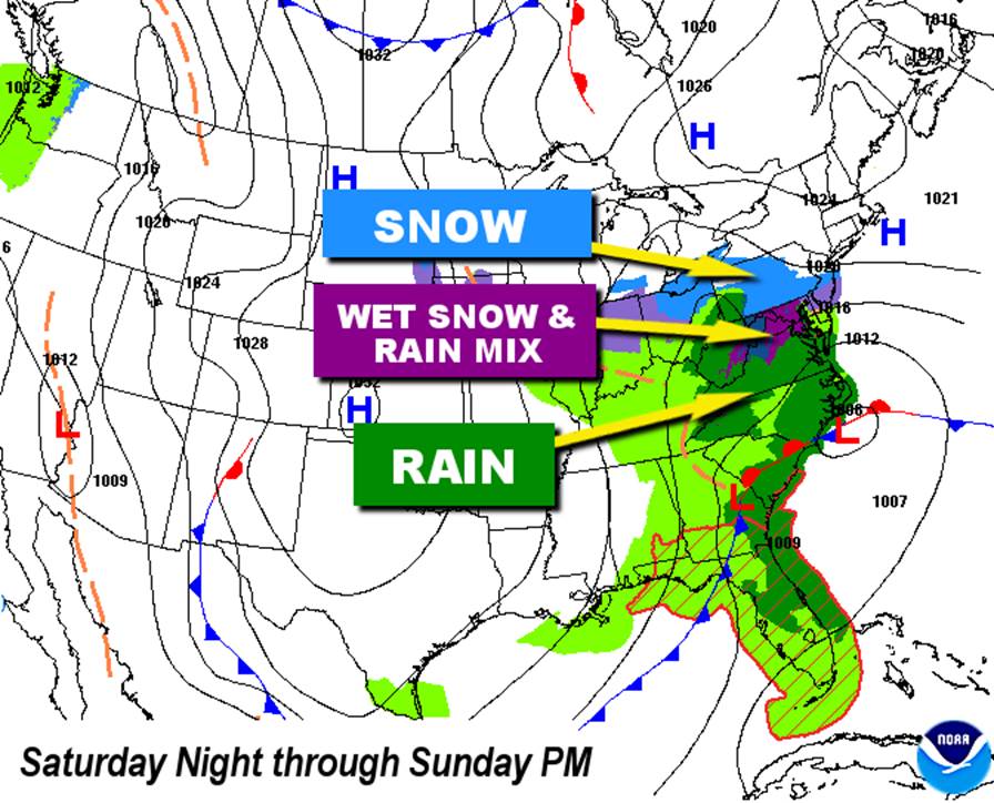
- It starts as rain Saturday evening, mixing with or changing to wet snow Sunday morning.
- Heaviest rain rates and snowfall rates will be late Sunday morning through Sunday afternoon.
- All precipitation ends Sunday evening.
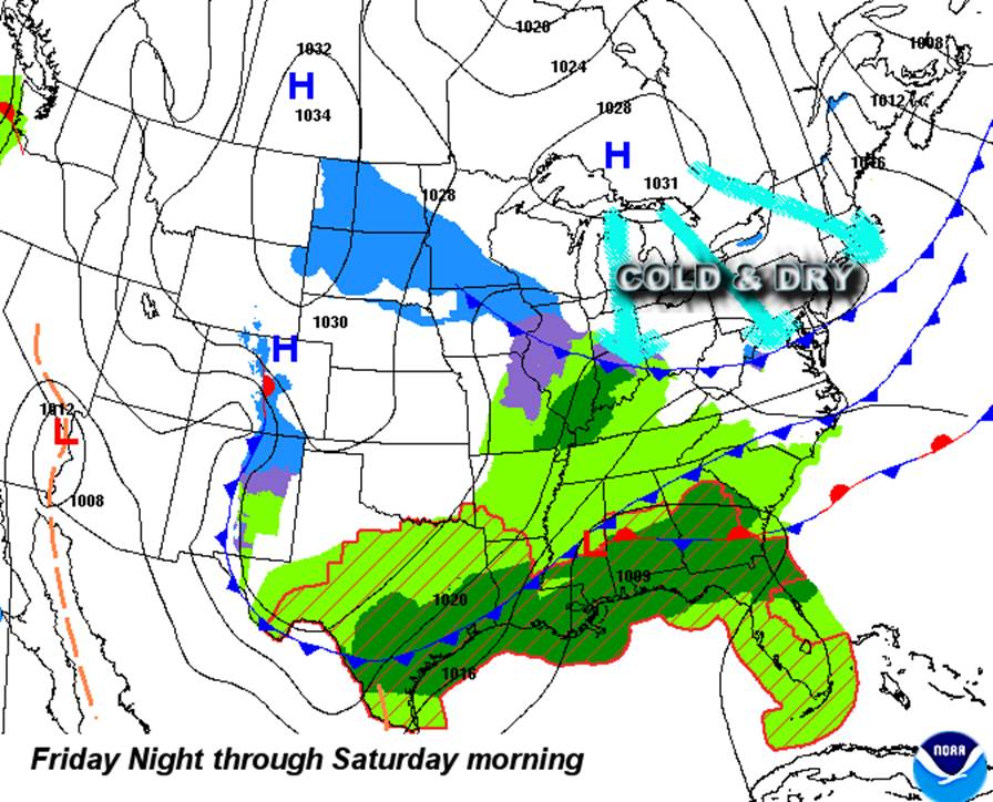
High pressure will bring us abundant sunshine Friday, but after that moves out, a cold front will pass through in the evening. The front will have some chilly air behind it, but mainly will bring in drier air, especially in the mid-levels of the atmosphere. At the same time, a low pressure system will start forming near the Gulf states along an older front and start heading for the mid-Atlantic coast.
Temperatures will be well above freezing Friday night and through the day Saturday, but the dry air will ensure that the first batch of precipitation moving toward the area will not make it to the ground. But that process will take heat out of the atmosphere and moisten it up at the same time. So more snowflakes will start getting closer to the ground.
Then those snowflakes will start melting into raindrops. That melting process also cools the atmosphere: More and more snowflakes will make it closer to the ground before melting. Eventually, the snowflakes can make it all the way to the ground and don’t melt until they make contact. But in spots where it’s snowing faster than melting, there will be a net accumulation.
So this will be another scenario where the greatest chance for measurable snow will be in the highest elevations (less time for snowflakes to melt). That being said, the ground will be unfrozen, especially the roadways. There will be much less accumulation potential on the roadways compared to grassy areas.
It should be noted this is not a big icy scenario; it’s a rainy scenario with a slushy, wet snow mix. South of the northern Virginia metro area and east of Interstate 95, rain will be the primary precipitation type.
As mentioned earlier, time of day matters here, too. During the daylight hours, even more melting will occur, especially on the roads, because the late-March sun angle is fairly high. Even on a cloudy day, enough solar energy will get through to help with the melting.
The system will scoot out to sea Sunday evening, and drier air on northwesterly winds will end all the snow and rain. A few spots along the Interstate 81 corridor could get some temperatures just below freezing Sunday night, so some icy spots may have to be watched for, but it won’t be a hard freeze.
Just as quickly as this storm moves in, the warmer air will return during the new workweek. Temperatures by next Wednesday will approach 70 again!