by Matt Ritter, wtop.com
Storm Team 4 meteorologist
WASHINGTON — Tuesday has the potential to be the hottest day of the year, so far, when measured by both the official thermometers and also by the heat index, which is commonly called the “feels like” temperature.
The intense heat will be the result of a combination of several conditions starting with Tuesday morning’s low temperature, which will not be that low. A warm front will produce a thin blanket of clouds that will be here Tuesday morning along with some slightly higher humidity; those will keep temperatures in the mid 70s, and that’s already a high starting point for the day.
Then, during the day, a few more things will come into play. One will be warm air aloft transported on winds out of the Southwest. Those winds will be “sloping” down the Appalachian Mountains. “Downsloping,” as it’s called, produces a warming effect on the air, which was already warm to begin with.
Another ingredient will be energy from the sunshine. We just had the Summer Solstice, so the sun angle is as high as it gets at our latitude. More energy equals more warming.
Lastly, our highly developed urban areas are yet another factor contributing to the high temperatures. More concrete and pavement can easily tack on a few extra degrees.
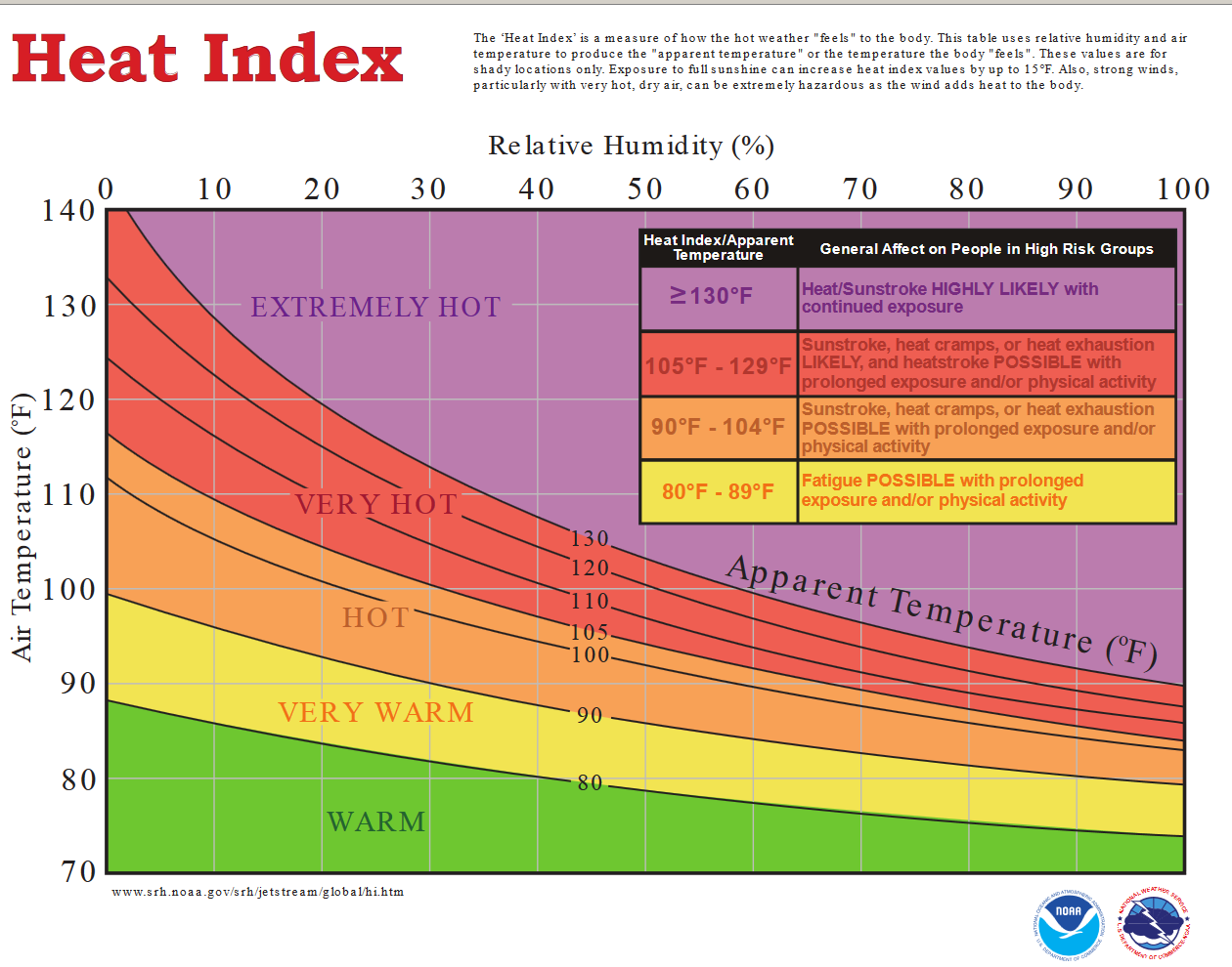
Now, when you factor in the moisture in the air, there is a temperature adjustment called the Heat Index. Here are the gory details on how that works.
The higher the relative humidity, the less sweat evaporates off the human body. The human body uses sweat as a mechanism to try to maintain body temperature. So, the less sweat evaporating off your skin, the easier it is for the body to overheat. As such, the Heat Index is not simply the temperature it “feels like,” but it could be considered the temperature “it might as well be.”
A lot of the computer models, which use statistics to predict the weather, are indicating Tuesday’s high temperatures will be in the upper 90s, based on what has happened in similar past scenarios. But the heat indexes could easily range from 100 degrees to as much as 110 degrees in a few downtown locations.
The relative humidity Tuesday will range between 50 and 60 percent. So there will be some moisture in the air but that moisture coupled with the heat will be enough to make it feel hotter than what the thermometer indicates.
When the relatively humidity is low and temperatures are high, the heat index can be lower than the actual temperature. If a lot of sweat evaporates off the skin, you will feel cooler. It works the same way coming out of the pool or a lake. Have you ever felt a little chilly after getting out of the water on a hot day? That’s the dry air at work.