There may be some clouds in the D.C. area dotting the sky, but they are not expected to interfere completely with eclipse viewing.
High pressure that brought abundant sunshine on Sunday is heading out to sea, and southeasterly winds in its circulation started transporting increased humidity back into the D.C. area at night. That’s what led to the cloud cover that will be over some of the area first thing Monday morning.
(WTOP/Storm Team 4)
WTOP/Storm Team 4
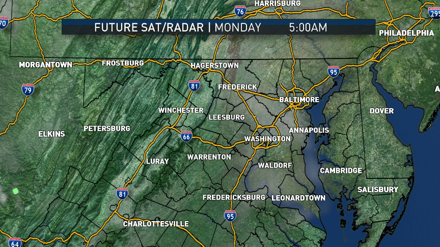
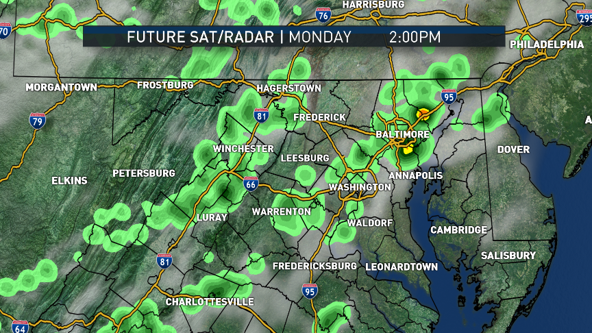
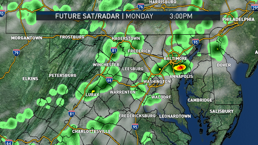
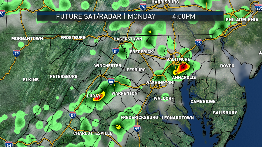
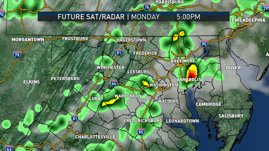
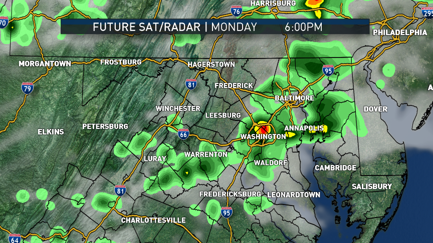
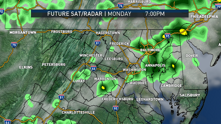
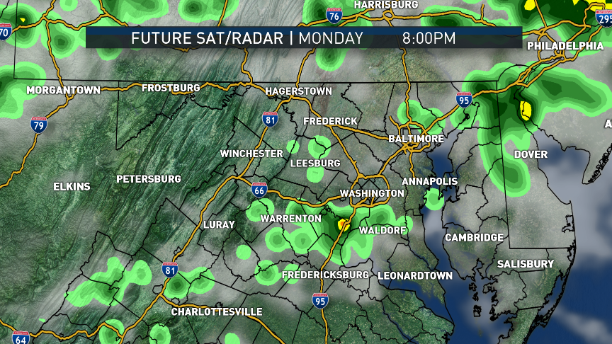
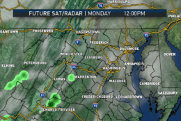
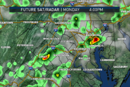
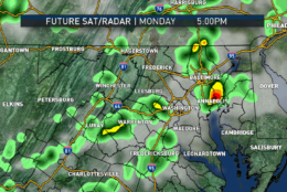
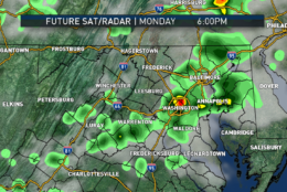
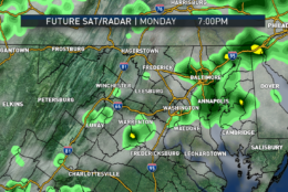
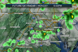
Here’s a series of images from the output of the RPM computer model from Sunday afternoon’s data. It is the simulation of the satellite (cloud cover) and appearance of weather radar. It, like many models, shows batches of clouds from morning through the day, but only scattered around. There will be breaks. The model also generates some isolated showers or thunderstorms in the daytime heating. It is noted that the model often “overproduces” light precipitation. But the model does not “know” that there is going to be an eclipse, causing some cooling, temporarily taking away available energy to initiate storms.
So, Storm Team 4 is discounting the overabundance of storms shown here, but believes they are most possible toward the end of the day, after the eclipse, when it’s warm and muggy again.
(Data: The Weather Company | Graphics: Storm Team 4)
Data: The Weather Company | Graphics: Storm Team 4
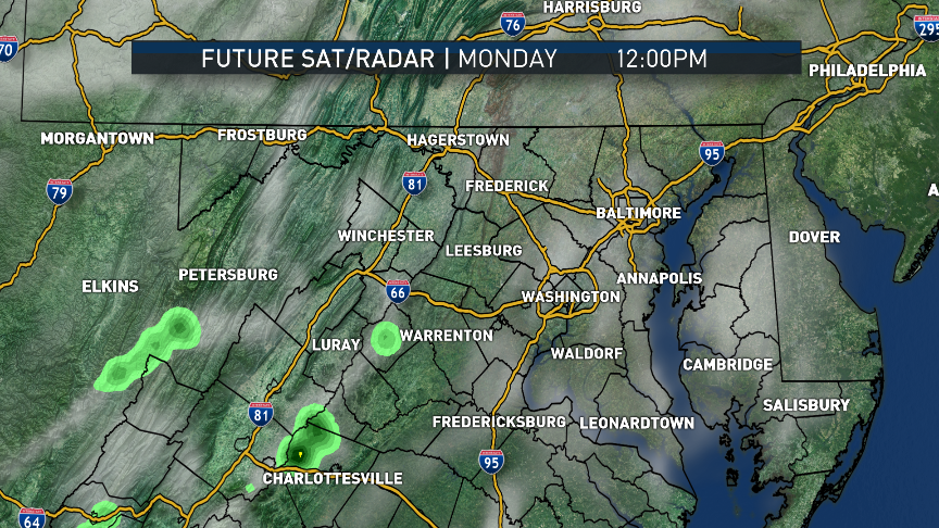
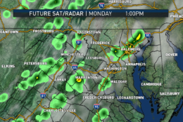
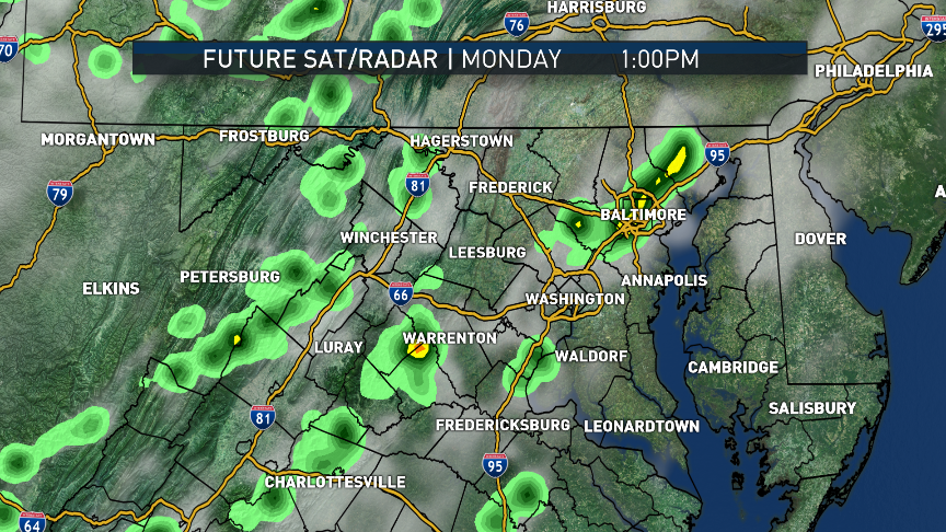
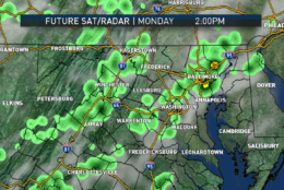
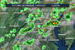
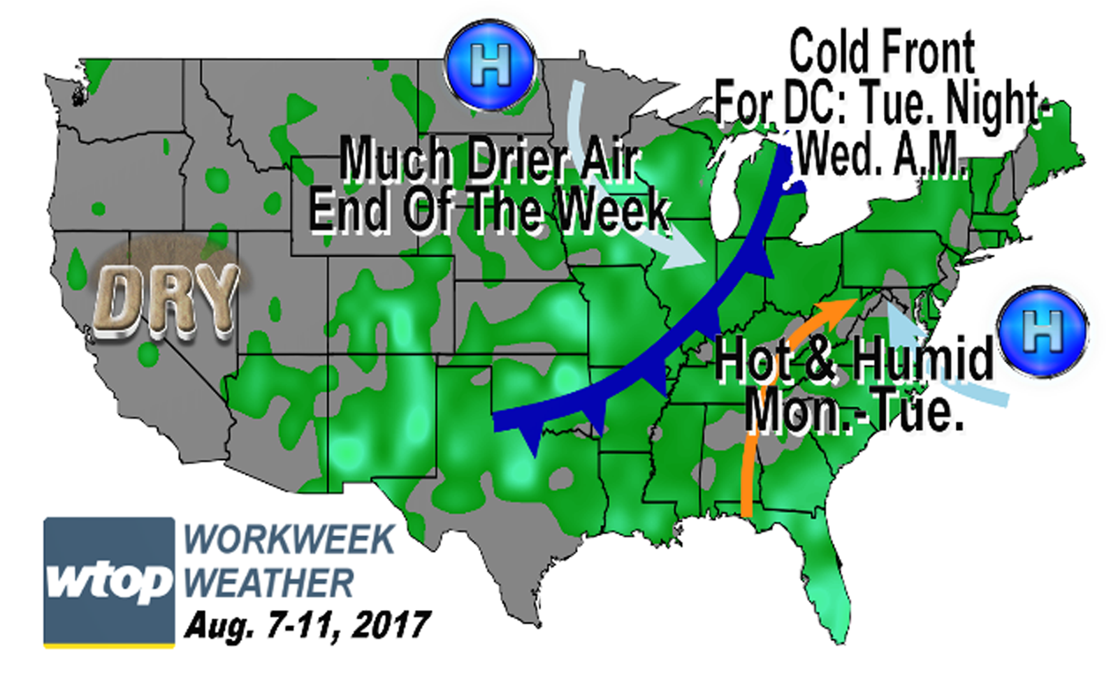
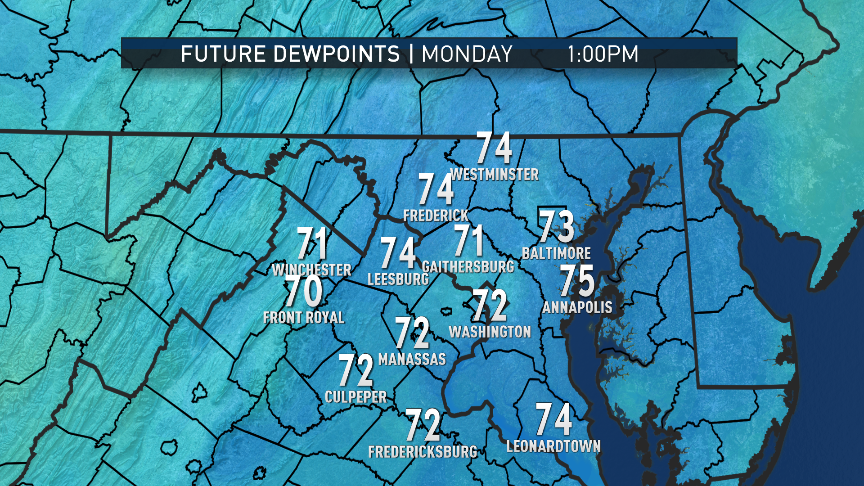
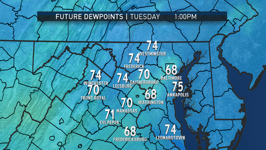
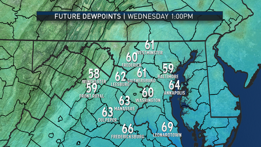
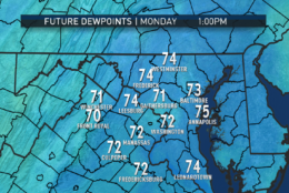
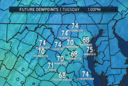
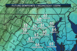
These images show the RPM computer model’s projection of dew points. Remember, the higher the dew point, the more moisture is in the air. Monday and Tuesday will be uncomfortable (oppressive to some), but Wednesday — the extent of this model — already starts to show the improvement. The longer range models have the area’s dew points in the 50s from Wednesday night into the weekend, making for very pleasant conditions.
(Data: The Weather Company | Graphics: Storm Team 4)
Data: The Weather Company | Graphics: Storm Team 4
WASHINGTON — The late American comedian George Carlin quipped that the forecast was dark at night followed by partial lightness toward morning. On Monday, that’s the forecast for most of the afternoon followed by the evening.
Naturally, this is regarding the much-anticipated solar eclipse. Unfortunately, it does not look like Monday will have a repeat of Sunday’s near totally clear skies. But at the same time, it still looks like the eclipse will be at least partially visible through the clouds.
(The Weather Company, Storm Team 4)
(And, again, it cannot be emphasized enough to make sure you’re doing so with approved, genuine eclipse filters or you’re not looking directly at all.)
High pressure that brought abundant sunshine on Sunday is heading out to sea, and southeasterly winds in its circulation started transporting increased humidity back into the D.C. area at night. That’s what led to the cloud cover that will be over some of the area first thing Monday morning.
However, these types of clouds this time of year are usually a morning phenomenon, and the daytime heating will mix them up and break them up into scattered cumulus clouds — they are not expected to interfere completely with eclipse viewing. We are categorizing the day as “partly sunny,” which basically means even though there will be some cloud cover, at most times, the disc of the sun will be visible in the sky, even though there may not be an abundance of blue color.
Cloud cover or no cloud cover, during the eclipse, it will still get fairly dark. Temperatures will drop temporarily. Interpolating from some reports of past eclipses, there are estimates there could be a 5-10 degree drop in the greater D.C. area.
Later in the day after the eclipse is over, temperatures will climb again, and the region will likely be tracking an isolated or a few scattered thunderstorms that will form near the mountains. They would drift toward the greater WTOP listening area in the evening.
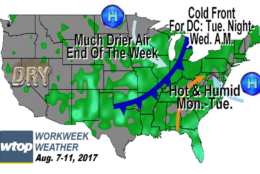
After the eclipse and everything on Monday is over, the region will be in more of a southwesterly flow on Tuesday, keeping the humidity in place but bringing in even hotter temperatures. Combined with the humidity, Tuesday will be a very uncomfortable day. A line of storms will accompany a cold front in the Midwest and Ohio Valley but may not make it to the D.C. area before the day is through.
That cold front will pass through likely midday Wednesday. Some showers and storms will be scattered along the front, some with potentially gusty winds. But the good news is much drier air will filter in behind the front Wednesday evening and last the rest of the week, possibly into the upcoming weekend, courtesy of a big area of Canadian high pressure.
The second half of the week will have seasonable temperatures with much lower humidity levels. The region will be getting an extended break from storms and rain.
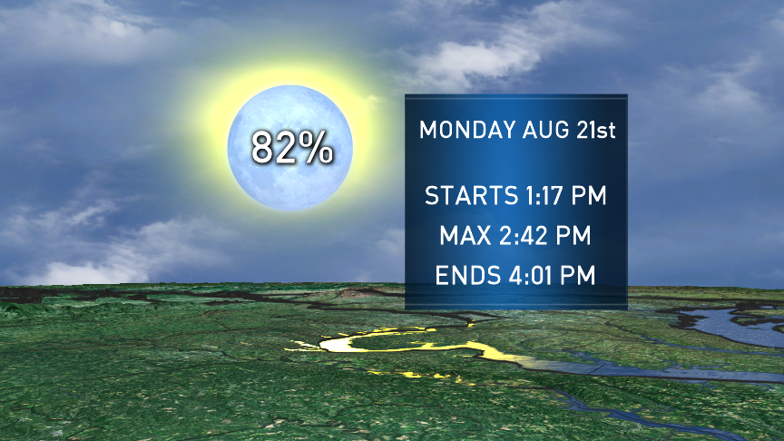
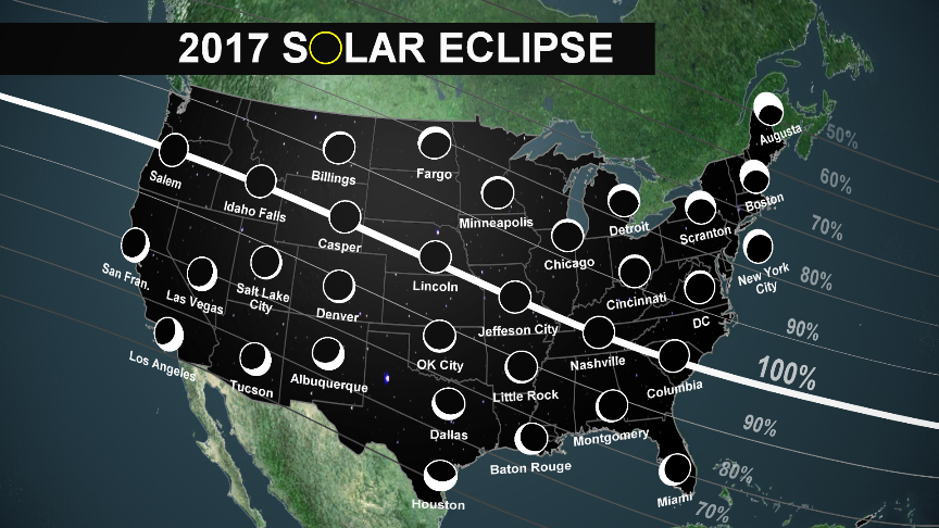
Recapping some eclipse factoids: The region is looking at 82 percent coverage, peaking at 2:42 p.m. The areas in the country which will see total coverage will stretch from Oregon to South Carolina.
(The Weather Company/Storm Team 4)
Daily weather highlights
MONDAY
• Muggy to start with low-level clouds
• Heating up quickly in partial morning sunshine
• Mostly dark from roughly 1:45 p.m. until 3:45 p.m. (Yes, that’s the eclipse effect!)
• Hot and humid, except for about 5-10 degrees cooler during the eclipse
• Isolated thunderstorms toward evening
TUESDAY
• Hazy, hot and very humid
• Heat index close to 100
• Isolated thunderstorms possible, mostly west or near Interstate 81
WEDNESDAY
• Mostly cloudy, warm and very humid in the morning
• Midday storms – at least scattered, possibly in an organized line
• Breezy and turning less humid late in the day
THURSDAY & FRIDAY
• Partly to mostly sunny
• More seasonable high temperatures (low 80s)
• Much lower humidity and very comfortable
Editor’s Note: The WTOP Workweek Weather Blog is intended as an in-depth yet plain language summary of the business week’s weather potential in the D.C. area along with an explanation of the contingencies and uncertainties that exist at the time of publication. For the latest actual Storm Team 4 forecast, check out the main WTOP Weather Page.