Workweek weather: Hot, humid with a few chances of storms

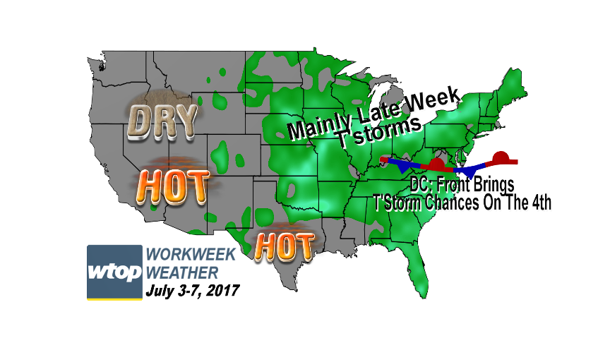
WASHINGTON — The first workweek of July is obviously abbreviated by the holiday for a lot of people. But for anyone who does have to work, the weather won’t interfere for the most part.

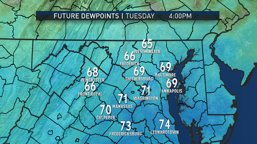
We will have a lot of seasonably hot weather with only fluctuations in humidity levels affecting the “feel” of each day. Monday will be the least humid day of the week with dew point temperatures in the lower end of the “sticky” range, but we will be right back into the “muggies” on Tuesday.

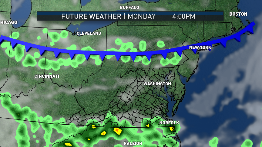
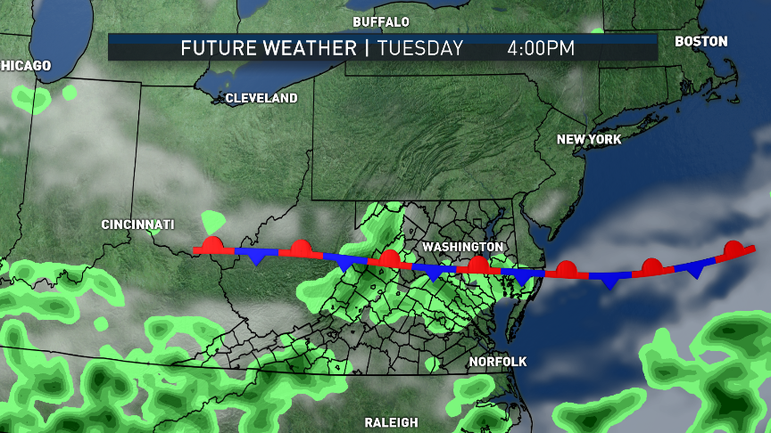
Storms aren’t too likely on Monday because of the relative lack of humidity, but a weak cold front will be moving south from Pennsylvania, so storms are at least possible mostly in northern Maryland. That front will stall right in the middle of the D.C. area on Tuesday, with a surge in humidity just ahead of it.

Storm chances on the Fourth of July are a bit higher, mostly right along the edge of the front. Slight differences in placement of the front will result in big differences in storm chances. As of this posting, the highest likelihood looks to be south of D.C., but it will be close — the Storm Team 4 radar will have to be monitored all day. At any rate, the storms would be scattered, we won’t all get them and the day won’t be a total washout.

On Wednesday, the front will be mostly south of the area again and humidity will drop a notch or two again on northeasterly winds. Cloud cover may also keep the region just shy of the 90-degree mark.

But on Thursday into Friday, a wave of low pressure will form on the front out in the Ohio Valley, sending the front back north as a warm front, making it more humid and bringing an increased chance of scattered thunderstorms both days. A lot of spots are kind of dry again because of last month’s rainfall shortfall, so some rain would definitely help the lawns and gardens.
The first workweek of July is obviously abbreviated by the holiday for a lot of people, but for anyone who does have to work the weather won’t interfere, for the most part. (WTOP/Storm Team 4)
The first workweek of July is obviously abbreviated by the holiday for a lot of people. But for anyone who does have to work, the weather won’t interfere, for the most part. (WTOP/Storm Team 4)
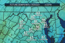
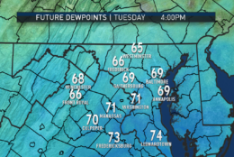
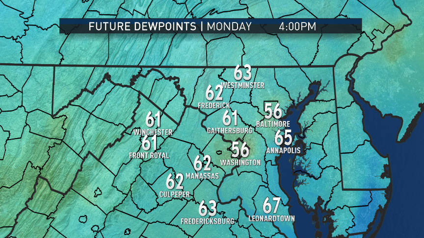
How the week feels will largely be determined by changes in the dew points. The RPM computer model shows us on the borderline of comfortable and sticky for Monday afternoon. On July Fourth, we’ll be back into the muggy range. Remember, the higher the dew point, the more moisture there is in the air. (Data: The Weather Company. Graphics: Storm Team 4)
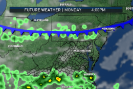
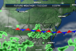
In terms of storms, the highest chances on Monday will be in southern Pennsylvania and northern Maryland, depending on the exact progress of the front. On Tuesday, the front will stall in our area and the highest chances for storms (scattered and temporary though they would be) will be right along and south of the boundary. This is also RPM computer output for simulated clouds and radar. Frontal positions are inherently approximated (fronts are actually zones of transition between air masses, not neat lines). (Data: The Weather Company. Graphics: Storm Team 4)
In terms of storms, the highest chances on Monday will be in southern Pennsylvania and northern Maryland, depending on the exact progress of the front. On Tuesday, the front will stall in the D.C. area, and the highest chances for storms (scattered and temporary though they would be) will be right along and south of the boundary. This is also RPM computer output for simulated clouds and radar. Frontal positions are inherently approximated (fronts are actually zones of transition between air masses, not neat lines). (Data: The Weather Company. Graphics: Storm Team 4)
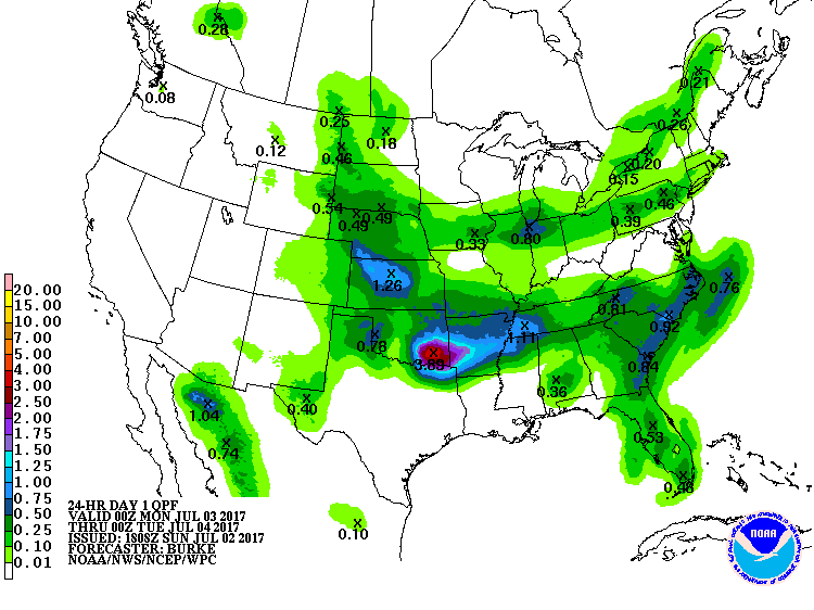
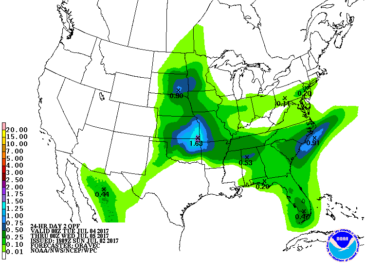
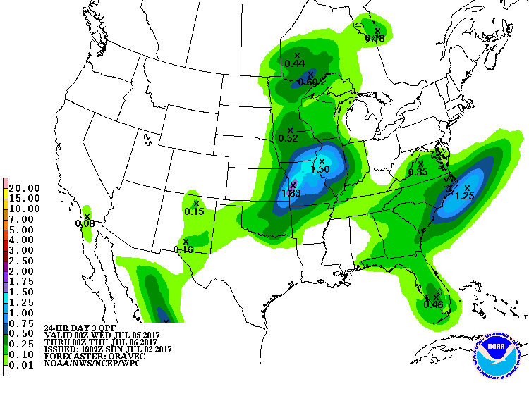
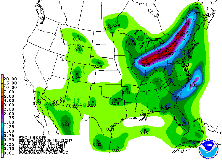
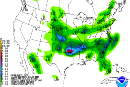
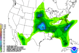
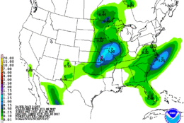
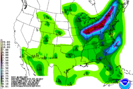
Rainfall in the summer can indeed be spotty and random. Some neighborhoods can benefit more than others just a few miles away. The official rainfall forecast for the week across the country has the highest amounts in areas where thunderstorms will be most repetitive and/or strongest. The last graphics are for Thursday/Friday totals, and that’s when most of us will probably see the most storms with some beneficial rains. Monday’s and Tuesday’s activity will be too sparse to benefit most of us in the D.C.-area. (Weather Prediction Center, NOAA)
Rainfall in the summer can indeed be spotty and random. Some neighborhoods can benefit more than others just a few miles away. The official rainfall forecast for the week across the country has the highest amounts in areas where thunderstorms will be most repetitive and/or strongest. The last graphics are for Thursday/Friday totals, and that’s when most of us will probably see the most storms with some beneficial rains. Monday’s and Tuesday’s activity will be too sparse to benefit most in the D.C. area. (Weather Prediction Center, NOAA)
(1/9)
The first workweek of July is obviously abbreviated by the holiday for a lot of people, but for anyone who does have to work the weather won’t interfere, for the most part. (WTOP/Storm Team 4)
How the week feels will largely be determined by changes in the dew points. The RPM computer model shows us on the borderline of comfortable and sticky for Monday afternoon. On July Fourth, we’ll be back into the muggy range. Remember, the higher the dew point, the more moisture there is in the air. (Data: The Weather Company. Graphics: Storm Team 4)
In terms of storms, the highest chances on Monday will be in southern Pennsylvania and northern Maryland, depending on the exact progress of the front. On Tuesday, the front will stall in our area and the highest chances for storms (scattered and temporary though they would be) will be right along and south of the boundary. This is also RPM computer output for simulated clouds and radar. Frontal positions are inherently approximated (fronts are actually zones of transition between air masses, not neat lines). (Data: The Weather Company. Graphics: Storm Team 4)
Rainfall in the summer can indeed be spotty and random. Some neighborhoods can benefit more than others just a few miles away. The official rainfall forecast for the week across the country has the highest amounts in areas where thunderstorms will be most repetitive and/or strongest. The last graphics are for Thursday/Friday totals, and that’s when most of us will probably see the most storms with some beneficial rains. Monday’s and Tuesday’s activity will be too sparse to benefit most of us in the D.C.-area. (Weather Prediction Center, NOAA)

Daily weather highlights

MONDAY:

• Hot and a bit sticky
• Mix of high-level and low-level clouds, but the sun getting through the breaks
• An isolated thunderstorm possible late in the day, mostly in far northern Maryland

TUESDAY/INDEPENDENCE DAY:

• Mostly cloudy
• Hot and very humid south of D.C.; not as humid in northern Maryland
• A few isolated or scattered thunderstorms late in the day, most likely in central Virginia and southern Maryland

WEDNESDAY:

• Lots of high-level clouds
• A little less humid than the day before
• Only a slight chance of scattered thunderstorms, again mostly in central Virginia and southern Maryland

THURSDAY/FRIDAY:

• Hot and humid
• Lots of clouds and scattered thunderstorm chances, especially in the afternoons and evenings


Editor’s Note: The WTOP Workweek Weather Blog is intended as an in-depth yet plain language summary of the business week’s weather potential in the D.C. area along with an explanation of the contingencies and uncertainties that exist at the time of publication. For the latest actual Storm Team 4 forecast, check out the main WTOP Weather Page.

Federal News Network Logo
Log in to your WTOP account for notifications and alerts customized for you.

Sign up