Any snow showers fighting dry air to fall this aft. - besides a dusting in spots - likely sticking to roads after 7p pic.twitter.com/wOqpLYAePj
— Lauryn Ricketts (@laurynricketts) January 5, 2017
WASHINGTON — The first snow of the season is just a few hours away. While the amount is expected to be relatively minor, timing is everything.
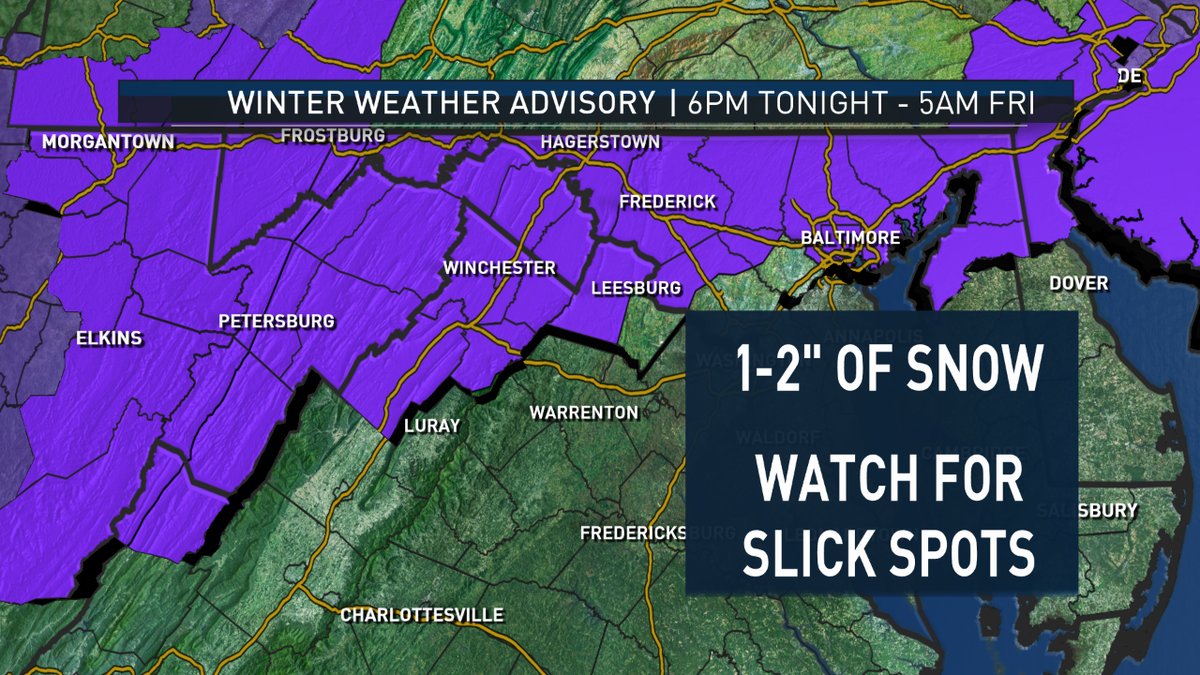
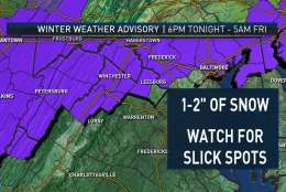
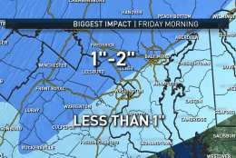
Some areas have been placed under a winter weather advisory from Thursday evening to early Friday morning.
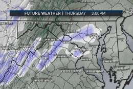
Watch for a few snow showers developing through the afternoon on Thursday. However, any snowflakes that do fall will be fighting a rather dry air mass. This means that while you may be seeing some snowflakes on your radar, they may or may not be reaching the surface. This will be the case as we head into the afternoon and evening. Therefore, for the evening commute we could have a dusting in spots with snow showers.
More widespread snow showers will develop after about 7 p.m. Thursday, and I do believe that at this time snow will begin to really stick to the roads. So if you are headed to the Capitals game, use caution when you are headed home because some of the roads may be a little slick.
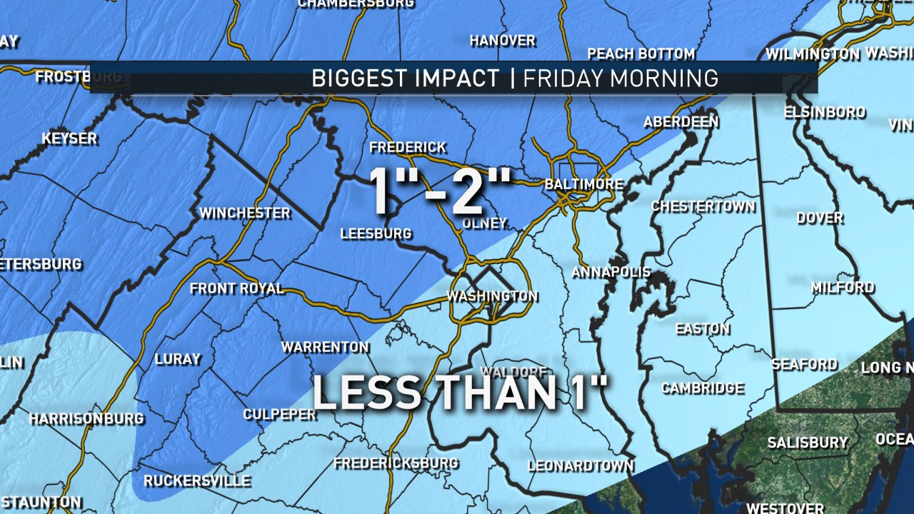
By Friday morning’s commute, the snow will have stopped falling, but there will still be some slickness on the roads and untreated surfaces. Temperatures will remain in the 30s Friday as well with some sun shining.
View WTOP’s latest weather forecast, road conditions and snow closings and delays.