
An under-utilized park south of Crystal City is in line for some major upgrades.
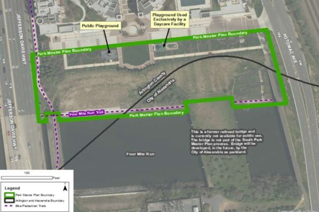
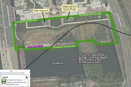
Across jurisdictional lines, the planning process for South Park at Potomac Yard near Four Mile Run is gathering steam, with a projected completion date of later this year. Arlington County and the City of Alexandria both own portions of the park, located between Potomac Avenue and U.S. Route 1, along Four Mile Run.
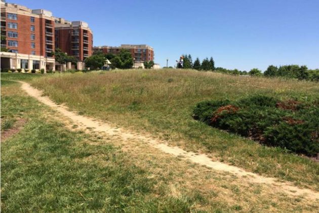
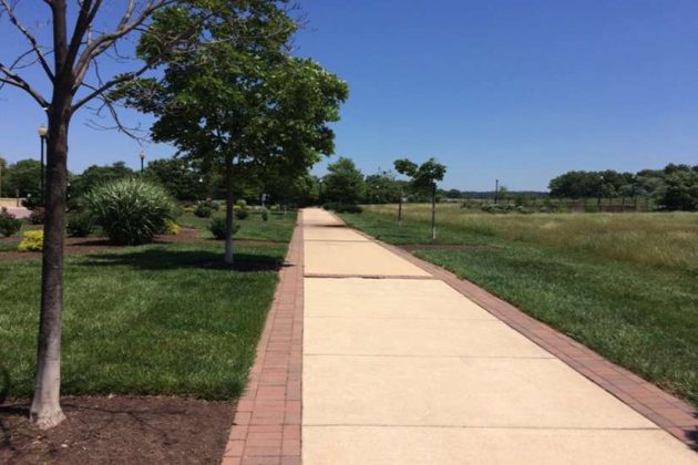
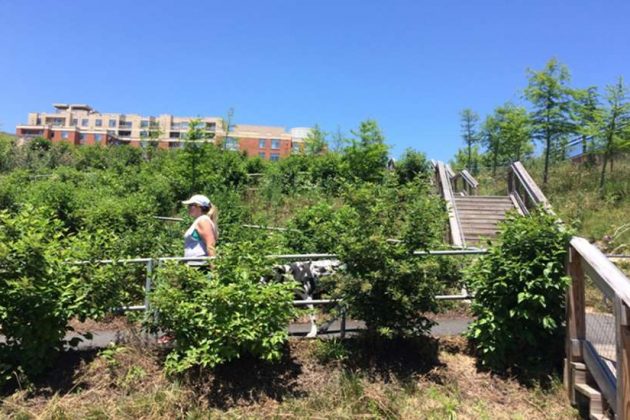
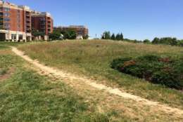
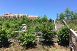
The park currently has a publicly accessible playground and a playground exclusively used by a daycare facility, planted shrub/perennial beds, walkways, a large grassy field and a steeply sloped grassy area.
A post on the county website explains the park’s unique history.
“The boundary line curvature represents the natural Four Mile Run channel before it was straightened and channelized by the Army Corps of Engineers after the 1972 Hurricane Agnes, which produced heavy rain and extensive flooding,” the post reads. “As a result, the Army Corps of Engineers straightened and channelized Four Mile Run and covered the stream’s natural banks with riprap. Unfortunately, this created a less than desirable condition for the stream’s ecology.”
And with money available in the county’s capital budget as well as a federal grant available to construct and improve connectivity to the Four Mile Run Trail, staff in the parks department are preparing to make improvements.
The first phase of construction is anticipated to begin early next year and link Route 1 to the Four Mile Run Trail. The second phase is slated to begin in 2022 for the remaining park elements.
Those remaining park elements will be decided through a civic engagement process led by county parks and recreation staff that began late last month with a community meeting at Gunston Middle School.
Three more meetings are scheduled — the next on March 29 at a location yet to be determined — with a view to residents helping determine the park’s design.
Attendees wrote down their desired park amenities at that first meeting, then the next meeting will bring further determination of park elements as well as staff soliciting potential park names.
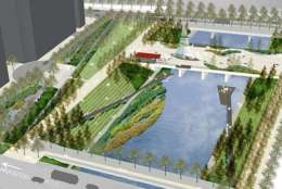
But the park’s location and future is complicated by its location, and so the design will be guided in part by the Four Mile Run Restoration Master Plan and Design Guidelines.
“The Four Mile Run Restoration Master Plan and Design Guidelines provide a vision for in-stream and near-stream improvements,” said Bethany Heim, an associate planner at the county’s parks and recreation department. “The vision calls for public and private improvements to recognize Four Mile Run as an asset and, through design, make visual and physical connections to the water. The master plan also calls for innovative strategies to treat stormwater runoff that will improve the water quality.
“The South Park Master Plan will identify ways to connect people to the water, take advantage of view sheds, and improve the water quality of Four Mile Run.”
Alexandria, meanwhile, intends to improve its section of the site as part of the redevelopment of North Potomac Yard.
Dana Wedeles, acting principal planner in Alexandria’s department of recreation, parks and cultural activities, said she expects plenty of cooperation between the two jurisdictions on this project despite the differing timelines.
“We are working collaboratively to ensure that what is proposed through the Arlington process does not preclude complimentary future improvements to the Alexandria portion,” Wedeles said in an email. “We envision that the site will be used by both Arlington and Alexandria residents and, despite the two jurisdictions having different, timing of planning, design and implementation, we ultimately want to see one seamless improved open space.”