Those who were excited for the D.C. region’s (albeit minimal) taste of snow on Wednesday might have even less to look forward to now.
Predictions originally called for about a 60 to 70% chance of light snow, with minor accumulation on the roads and up to an inch in some grassy areas. Above all, calm was advised.
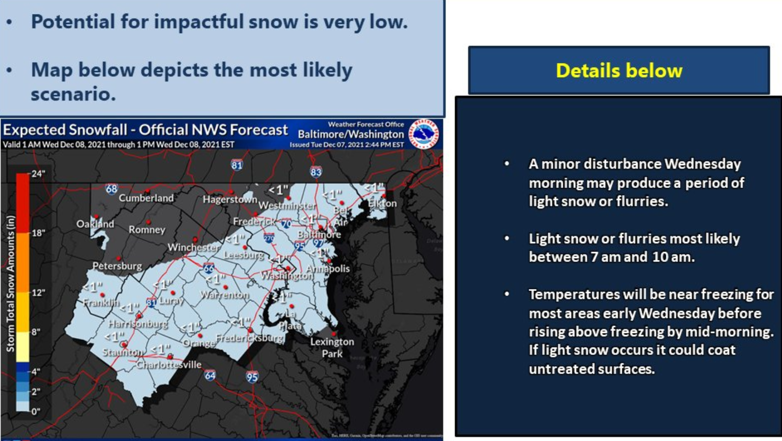
The latest update from the National Weather Service is even measlier: Any flurries that do materialize will be lucky to reach half an inch.
Our average high is now 50° so, after a few cold days, the overall trend is for the warmer than average weather to continue. Chances for snow on Wednesday are still there… but they are hanging on by a thread. Unlikely that anyone gets even an inch. @nbcwashington pic.twitter.com/HGS2q8bi9g
— Chuck Bell (@ChuckBell4) December 7, 2021
You can blame the lack of accumulation on the ground temperature for not dipping below freezing, according to Storm Team 4 meteorologist Chuck Bell. Then again, it looks like nothing will be freezing around the national capital area anytime soon.
Clouds will be on the increase Tuesday night into the overnight, which will keep it from cooling off too much, barely to the freezing point; and the atmosphere will remain extremely dry, Storm Team4 meteorologist Matt Ritter said.
Although factors are still in play for a system Wednesday, “it is looking increasingly likely that it won’t have too much of an impact on us, as it will be disorganized, quick, and mostly centered to our south, and unable to overcome temperatures that will climb above freezing and the extremely dry air,” Ritter said.
Add unfrozen ground and many treated roadways, any bands of light wet snow, very light rain and possibly some sleet mixed in will taper off Wednesday afternoon, leaving mostly wet roads and some very light, wet accumulation on untreated services.
However, it will be a chilly Wednesday, with temperatures moderate to above average by the end of the week. There are early indications of a system that could bring some needed rainfall this weekend.
Bell mentioned that after Wednesday’s high of 40 and Thursday’s high of around the mid-40s, temperatures will be flirting with 70 (again) by Saturday.
- Listen to WTOP online and on the radio at 103.5 FM or 107.7 FM.
- Current traffic conditions
- Weather forecast
- Closings and Delays
- Sign up for WTOP alerts
Forecast
Tuesday night: Cloudy and seasonably cold with a light breeze. The chance of rain/snow around 20%. Lows in the upper 20s to mid 30s.
Wednesday: Cloudy and cold with wet snow likely before noon. Light rain follows morning flurries. Chance of snow around 60%, but snow accumulations expected to be under one inch. Highs in upper 30s to nearing 40.
Thursday: Mostly cloudy and cold, but dry and with a light breeze. Highs in the upper 30s to mid 40s.
Friday: Cloudy and seasonably cold with a slight breeze. Some evening sprinkles are also expected. highs in mid to upper 50s.
WTOP’s Rick Massimo contributed to this report.