TUESDAY: Slushly snow accumulations likely on Tuesday morning for the I-81 corridor & #ShenandoahValley including Frederick CO, MD. Snow cancellations likely. #snow #school pic.twitter.com/DP5USbgprl
— Lauryn Ricketts (@laurynricketts) March 19, 2018
TUESDAY: We will have to watch the AM commute for possible SLEET/FREEZING RAIN & SNOW on Tuesday morning taking over just plain rain. Temps are a little tricky for Tuesday AM in this region so schools will need to watch how this develops Tuesday AM pic.twitter.com/czxjBBuqTk
— Lauryn Ricketts (@laurynricketts) March 19, 2018

WASHINGTON — Nothing about this year’s first day of spring will bring visions of flowers and Easter egg hunts.
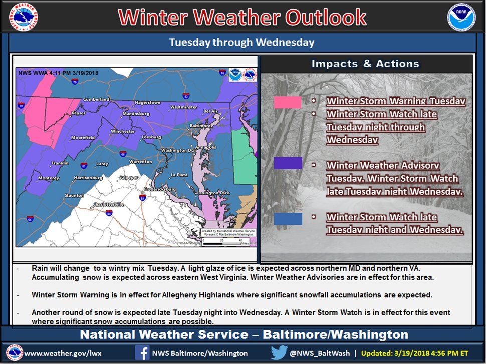
A mix of rain, sleet and snow is expected to arrive in the D.C. area overnight and affect Tuesday morning’s commute. Forecasters are also looking out for another storm to move into the area Tuesday night and potentially bring snow Wednesday, said Storm Team4’s chief meteorologist Doug Kammerer.
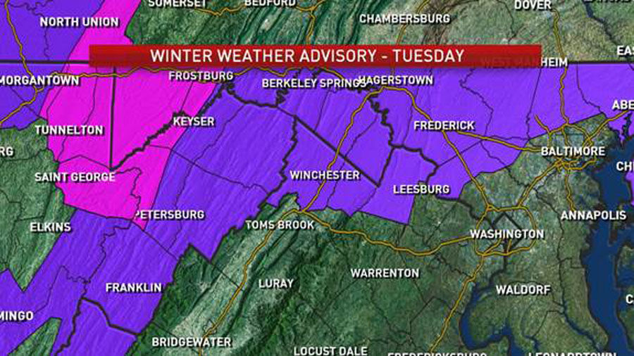
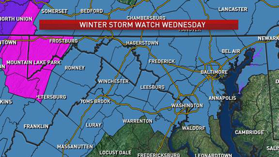
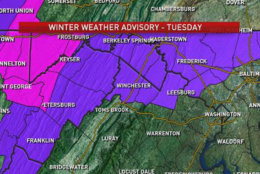
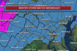
The National Weather Service has a Winter Weather Advisory in effect from 6 a.m. to 6 p.m. on Tuesday, and a Winter Storm Watch in effect from late Tuesday night through Wednesday night.
Quick Links:
Weather
After a sun-filled Monday, two waves of winter weather are expected to cast a shadow during the first week of spring in the D.C. region, with possible snow in the forecast.
“There are two parts to this system,” Storm Team4’s Lauryn Ricketts said.
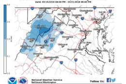
Showers and falling temperatures overnight could change over to a snow mix by daybreak Tuesday. A mix of sleet and snow is especially expected to affect areas north and west of D.C., Kammerer said, with roads expected to be slushy the farther north and west drivers go.
The National Weather Service’s Winter Weather Advisory means “periods of snow, sleet or freezing rain will cause travel difficulties” on Tuesday. Wet snow and freezing rain is expected.
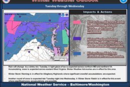
Update regarding the winter weather headlines for Tuesday and Wednesday. See map for details. For additional information, go to https://t.co/NE4IUzNKyF pic.twitter.com/ztUwkEx0uQ
— NWS DC/Baltimore (@NWS_BaltWash) March 20, 2018
Kammerer said it’s tough to forecast because of temperatures — one degree will make a different from sleet to snow, he added.
A light glaze of ice will be a major impact Tuesday for northern Maryland, Northern Virginia and the Shenandoah Valley, according to the weather service. The advisory affects D.C. and several surrounding counties in Maryland and Virginia.
In Maryland, affected areas include Anne Arundel, Baltimore, Baltimore City, Calvert, Charles, Carroll, Howard, Montgomery, Prince George’s County and St. Mary’s counties. In Virginia, affected areas include City of Alexandria, and Arlington, Fairfax, Fauquier, Loudoun and Prince William counties
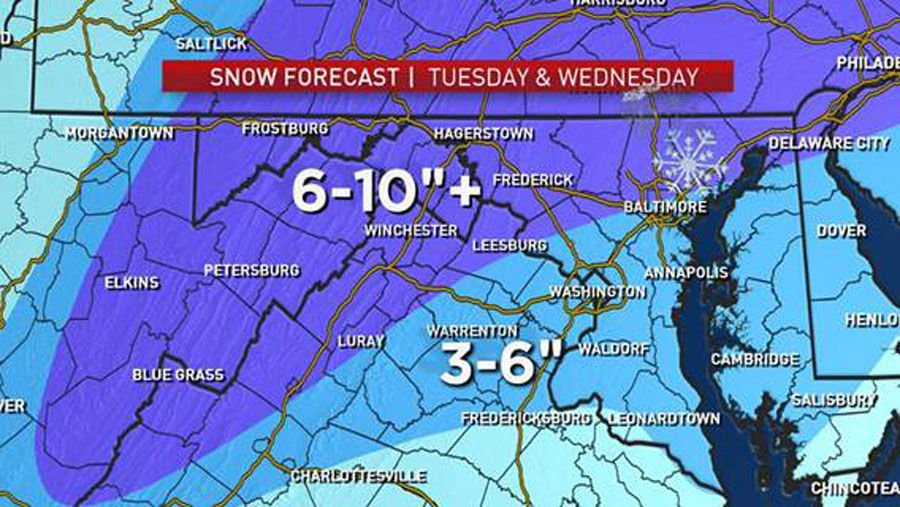
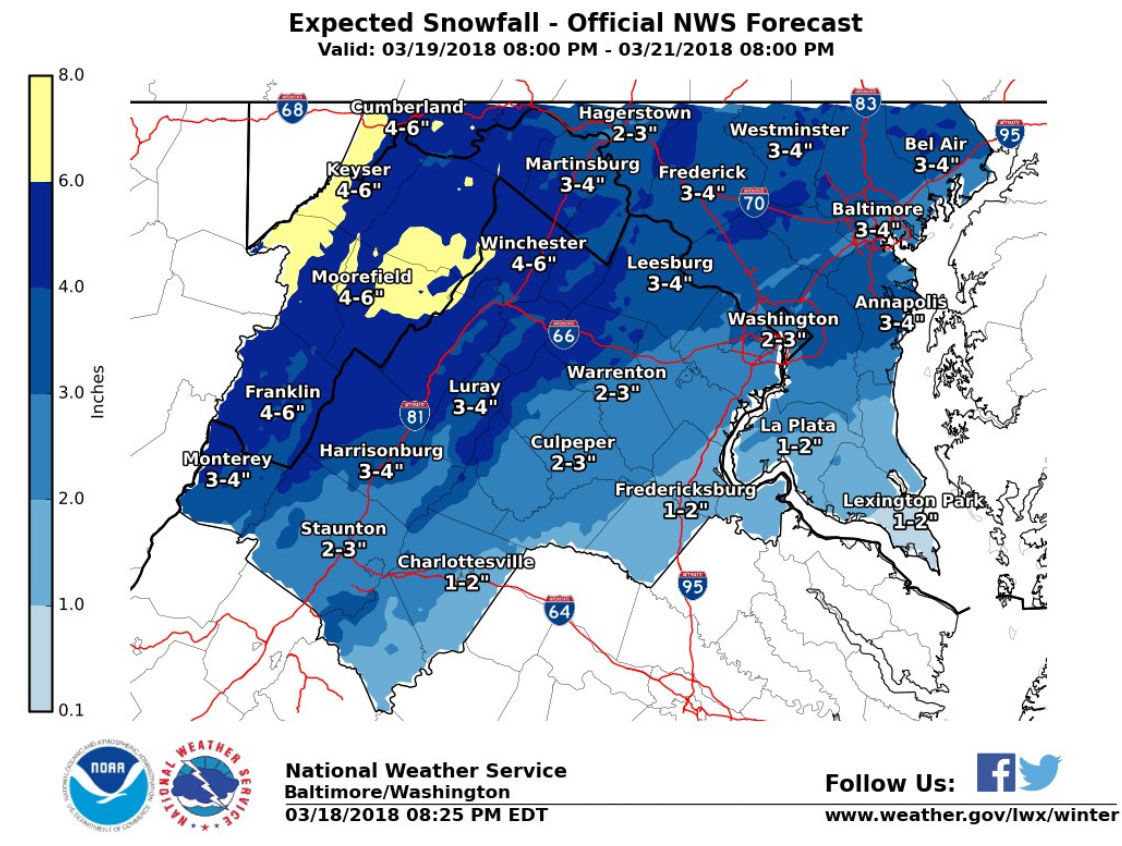
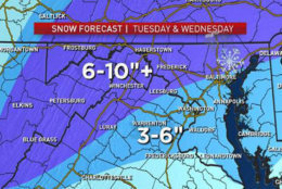
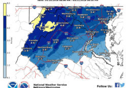
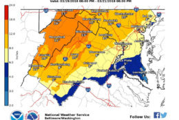
The weather service said another round of snow is likely late Tuesday night and Wednesday. Kammerer said area-wide totals could fall between 3 to 6 inches; in the north and west zones, totals could be even higher.
Wednesday will see the most snowfall, Kammerer said. Thursday is looking breezy and cool with winds out of the Northwest.
Here is the forecast:
- Overnight: Rain moving in as temperatures drop — changing to snow north/west of D.C. by daybreak. Highs in the 30s to 40s.
- Tuesday: Weather alert — snow possible north and west of D.C. Around Interstate 95 sees possible rain or mix. Southeast of D.C. will have mostly rain. Highs in the 30s.
- Wednesday: Weather alert — snow all day, heavy at times, moving out by the evening. Highs in the upper 30s.
Latest forecast:
Travel and transportation
Storm Team4’s Sheena Parveen said the roads will be wet in the D.C. area on Tuesday, following a wintry mix of rain and snow, except in Northwest D.C. where roads may be slicker.
The Maryland Department of Transportation State Highway Administration had crews pre-treat highways and bridges in northern counties in advance, as nighttime temperatures will increase the chance of roads refreezing.
Maryland crews are also clearing stormwater management systems of debris to enable positive drainage and preparing chain saws, chippers and generators, and road closed signs.
The weather service also advises that commuters expect slippery road conditions Tuesday going into Wednesday and reduced visibility at times.
Two winter storms coming our way…expect snow for EVERYBODY on Wednesday which means cancellations, travel delays and accumulating snow pic.twitter.com/53P48KPWQi
— Lauryn Ricketts (@laurynricketts) March 19, 2018
Closings and delays
If the bleak forecast comes to fruition and causes any school delays Tuesday or Wednesday, they will be listed on WTOP’s Closings and Delays page.
Closings and Delays
WTOP’s Weather Center
WTOP Traffic Center


