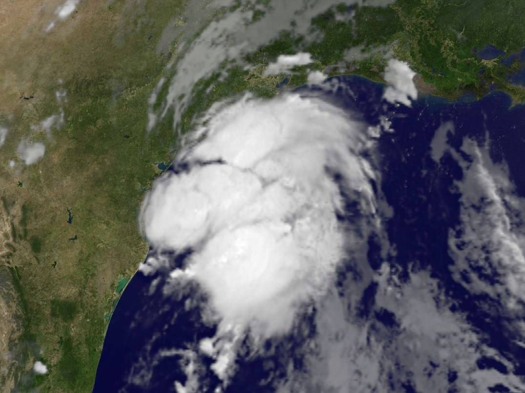
WASHINGTON — Our second named storm of the season has formed. I introduce to you Tropical Storm Bill, which made landfall earlier Tuesday morning around Matagorda Island northeast of Corpus Christi, Texas.

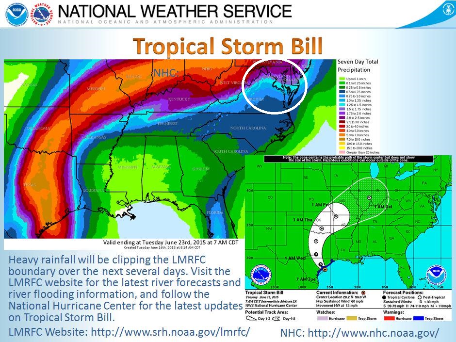
Tropical Storm Bill will move inland over south-central Texas through Tuesday afternoon and will continue on its trek to the north-northeast all while weakening. However, the rains will continue to be fairly heavy despite the weakening storm.
The movement of weakening Tropical Storm Bill is something that we will have to monitor here on the East Coast as we head into the weekend. It is forecast to move around the area of high pressure (Bermuda High) that is over the Southeastern United States on the southwestern and western periphery. Yes, that is the same high pressure that is responsible for all this heat and humidity we are getting here in the D.C. area. This movement should be the case for the next 48 hours or so and then, the remnants of Bill will get absorbed and caught up in mid-latitude westerlies, curving the track more to the east-northeast.

As the moisture from what was Tropical Storm Bill rounds to the Northeast on Friday, it will interact with a front in the Ohio Valley that will make moves toward the D.C. area for the weekend. This means that if this moisture stays on the current track, we could see lot of rain this weekend.
If you are planning to head to northern beaches, taking a boat out on the Chesapeake, catching a Nats game or perhaps even camping out at the Firefly Festival in Dover, Delaware, you are going to want to pay attention to the forecast as we get closer to the weekend. We should know more about how the remnants of Bill will affect our weather in the coming days so stay tuned.


