WASHINGTON –Update: Saturday 5:30 a.m. There are a few slick spots out there from some minor accumulation of snow, ice and rain overnight. The bulk of the system out of the region as it pushes up the eastern seaboard. There could a few snow/rain showers through mid-morning but anything will be light.
As we continue through the day, temperatures will top out around 40 degrees but it will feel like the 30s with a blustery north wind that will calm this evening as temperatures fall into the upper 20s and low 30s.
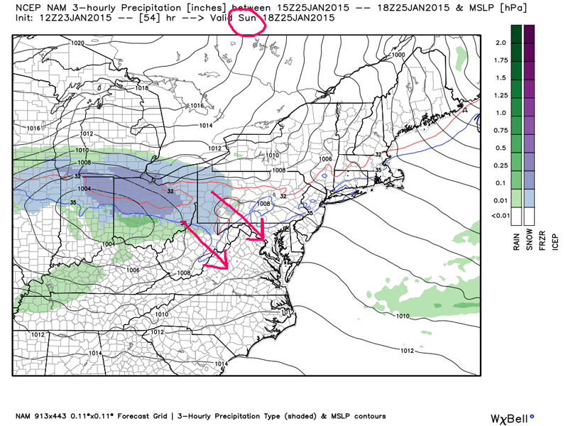
There could even be clearing before sunset continuing into the overnight. Temperatures tomorrow will move into the lower to mid 40s with our next clipper system approaching. Sunday night, we could start off as rain, as this system moves in from the northwest to the south and east. It will eventually change to snow overnight and that snow will continue into Monday.
I do believe there will be some cancellations on Monday morning.
***
Well, here we go!
A storm system that continues to approach us out of the southwest will move northeast through this Friday, ending by Saturday afternoon.
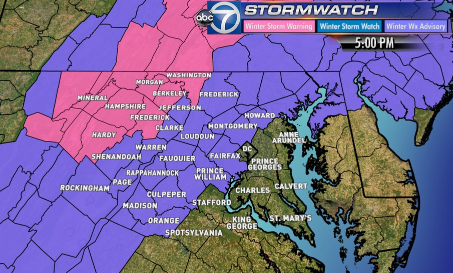
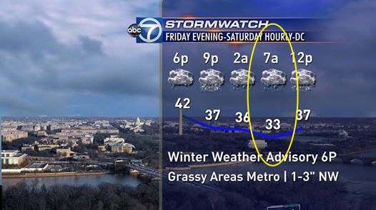
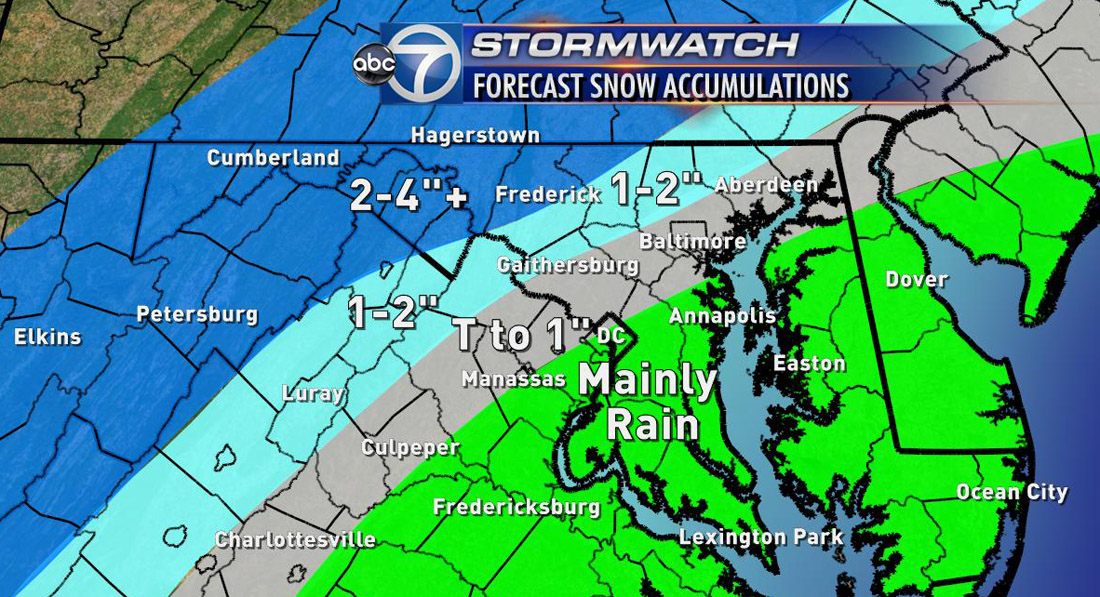
A winter weather advisory (purple) is in effect Friday evening through Saturday with the exception of Stafford, Spotsylvania, King George and the majority of Southern Maryland. A Winter Storm Warning is in effect for Winchester, Morgan and Berkeley counties in West Virginia and Washington County in Maryland.
If your commute takes you to the southwest of the region tonight, you might want to try to scoot out a little on the early side given Friday traffic and with the added precipitation, we all know too well what kind of headaches that can cause. I wouldn’t be surprised if sporting events (basketball, wrestling matches, etc.) at area high schools are canceled given the going forecast, so please be prepared for that.
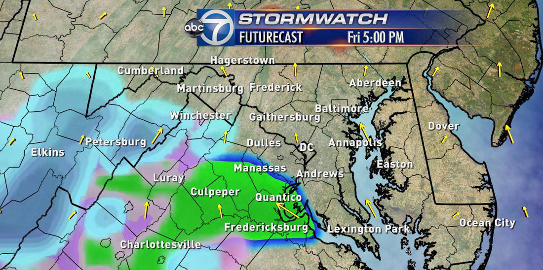
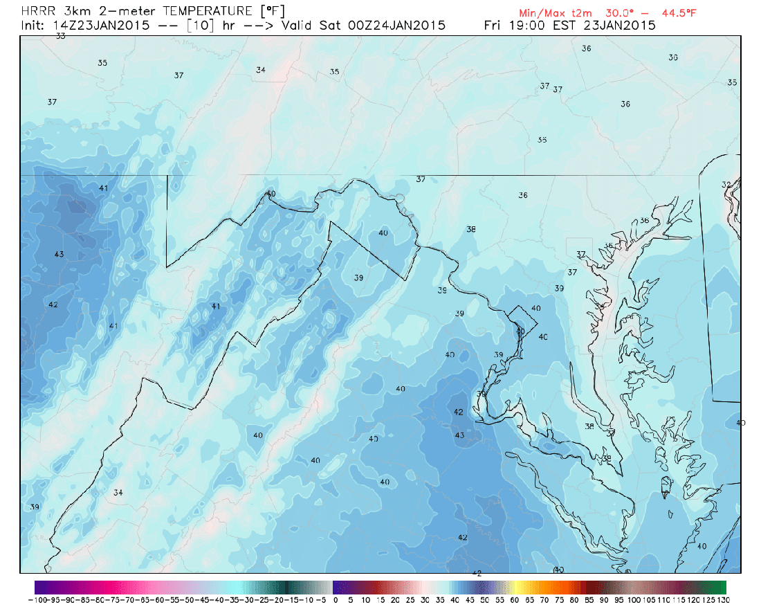
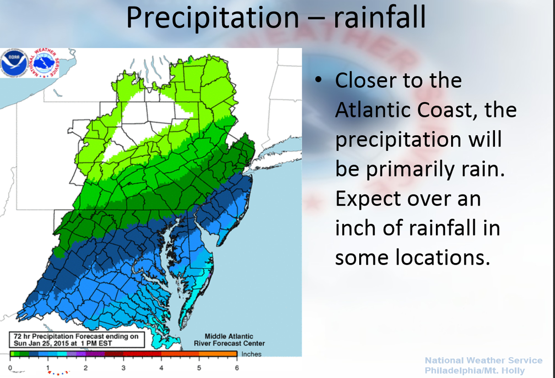
We are looking at mainly rain to start as it moves in from the southwest to the northeast. There will be some snow mixed in and some pockets of wintry mix across the region as well. However, temperatures will still be relatively warm as the precip moves in. We will need to keep a constant eye on temperatures because, of course, that will determine the precip type as we move into the evening and late evening hours.
Rain showers, moderate to heavy at times, around D.C and areas south will continue through the overnight with snow and a mix to the north and west – that’s again where we can find the heaviest accumulation of snow with just a trace to perhaps a slushy inch around the D.C. metro area by the time it is all said and done.
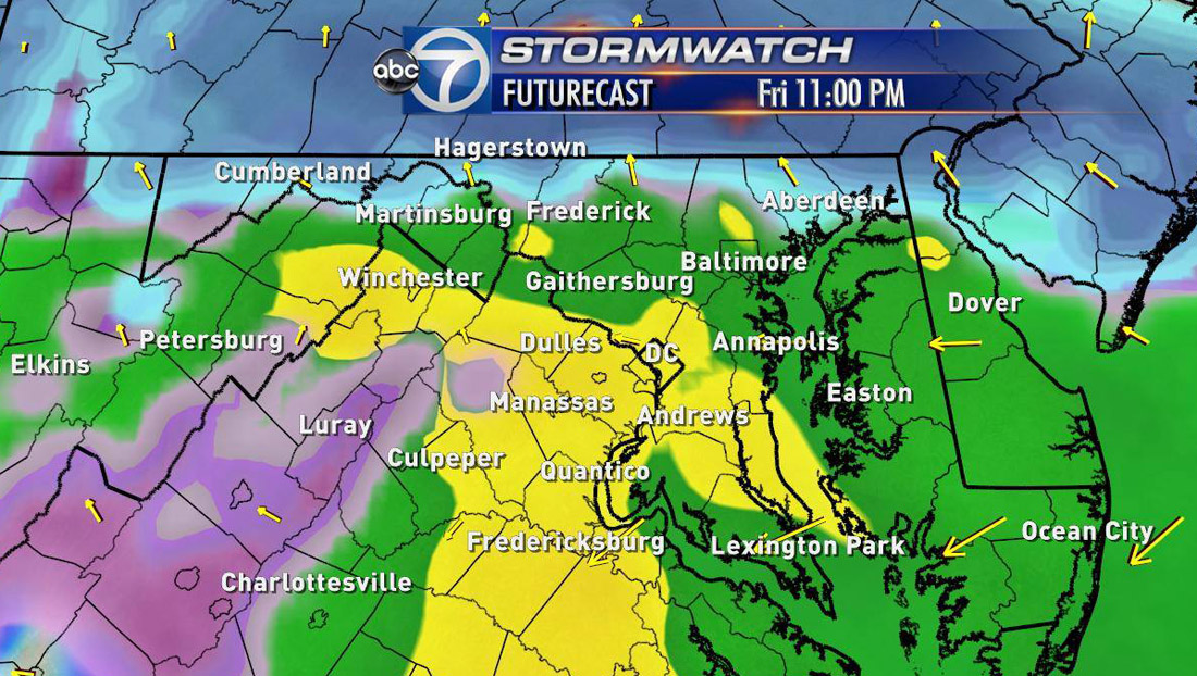
By the time daybreak comes around, we could see a changeover to snow for D.C. and areas north as temperatures drop to the lower 30s. There could be some sleet mixed in as well.
I do believe travel will be impacted overnight Friday into Saturday morning and through the first half of Saturday. Again, if your commute takes you anywhere north and west of D.C., that is where we are going to find the highest amounts of snow.
All precip should be out of here as we go through the early afternoon hours on Saturday. Winds will pick up and we may even see some clearing as we continue into Saturday night. However, that will not last long. Our next system will be knocking on our door Sunday night into Monday morning.
Follow @WTOP on Twitter and on Facebook.