WASHINGTON — I’m going to start with the good news: Washington, D.C. gained two minutes of daylight on Wednesday! Finally, we have turned the page toward spring. Although, yes, we are in the dead of winter and it felt like it.
There’s piece of good news, I’m going to write about some precipitation moving through the region on Thursday, but it looks light.
However, it could impact the evening commute (we all know how one raindrop can affect the evening commute, so I felt compelled to just mention it).
A Winter Weather Advisory is in effect beginning Thursday afternoon and lasting through late this evening for parts of the metro area.
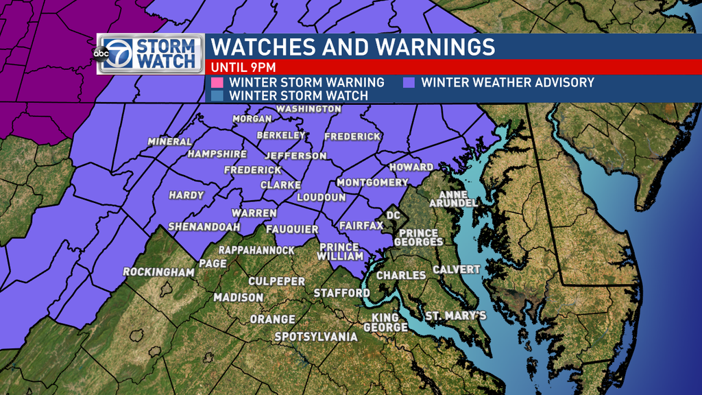
Clouds will begin to pile in through the day on Thursday. The first part of the day will remain dry while our next system moves out of the upper Midwest.
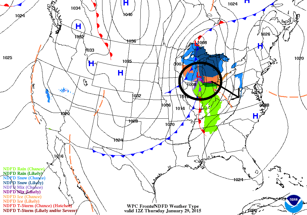
The system will move southeastward into our region by late tomorrow afternoon and into the evening bringing some light precipitation with it. Temperatures are forecast to make it into the mid-30s to around 40 degrees on Thursday.
So, although observed temperatures and daytime highs will be above freezing by the time precipitation begins, road surface temperatures could remain below freezing, especially north and west of D.C. where some snow is still on the ground.
Therefore, there could be some slick spots out there tomorrow evening and into the late evening.
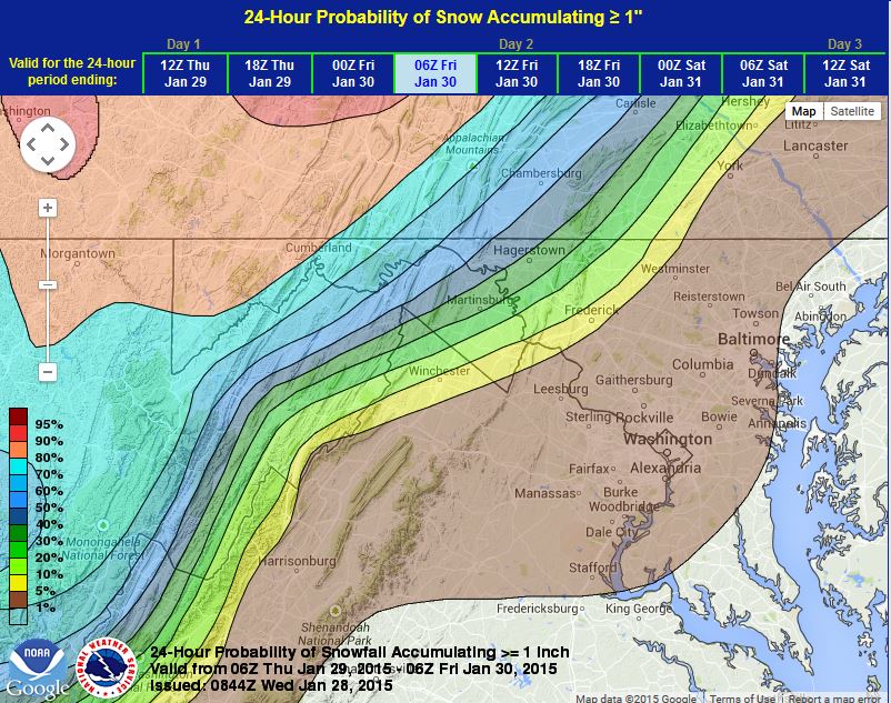
We are expecting just some light snow and/or rain showers (some pockets of freezing rain) moving through the area during the evening commute and then zipping on out of there by the late evening hours. Again, you can see that just a little is going to fall across the region –so maybe a coating of snow possible in some areas with some light icy glaze in other parts.
After this, winds will pick up on Friday. We are talking wind gusts of up to 40 mph! That means with temperatures only in the 20s/30s, we are going to have wind chills in the teens for much of the day.
High pressure will continue to build in on Saturday, and by Sunday, we will be turning our attention to our next system that could bring us, once again, a mixed bag of precipitation Sunday night into Monday.
Too early to get into details but if you are headed out for Super Bowl Sunday, make sure you keep it here for the up-to-date forecast!
Follow @WTOP on Twitter and WTOP on Facebook.


