Hope you enjoyed it while it lasted.
After a stretch of warm weather in the D.C. area, Thursday is bringing a sharp reality check.
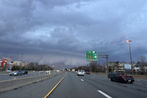
A powerful cold front sweeping through the region Thursday morning will flip the script quickly — sending temperatures tumbling from the 60s into the 40s before most people even finish their morning coffee.
By afternoon, readings will likely fall into the 30s, according to 7News First Alert Meteorologist Eileen Whelan, as gusty northwest winds push a colder air mass into the region.
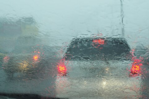
Thursday will start wet for the morning commute, with periods of rain moving through the region. As colder air pours in behind the front, that rain could briefly mix with or change over to wet snow during the afternoon hours, Whelan said.
“You’ll know when the cold front slides through; its going to get windy and temperatures will drop pretty quickly,” Whelan said.
Drivers shouldn’t expect major travel problems — road temperatures remain warm enough that accumulation isn’t expected on pavement, though a light dusting on grassy surfaces or rooftops isn’t out of the question. More than likely, Whelan said, the region could see up to a half inch of rain.
Wind will be a bigger factor through the day, with northwest gusts topping 30 mph at times. Those gusts will make the already falling temperatures feel even colder. 7News First Alert Meteorologist Jordan said the cold front hit Reagan National Airport early Thursday morning with gusts reaching 40 mph.
The good news is the skies should begin clearing before the evening commute, allowing some sunshine to return before sunset.
Temperatures will continue dropping overnight, falling below freezing across much of the area. Any leftover moisture or puddles could refreeze, creating isolated slick spots early Friday morning.
The weather calms down as we reach the end of the week, though the wind will stick around.
Friday looks partly cloudy and breezy with highs returning to the mid- to upper 50s.
The weekend starts mild and dry Saturday, before the next chance of showers moves in late Sunday.
- Listen to WTOP online and on the radio at 103.5 FM or 107.7 FM.
- Current traffic conditions
- Weather forecast
- Closings and Delays: DC-area schools make decisions for Monday instruction
- Sign up for WTOP email alerts
- Get custom alerts with the WTOP app for Apple and Android phones
FORECAST
THURSDAY
Rain to snow to sun; falling temps, windy
Temps: 60s to 40s
Winds: Northwest 10-20, Gusts: 30+ mph
THURSDAY EVENING
Mainly clear
Temps: 30s
Winds: Northwest 5-10 mph
THURSDAY NIGHT
Mainly clear
Lows: 27-32
Winds: NW to SW 5 mph
FRIDAY
Partly cloudy, windy
Highs: 55-59
Winds: Southwest 10-20, Gusts:35 mph
THIS WEEKEND
Partly cloudy Saturday, PM showers Sunday
Highs: 50s and 60s
Winds: Saturday West 5-10 mph, Sunday Southeast 15-25 mph
CURRENT CONDITIONS
Get breaking news and daily headlines delivered to your email inbox by signing up here.
© 2026 WTOP. All Rights Reserved. This website is not intended for users located within the European Economic Area.