Arctic air has entered the D.C. region Friday night, setting the stage for a weekend wintry blast as a colossal winter storm approaches the area from the west.
The National Weather Service has issued a winter storm warning for the D.C. region beginning Saturday at 11 p.m. and lasting through Monday at 4 a.m.
During the winter storm warning, the weather service said driving on snowy roads will be “nearly impossible” and ice could knock out power or damage trees.
Anywhere between 7 and 14 inches of snow and sleet are in play for the D.C. region, according to the weather service. On top of that, ice accumulations could fall between one and two tenths of an inch.
WTOP meteorologist Mike Stinneford said the majority of the D.C. region will not see snow until after Saturday’s sunset.
According to the weather service, the snow will fall at a rate of one to two inches an hour at times.
The latest forecast updates, Stinneford said, indicate snowfall is set to transition to sleet and freezing rain Sunday, potentially cutting down snow accumulation.
Areas that are north and west of D.C. are expected to see the highest snow totals.
“Right now it appears that we will have an extended period of sleet,” he said. “The biggest risk of freezing rain will be east of Interstate 95, and over the far southern suburbs. This is a dynamic forecast.”
If the snow does transition to sleet or freezing rain Sunday afternoon or evening, that will create a hard layer at the top of the snowpack; and that could stick around for quite a while.
Bitter cold moves in Friday night
For anyone braving the cold and hitting the town, wearing appropriate winter clothing is strongly encouraged as temperatures will remain bitterly cold over the next several days.
The weather service issued cold weather advisories for the D.C. area from 8 p.m. Friday to 10 a.m. Saturday, warning of wind chills as low as -10 degrees during that time range.
In its advisory the weather service said “cold wind chills could result in hypothermia if precautions are not taken.”
And the cold trend continues during the weekend storm.
“We’re going to be precipitating in the upper teens, low 20s during this whole event. So that’s kind of unusual. Usually, our events are right around 32,” said Brendon Rubin-Oster, lead meteorologist at the National Weather Service.
Cold air remains in place not just before and during, but after the storm as well. Temperatures are forecast to remain below freezing well into next week.
- Listen to WTOP online and on the radio at 103.5 FM or 107.7 FM.
- Current traffic conditions
- Weather forecast
- Closings and Delays
- Sign up for WTOP alerts
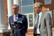
D.C. Mayor Muriel Bowser has declared a state of emergency and a snow emergency from Saturday at noon through Tuesday at 9:30 a.m. During the snow emergency, drivers can’t park on snow emergency routes. Any vehicles parked on those routes could be ticketed and towed.
Virginia’s governor has also declared a state of emergency, as has Maryland’s governor, in response to the impending storm. Read more about what’s being done to prepare here.
Full forecast
FRIDAY NIGHT: COLD ALERT
Partly cloudy and blustery
Lows: 8-13
Feels Like Temperatures: 0 to -10
Winds: North 20-25, gusts to 35 mph
A cold weather advisory has been posted for the night with feels like readings well below zero.
SATURDAY: COLD ALERT
Cloudy with late evening snow
Highs: Near 20
Winds: North 5-10 mph
As of now, Saturday daytime looks dry but very cold, with highs around 20 degrees. That should give time to wrap up any pre-storm prep or last-minute shopping. The first flakes may show up Saturday evening, then snow becomes steadier and heavier overnight. If you’re heading out, travel conditions could go downhill pretty quickly.
SUNDAY: WINTER ALERT
Moderate to heavy snow possibly transitioning to sleet and freezing rain
Highs: 20s
Winds: North 5-10 mph
A significant winter storm is expected to bring measurable snow to much of the D.C. area, and it’s going to stay cold with highs in the 20s. One thing to watch: some of the latest trends hint that a push of warmer Gulf air could sneak in south and east of D.C., which would raise the chance for sleet or a bit of ice mixing in with the snow. Regardless, this system will have a high impact. Snowfall totals could range from 5-10″ or more for the immediate metropolitan area. Ice and sleet accumulation is possible, as well. There is a higher probability of the system to remain all snow in our north and western suburbs. The First Alert Weather team will be tracking this closely over the next few days as the snow totals come into sharper focus.
MONDAY AND TUESDAY: Mostly sunny
Highs: 20-25
Winds: Northwest 10-20 mph
Sunshine returns, however, cold afternoon highs stay in the 20s.
CURRENT CONDITIONS
Get breaking news and daily headlines delivered to your email inbox by signing up here.
© 2026 WTOP. All Rights Reserved. This website is not intended for users located within the European Economic Area.