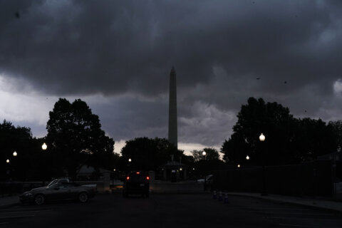
Passing showers and scattered thunderstorms hit the D.C. region on Saturday, triggering severe thunderstorm warnings. But the first day of June starts off with sunshine and low humidity, as a cold front comes through.
The storms come a day after heavy showers and severe storms slammed through the area Friday night.
WTOP Meteorologist Mike Stinneford said a cold front is coming through the area Saturday evening.
“With that front, we can’t rule out a shower or thunderstorm,” before 9 p.m., Stinneford said.
It will be clear and cool overnight with dmishining winds. Temperatures will be in the upper 40s to lower 50s.
- Listen to WTOP online and on the radio at 103.5 FM or 107.7 FM.
- Current traffic conditions
- Weather forecast
- Closings and Delays
- Sign up for WTOP email alerts
- Get custom alerts with the WTOP app for Apple and Android phones
But Sunday’s weather will be much better than it was on Friday and Saturday.
“(It will be) a beautiful day on Sunday,” Stinneford said. “Lots of sunshine, pleasant, (and) low humidity.”
Temperatures will be in the low to mid-70s.
The warmer weather will continue into the workweek. Monday will be partly cloudy with temperatures in the low to mid-70s. Tuesday and Wednesday will be sunny and warm.
FORECAST
THROUGH SATURDAY NIGHT: Breezy with a chance of a shower or thunderstorm.
OVERNIGHT: Clear and cooler with diminishing winds. Lows in the upper 40s to lower 50s.
SUNDAY: Sunny and pleasant with low humidity. Highs in the low to mid-70s.
MONDAY: Partly cloudy. Highs in the low to mid-70s.
TUESDAY: Mostly sunny and a little warmer. Highs in the upper 70s to lower 80s.
CURRENT CONDITIONS
Power Outage Map for Virginia, Maryland and D.C.
Get breaking news and daily headlines delivered to your email inbox by signing up here.
© 2025 WTOP. All Rights Reserved. This website is not intended for users located within the European Economic Area.