
Winter is taking its first shot at the D.C. area on Saturday. It’s expected to be a mixed bag that will bring messy weather.
Very little precipitation has come down so far, with snow and rain forecasted to get worse in the late morning, here’s what you need to know.
WTOP meteorologist Briana Bermensolo said to expect some snow and a lot of rain.
“Mostly cloudy and chilly Saturday morning, with snow on the horizon,” Bermensolo said.
A Winter Storm Warning remains for Washington, Frederick and Carroll counties in Maryland from 7 a.m. to 7 p.m. Saturday. There is also a Winter Weather Advisory until 4 p.m. along and west of Interstate 95, including Prince William County in Virginia — but it does not include D.C.
Bermensolo said the rain, and possible ice, will set in pretty quickly after snow touches down in the northwestern suburbs of the District.
“Up to six inches of snow is possible to the north and to the west, with a quarter-inch of ice possible near I-95,” she said. “Expect a quick transition over to rain and that rain continues through the evening hours.”
She cautioned that “drivers should prepare for an eventful Saturday” even with only up to an inch of snow possibly coming down, with no accumulation predicted, in D.C. and on I-95.
Sleet & freezing rain continue to push toward northern VA, Maryland, & the eastern WV panhandle between 8-10am this morning. Precip will remain light to start with the heaviest this aft-eve. Highest snow & ice totals remain along & west of US-15 with a change to rain east. pic.twitter.com/AjdJARTXnX
— NWS Baltimore-Washington (@NWS_BaltWash) January 6, 2024
Road crews prepare
Despite the increased chance of rain by the middle of Saturday, state agencies were out since early Friday morning, pretreating the roads to prevent the precipitation from bonding with the road.
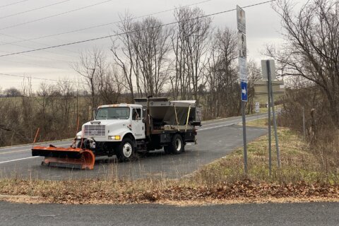
WTOP reporter Luke Lukert said he saw ice and snow preparations still underway early Saturday morning in Northern Virginia.
“As I’ve been driving around I’ve seen dozens of pickups and dump trucks filled with salt, and with a snowplow latched to the front,” Lukert reported. “As cities, like here in Middleburg, prepare for snow and freezing rain in the next few hours.”
Charlie Gischlar, from the Maryland State Highway Administration, recommended doing your best to stay at home if possible, because more people on the roads could hinder the road crews’ ability to clear the asphalt.
“The more traffic we’re in with our crews and our contracting partners, the less efficient we can be. So if we’re out there unencumbered, we can get more pavement clear in a more timely manner,” he said.
The Virginia Department of Transportation has been out on the roads as well.
“Our crews have been out brining since midnight this morning,” department representative Ellen Kamilakis said on Friday.
She told WTOP that the department plans to have 780 trucks out in the region, “but obviously based on the forecast, we’re heavily focused on Loudoun County.”
D.C. is also preparing for the storm.
At 9 a.m. on Saturday, the District Snow Team — including nearly 150 heavy plows to treat highways, streets, bridges and other elevated structures, plus 87 light plows for smaller streets — will deploy, according to D.C. Mayor Muriel Bowser’s office.
Other impacts
Fairfax County Public Schools canceled all of its Saturday activities ahead of the expected storm. That includes:
- Extracurricular activities
- Interscholastic contests
- Team practices
- Field trips
- Professional learning and training courses
- In-person Adult and Community Education (ACE) classes, recreation programs and community use by outside groups not affiliated with FCPS
CURRENT CONDITIONS
FULL FORECAST
WINTER STORM WARNING FOR WASHINGTON, FREDERICK, AND CARROLL COUNTIES IN MARYLAND FROM 7 A.M. TO 7 P.M. SATURDAY.
WINTER WEATHER ADVISORY ALONG AND WEST OF I-95, INCLUDING PRINCE WILLIAM COUNTY IN VIRGINIA. DOES NOT INCLUDE THE DISTRICT. ADVISORY RUNS FROM UNTIL 4 P.M. SATURDAY.
SATURDAY: The day starts with snow, sleet and a chance of freezing rain in the morning. Then a transition to rain for most of the day. Highs in the low to mid-30s.
SATURDAY NIGHT: Rain tapers off, mostly cloudy overnight. Lows in the upper 20 to low 30s.
SUNDAY: Partly sunny with gusty winds at times. Highs in the lower to upper 40s.
MONDAY: Mostly sunny. Highs in the mid-40s
WTOP’s Christopher Thomas and Kate Corliss contributed to this report.
Get breaking news and daily headlines delivered to your email inbox by signing up here.
© 2024 WTOP. All Rights Reserved. This website is not intended for users located within the European Economic Area.