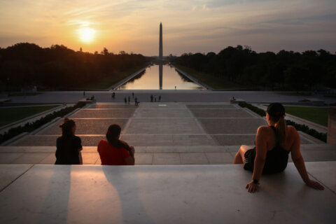
A mix of intense heat and thunderstorms are giving D.C. area residents both ends of the summer weather spectrum to cap off their weekend.
The weather pattern featuring high humidity and temperatures regularly in the 90s will carry until Wednesday. NBC Washington meteorologist Brianna Bermensolo said that in many areas, it will feel as if it’s over 100 degrees on Sunday due to heat indexes in the triple digits.
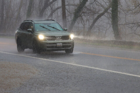
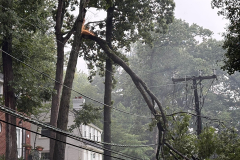
Sunday evening storms are in the forecast as well, with Bermensolo saying they could develop north of Interstate 66 and spread south later in the night.
- Listen to WTOP online and on the radio at 103.5 FM or 107.7 FM.
- Current traffic conditions
- Weather forecast
- Closings and Delays
- Sign up for WTOP alerts
Cooling centers in the District will remain open until July 28 for those who need them.
D.C. activates its Heat Emergency Plan whenever heat indexes exceed 95 degrees. You can find the nearest cooling center to you by checking out this interactive map.
Homeless residents can call a ride to the closest shelter by dialing 311 or the Shelter Hotline at 202-399-7093.
Monday’s weather will follow a similar track to Sunday’s — a hot and muggy start with storm chances increasing by the afternoon. Tuesday is expected to be dry, though storm chances return Wednesday afternoon before the heat finally starts to subside for the weekend.
Forecast:
Sunday night: Widely scattered thunderstorms, ending before midnight. Partly to mostly cloudy and muggy overnight. Lows upper 60s to mid 70s.
Monday: Partly sunny, hot and humid with a risk of afternoon thunderstorms, mainly south. Highs in the low to mid 90s.
Tuesday: Mostly sunny and hot, but a bit less humid. Highs in the mid 90s.
Wednesday and Thursday: Partly sunny, hot and humid. A chance of late day thunderstorms. Highs in the low to mid 90s.