Scattered storms moved through the region Tuesday night, after a hot day with a temperature of more than 100 degrees. Some of the storms could have damaging winds.
All showers and storms will end by midnight, with areas of fog developing overnight, Storm Team4 meteorologist Mike Stinneford said.
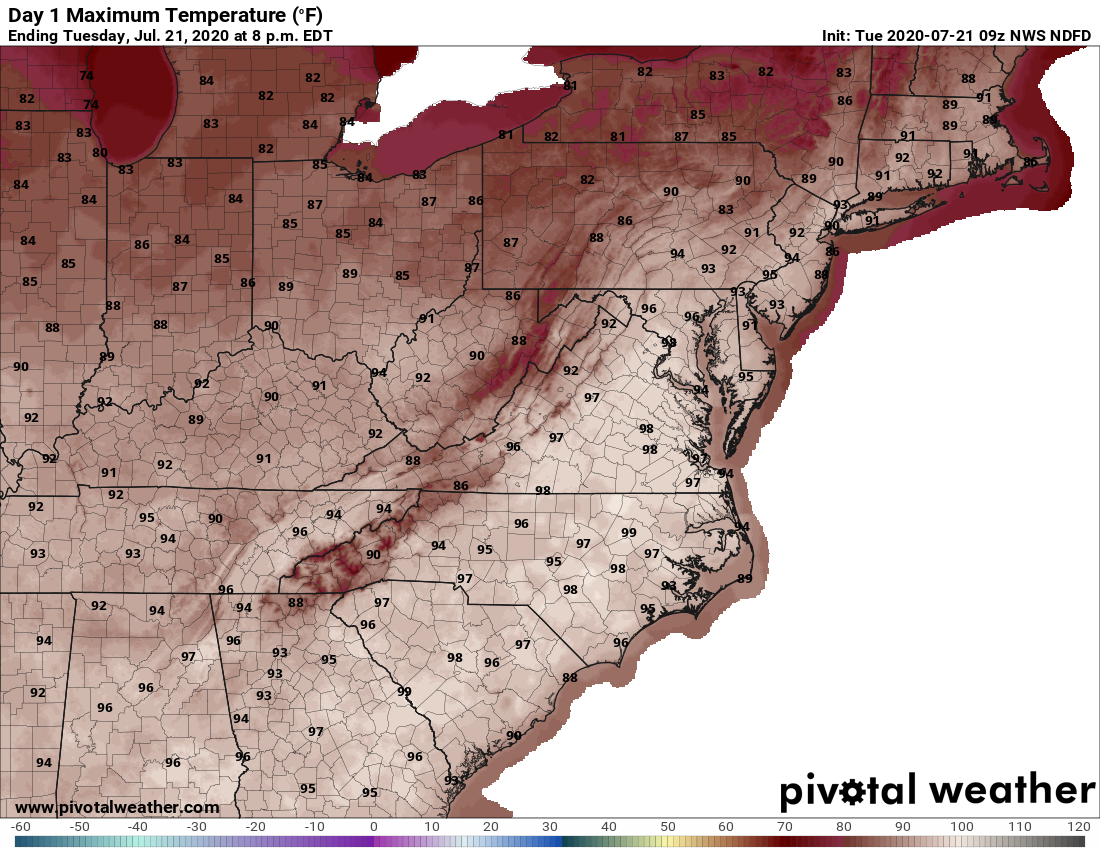
A dangerous combination of heat and humidity stifled the D.C. area again Tuesday, and while the heat index didn’t match Monday’s brutal 109 degrees, it was still oppressive as heck.
The heat index at Reagan National Airport topped out at 103 just before 5 p.m. Tuesday. The high was 96, but cloud cover diluted the misery somewhat.
And more humid heat is on the way. Wednesday’s high is expected to be comparable — 95 degrees, with a heat index that could hit 107, Stinneford said.
That will give way to storms that are expected to be more eventful than Tuesday evening’s fare. The forecast says they could bring potentially damaging winds and torrential rain to a wider area.
More muggy-to-stormy weather is expected through Thursday, with some relief arriving the next day.
“A weak cold front will slide through our area on Friday, bringing in some slightly drier air,” said Stinneford, who added that the long hot spell will probably continue at least through the end of the month.
- Listen to WTOP online and on the radio at 103.5 FM or 107.7 FM.
- Current traffic conditions
- Weather forecast
- Closings and Delays
- Sign up for WTOP alerts
Forecast:
Tuesday night: Scattered thunderstorms, ending by midnight. Damaging winds and heavy downpours possible. Muggy overnight with patchy fog. Lows in the 70s.
Wednesday: Partly sunny, hot and humid. Thunderstorms likely in the afternoon; some could be severe. Highs in the mid to upper 90s. Heat index 102 to 107.
Thursday: Partly sunny, with thunderstorms likely in the afternoon. Some could be severe. Highs in the upper 80s to mid 90s. Heat index near 100.
Friday: Mostly sunny. Chance of an afternoon thundershower. Highs near 90; heat index near 100.
Saturday: Mostly sunny, with highs near 90.


