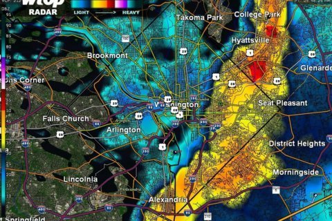
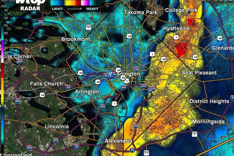
A somewhat stormy Thursday for the D.C. area is winding down with a chance for more rain into the evening.
Earlier in the afternoon, a long squall line extended from the Pennsylvania-Maryland border down into Spotsylvania County, Virginia, and its quick passage caused the National Weather Service to issue severe thunderstorm warnings for portions of the area.
As of 6:45 p.m., there were reports of downed trees in the Virginia counties of Prince William, Fauquier, Stafford and Culpeper and in the city of Manassas. There were similar reports in the Maryland counties of Carroll and Frederick.
Due to inclement weather, the start of tonight’s game vs. @BlueJays is starting in a delay. pic.twitter.com/K1T9Lx8fci
— Baltimore Orioles (@Orioles) June 13, 2019
Poolesville, MD (515p) Severe T-Storm WARNING - Tske Precautions pic.twitter.com/gAj9u2wiZV
— Pete Piringer (@mcfrsPIO) June 13, 2019
Just behind the severe thunderstorm here in Spotsylvania Virginia the sun popped out as did a Rainbow! @wusa9 @WeatherNation @capitalweather @weatherchannel @WTOP pic.twitter.com/L2pdP4LsQ4
— Kensi Michelle (@CiriAntares) June 13, 2019
@wtop no thunderstorm but very interesting skies in Rockville pic.twitter.com/37HO7reMy3
— Lyudmila Tatarov (@lyudmilatatarov) June 13, 2019
@wtop impressive front rolling in near Ft.Meade pic.twitter.com/Q6qqTe15EB
— Justin M. Boudreau (@JustinMBoudreau) June 13, 2019
Expect around an inch before it all moves out later Thursday night. What follows will be a warmer, more pleasant Friday. “Right now, the weekend is looking nice,” said Storm Team4 meteorologist Amelia Draper.
Saturday will be warmer and sunny, with low humidity and highs in the low to mid 80s. Sunday will be around 90 degrees. Storms, however, are possible in the afternoon. So if you have plans with your dad for Father’s Day, the earlier, the better.
Stick with WTOP on air and online for any severe weather advisories throughout the evening.
- Listen to WTOP online and on the radio at 103.5 FM or 107.7 FM.
- Current traffic conditions
- Weather forecast
- Sign up for WTOP alerts
Forecast
Thursday night: Scattered showers and thunderstorms. Clearing overnight, with lows in the mid 50s to low 60s.
Friday: Sunny and breezy with low humidity. Highs in the mid to upper 70s.
Saturday: Sunny and warm with low humidity. Highs in the low to mid 80s.
Sunday/Father’s Day: Hot and humid with late-day storms. Highs near 90.