Some scattered showers and storms for the afternoon hours. I'm still thinking tonight (after 6PM) we have the best chance for severe weather with VERY heavy rainfall and gusty winds the main concerns. West of line has a better chance for severe weather. pic.twitter.com/B8C1nipxoC
— Amelia Draper (@amelia_draper) June 20, 2018
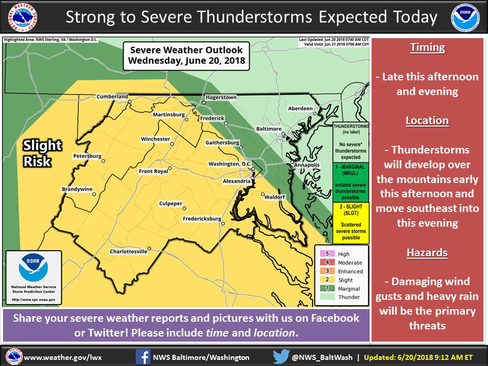
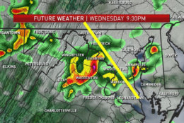
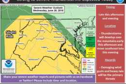
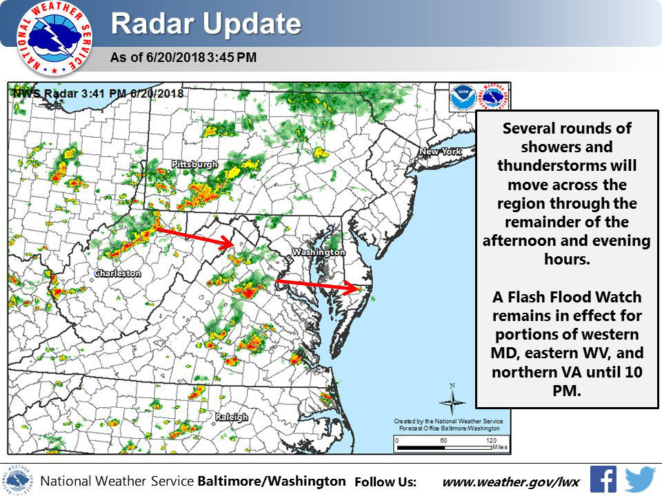
WASHINGTON — Showers and thunderstorms, some of which could be severe, could hit the D.C. area on Wednesday, potentially complicating the evening commute.
Quick Links:
“With any of these storms expect strong winds, heavy downpours that could lead to flooding and lots of lightning,” said Storm Team 4 meteorologist Lauryn Ricketts.
Some showers and isolated storms now but it's the rain and storms in WV and PA I'm watching to bring heavy rain from 6/7 – 11PM tonight to our area. Heavy rain and gusty winds main concerns. Some isolated flooding possible in spots. pic.twitter.com/l0622vHeAa
— Amelia Draper (@amelia_draper) June 20, 2018
Areas west of D.C. are at greater risk of seeing more severe weather.
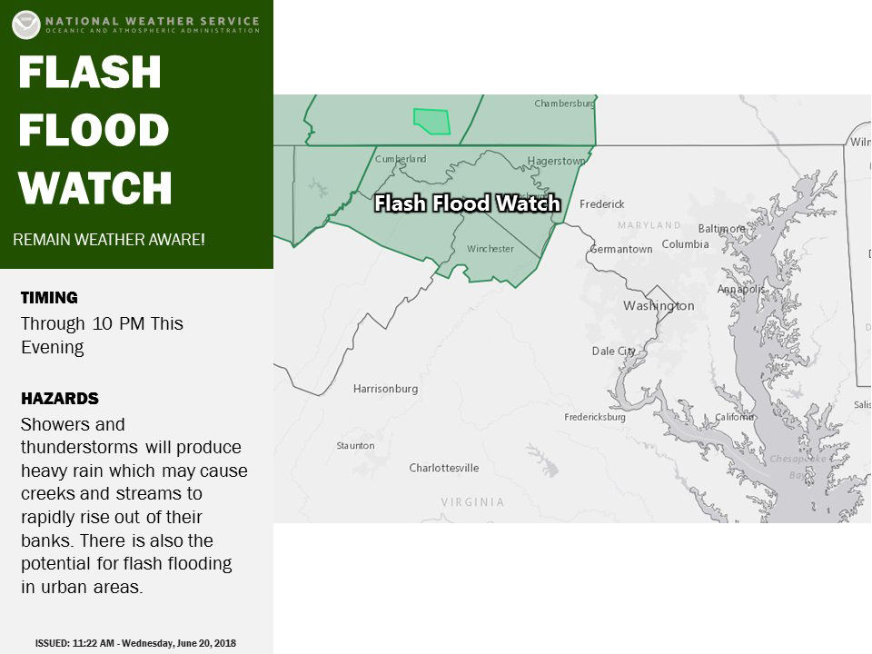
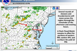
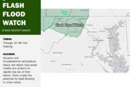
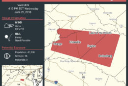
The National Weather Service has issued a Flash Flood Watch for areas outside of the D.C. area in Western Maryland, eastern Western Virginia and Northern Virginia until 10 p.m.
Current Conditions
Traffic
In addition to the weather, a crash on the Woodrow Wilson Bridge has closed the Outer Loop through lanes, although Maryland State Police said they hope to have all lanes reopened by 6 p.m.
For the most updated traffic report, visit WTOP’s traffic center. You can see a map of the latest traffic conditions below.