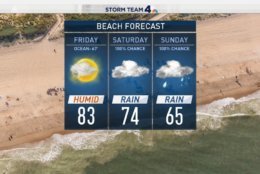
Damn the torpedoes, full speed ahead. Weather at the beaches this weekend will be, what's the word for it, LOUSY. I'm going anyway but I'm going with the knowledge that I'll be spending most of my time indoors. A bad day at the beach > a good day at work. pic.twitter.com/S85E7IMpY2
— Chuck Bell (@ChuckBell4) June 1, 2018
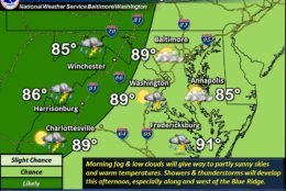


WASHINGTON — The D.C. area saw sunny skies with high temperatures and humidity on Friday but it will only be a brief reprieve from rain.
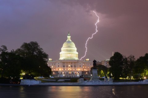
Severe storms are expected to batter the region again this weekend. A possible 2 to 4 inches of additional rain could mean flooding for the already-saturated region.
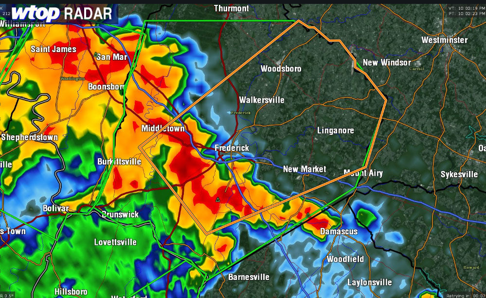
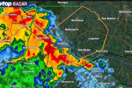
The National Weather Service has issued a flood warning for areas of Loudoun County in Virginia, until 3:15 a.m., Washington County in Maryland until 3 a.m., and Frederick County in Maryland until 4 a.m.
A big cluster of thunderstorms with heavy rain moved through Washington and Frederick counties in Maryland that could have brought about some nickle-sized hail, Storm Team4 Matt Ritter said.
Quick Links:
There is a 30 percent chance for scattered thunderstorms in the evening, with slightly higher chances in the Shenandoah Valley.
A wave of low pressure is expected to form over the Chesapeake Bay Saturday and will slowly spin its way off the coast with a push from a cold front on Monday afternoon, Storm Team 4 Meteorologist Chuck Bell said. That means trouble for weekend beachgoers and those on high-alert after flooding earlier this week.
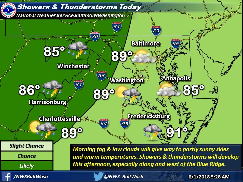
Saturday will start out dry, but rain will move in by late morning or early afternoon turning heavy at times by late afternoon and evening.
High Saturday temperatures are expected to reach near 80 degrees, Bell said.
Rainfall totals for the weekend are likely to be in the 1 to 4 inch range with the heaviest rain falling Saturday night.
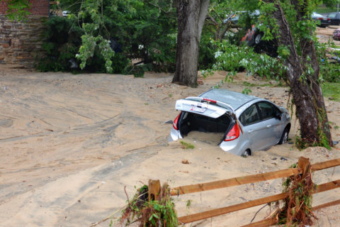
And because the ground is already saturated from rain, the risk of more flooding is high. Any individual thunderstorm could cause localized flash flooding, and residents out driving this weekend should use extreme caution.
“Avoid high, fast moving water at all costs,” Bell said. “Turn Around. Don’t Drown!”
On Sunday rain is expected to continue, and highs will in the mid to upper 60s, well below the 81 degree average.
A cold front will arrive on Monday and push this weekend storm out to sea, Bell said. But rain is likely again as highs hover in the low to mid 70s.
Later in the week, conditions are expected to be mostly dry and cooler than average, giving the area a chance to dry out.
Traffic
The WTOP Traffic Center is keeping its eye on road conditions 24/7.
For the most updated traffic report, visit WTOP’s traffic center. You can see a map of the latest traffic conditions below.
Weekend Forecast
Saturday
Saturday is expected to be cloudy and cooler, with highs in the high 70s to low 80s. It will start off dry, but a low pressure area is expected to form over the Chesapeake Bay. That could cause persistent rains later in the day. Rainfall between 1 and 3 inches is likely.
Sunday
An unseasonably cool day in the mid to high 60s expected Sunday. Another inch or more of rain is possible and it could be heavy at times.
Monday
A partly cloudy day is expected on Monday. Pleasant temperatures will hover in the low to mid 70s, but there is a chance for rain.