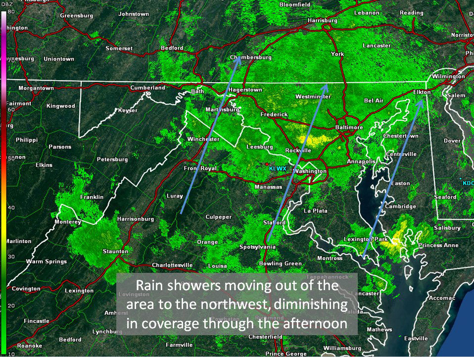
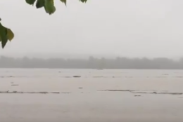
Waves of showers (heaviest I95 & points east) will move through the region today. It will be muggy, cloudy most of the day (could have SOME sun along the Shenandoah Valley).. otherwise please be careful if you are out and about pic.twitter.com/05hrKWalUF
— Lauryn Ricketts (@laurynricketts) May 19, 2018
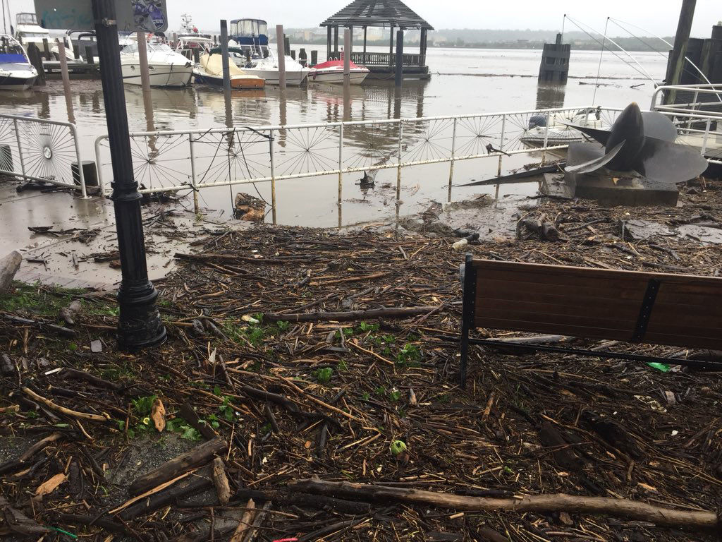
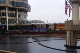
It is an insurance policy. The floodgates at the Georgetown Waterfront complex have been raised as our endless rain continues. The level of the Potomac River here is not expected to get that high. But no one here wants a replay of the Great Georgetown 2011 floods. @WTOP pic.twitter.com/gyZnt2lcLy
— Kathy Stewart (@KStewartWTOP) May 19, 2018
Floodgates are up here along Georgetown's Washington Harbour. It is a proactive measure since the Potomac River isn't expected to get that high. It's a preventive measure so there's not a replay of the 2011 Georgetown floods. @WTOP pic.twitter.com/YUr0TWRbt5
— Kathy Stewart (@KStewartWTOP) May 19, 2018
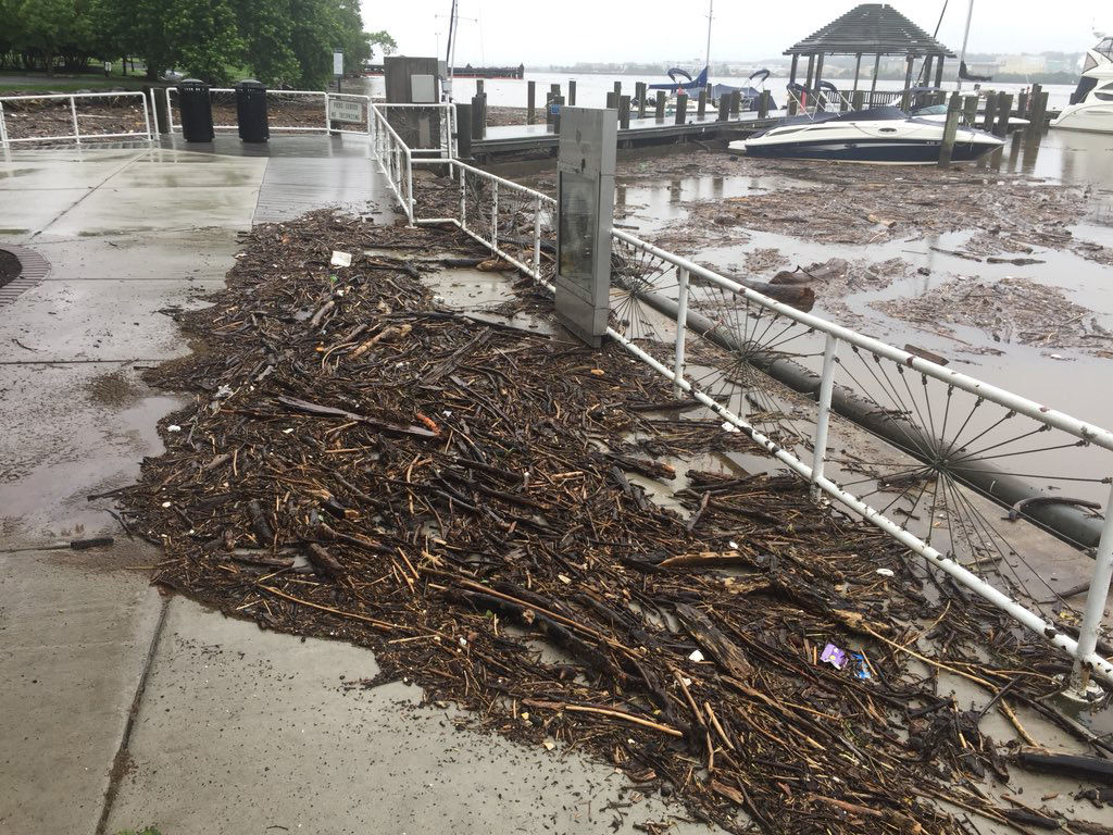
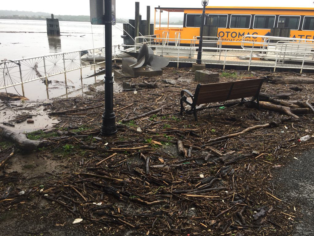
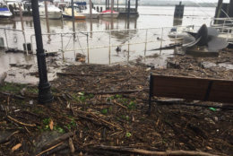
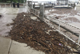
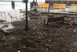
Check out all the tree debris floating past Old Town on the Potomac. Coastal flood advisory posted in the region thru most of tomorrow morning. Stay with @WTOP pic.twitter.com/m4HHlVNO84
— John Domen (@JDDsays) May 19, 2018
WASHINGTON — The rain just won’t stop in the D.C. area. The rain is expected to continue on Saturday and could bring more flooding with it.
Quick Links:
“We are going to be dealing with flooding as we continue through the weekend and possibly into early next week even though the threat of rain is lessening,” said Storm Team 4 meteorologist Lauryn Ricketts.
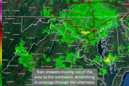
Showers are likely to stick around Saturday afternoon, though the showers won’t be as steady as in the days past. Some areas east of Interstate 95 could see heavy rain.
A flood warning is in effect for several rivers in the area.
A flood watch is in effect for several areas in the D.C. area. until 8 p.m.
Flood Watch canceled for MOST of #wtop area, remains in solid green. The various flood warnings (lt. green) for river and stream points with many various expiration times continue. Flash Flood Warning (teal) for southern Maryland continues until 4:15pm. #nbc4dc (radar data off) pic.twitter.com/4WrDrpFah4
— Met. Matt Ritter (@MetMattRitter) May 19, 2018
Flooding has been causing a lot of problems for parts of the D.C. area.
“Flooding is definitely a danger,” said Brian Lasora, a meteorologist with the National Weather Service. “I think Frederick, Maryland, has seen the worst because they had the heavy rains from the thunderstorms a couple of days ago on top of this.”
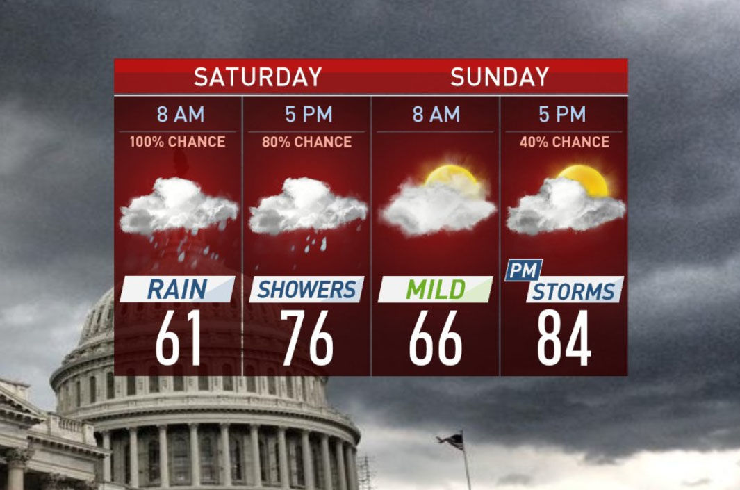
What to expect on Saturday
There is no let up for the rain in the D.C. area on Saturday as showers are expected to continue for much of the day.
Ricketts said areas east of I-95 could see heavy rain at times, but the rest of the D.C. area will see scattered showers.
But even a bit of rain could lead to more flooding.
“The ground is already saturated,” Lasora said. “That’s causing any additional rain to run off and streams and creeks are rising across the area. That’s causing ponding of water on roadways and the flooding of low lying areas.”
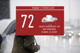
Temperatures will be in the low to mid 70s on Saturday with clouds sticking around, although some areas in the Shenandoah Valley could get a few peeks of sun.
Traffic
As you might expect, all the rain means wet roads, which could cause some traffic headaches Saturday.
For the most updated traffic report, visit WTOP’s traffic center. You can see a map of the latest traffic conditions below.
Current Warnings
A flash flood warning is in effect for central St. Mary’s and southern Calvert counties until 4:15 p.m.
The National Weather Service said that as of 11:22 a.m. stream gauges indicated river levels on the Monocacy River was rising again as a result of overnight rainfall.
Some locations that may experience flooding include:
- Frederick
- Thurmont
- Emmitsburg
- Harry Grove Stadium
- Ballenger Creek
- Taneytown
- Brunswick
- Walkersville
- Braddock Heights
- Clover Hill
- Discovery-Spring Garden
- Wolfsville
- Linganore-Bartonsville
- Jefferson
- Myersville
- Woodsboro
- Union Bridge
- Libertown
- Rosemont
- Burkittsville.
A flood warning has also been issued for St. Mary’s County until 10 p.m.
The National Weather Service said that as of 10:34 a.m., radar indicated moderate to heavy rain will move into portions of St. Mary’s, Calvert and Charles counties by midday, which could be enough to push streams out past their banks and lead to road closures.
In Virginia, the National Weather Service extended a Flood Warning for Prince William and Fairfax counties along with the city of Fairfax, Falls Church, Manassas Park and Manassas until 6 p.m.
Reporting gauges indicated streams in and bordering Prince William County were still rising, including Bull Run, Broad Run, Cub Run and Cedar Run, the weather service said.
As of 11:30 a.m., flooding was likely to begin on Broad Run in the vicinity of the Manassas Airport rail station with Piper Lane likely to experience flooding.
Some of the locations that might see flooding include:
- Centreville
- Dale City
- Woodbridge
- Quantico
- Lake Ride
- Linton Hall
- Chantilly
- Montclair
- Lorton
- Bull Run
- Triange
- Dumfries
- Manassas
- Sudley
- Cherry Hill
- Manassas Park
- Independent Hill
- Mason Neck
- Nokesville
- Occoquan
A flood warning means that flooding is imminent or occurring. The National Weather service urges drivers to turn around when encountering flooded roads.
D.C. is under a coastal flood warning starting at 6 a.m. Saturday until 8 a.m. Sunday.
Radar
Forecast
Saturday: Rain early, then a possible break with a chance for scattered showers throughout the day. Highs in the mid-70s.
Sunday: Mostly cloudy, chance for showers. Temps in the mid-80s.
Monday: Chance for showers. Highs in the mid-80s.
Tuesday: Chance for showers. Temps in the mid-80s.
Wednesday: Mostly cloudy, temps in the low 80s.