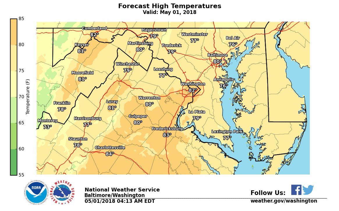
WASHINGTON — The warmest temperatures of the year are expected to move into the D.C. area as the first days of May arrive.
“This week will be the hottest stretch we’ve seen so far this year,” said NBC4 meteorologist Sheena Parveen. “Each day this week will be warmer than the previous until we hit a high near 90 on Thursday.”

The average high for this time of year is 71. The record high for Reagan National Airport is 91 for Thursday, making it be a near-record high day.
Parveen said that its going to be mostly sunny and dry this week as the warm air heads to the area.
“There’s a big area of high pressure South of us which will move off into the Atlantic Ocean over the next couple days, and that will give us more of a South wind, and that wind will pull in all the hot air from the South, which is why we’ll be getting so warm,” she said.
Expect a warming trend this week, with high temperatures 15 to 20 degrees above normal. Temperatures on Wed and Thu may come within a few degrees of the record for the date. pic.twitter.com/JTfxPhqcyO
— NWS DC/Baltimore (@NWS_BaltWash) April 30, 2018
There is a cold front approaching on late Friday with a slight chance for a rain shower late in the day.
The temperatures will drop a bit over the weekend with temperatures in the 70s.
And as the warmer weather moves in, Bei Bei has the right idea for staying cool. The panda at the National Zoo was “making a splash” in a baby pool Monday.
🐼 #BeiBei making a splash! #PandaStory pic.twitter.com/2IwVNkhZ3p
— National Zoo (@NationalZoo) April 30, 2018


