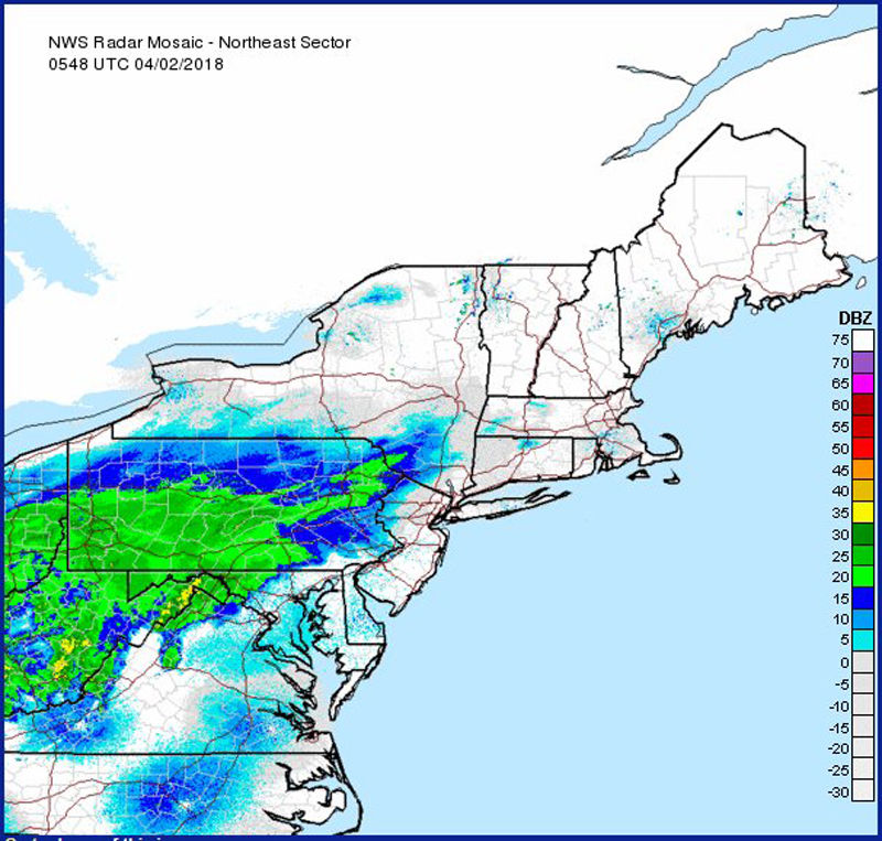
Spring snow falls in parts of DC region

Storm Team4 meteorologist Chuck Bell said the last of the rain and snow will move out of the area by 10 a.m. Highs will get back into the low 50s on Monday.
The radar imagery of the winter storm on Monday, April 2 as of 2:30 a.m. Moderate to heavy snow is occurring in western Maryland and Northwestern Virginia. A mix of light snow and rain farther easto to near I-81, light to moderate rain east to central Maryland. (Courtesy National Weather Service)
This map is the official snowfall forecast by the National Weather Service, which National Weather Service forecasters believe to the most likely outcome. (Courtesy National Weather Service)
The winter weather update for late Sunday night and early Monday morning from the National Weather Service. (Courtesy National Weather Service)
The National Weather Service said the higher amount of snow totals is unlikely, with only a 10 percent chance that more snow will fall, but it is a "reasonable upper-end snowfall amount" based on many computer models and can help serve as "an upper-end scenario for planning purposes." (Courtesy National Weather Service)
The National Weather Service said the higher amount of snow totals is unlikely, with only a 10 percent chance that more snow will fall, but it is a “reasonable upper-end snowfall amount” based on many computer models and can help serve as “an upper-end scenario for planning purposes.” (Courtesy National Weather Service)
Conversely, this map shows what the National Weather Service calls a “reasonable lower-end snowfall amount.” There is a 90 percent chance that the area sees more snow than this, but the numbers can serve “as a lower-end scenario for planning purposes.” (Courtesy National Weather Service)
(1/6)
The radar imagery of the winter storm on Monday, April 2 as of 2:30 a.m. Moderate to heavy snow is occurring in western Maryland and Northwestern Virginia. A mix of light snow and rain farther easto to near I-81, light to moderate rain east to central Maryland. (Courtesy National Weather Service)
This map is the official snowfall forecast by the National Weather Service, which National Weather Service forecasters believe to the most likely outcome. (Courtesy National Weather Service)
The winter weather update for late Sunday night and early Monday morning from the National Weather Service. (Courtesy National Weather Service)
The National Weather Service said the higher amount of snow totals is unlikely, with only a 10 percent chance that more snow will fall, but it is a "reasonable upper-end snowfall amount" based on many computer models and can help serve as "an upper-end scenario for planning purposes." (Courtesy National Weather Service)

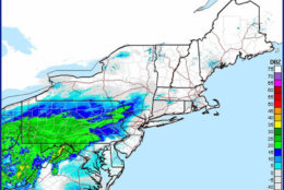
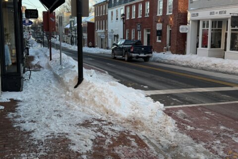
WASHINGTON — It is April, but parts of the D.C. area saw snow falling on Monday morning.

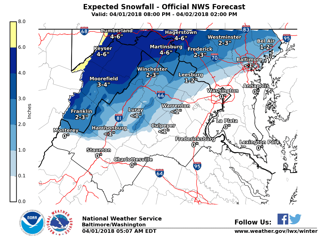
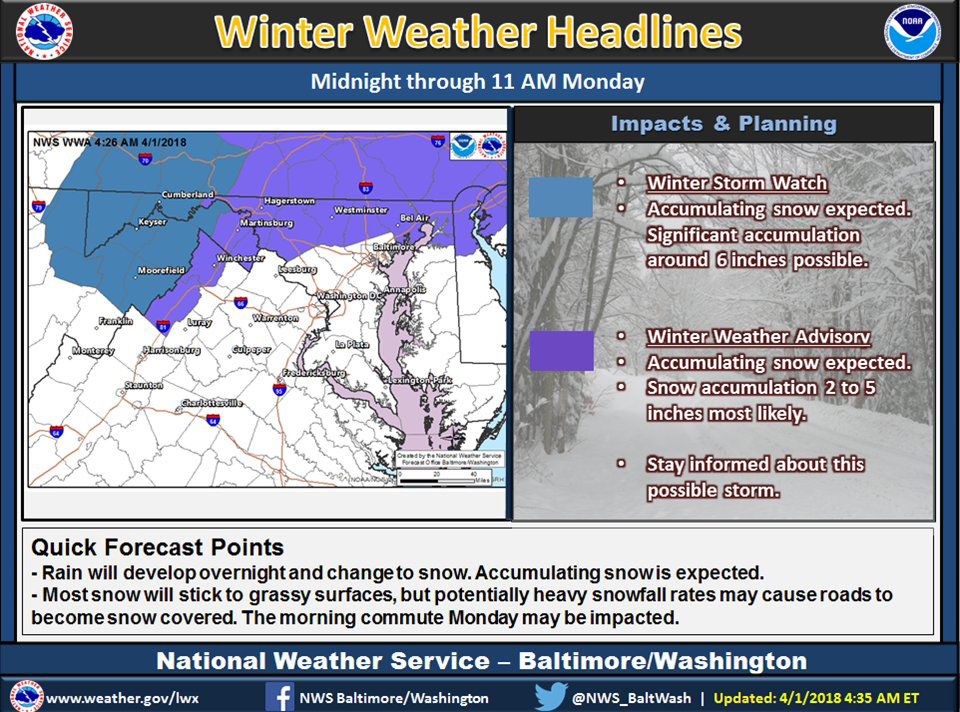
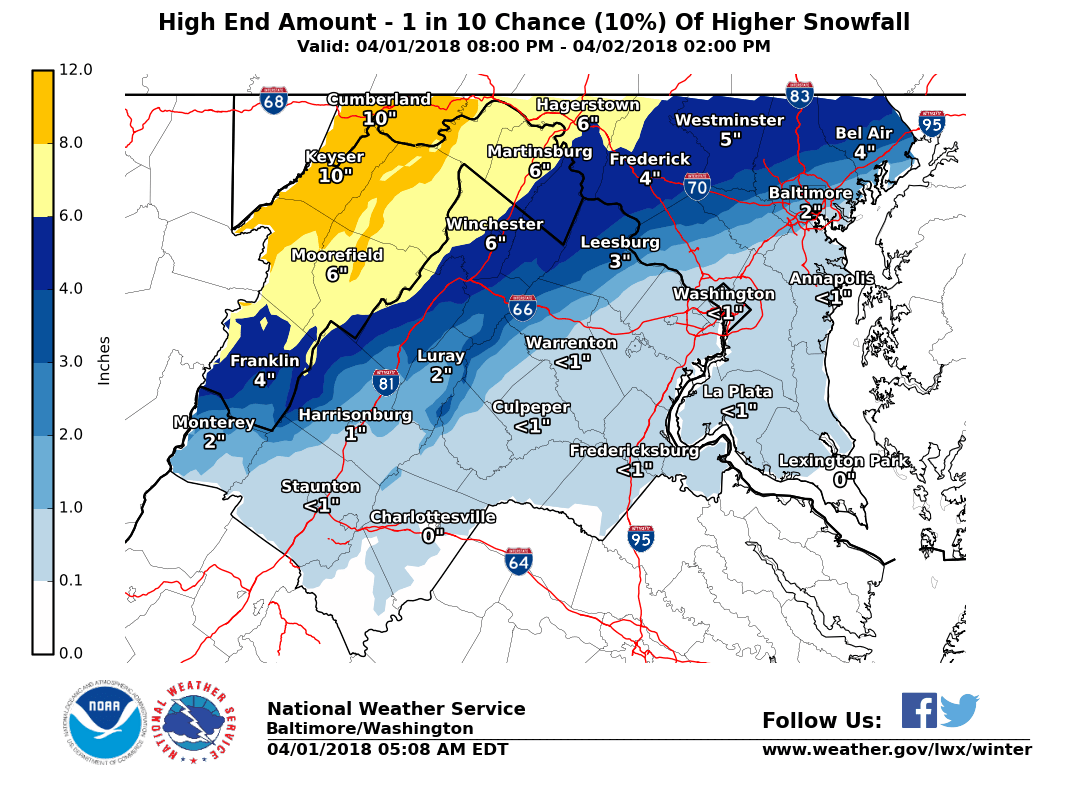
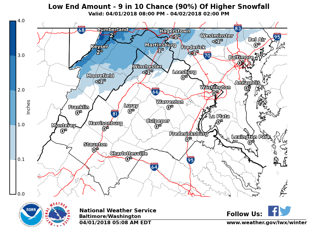
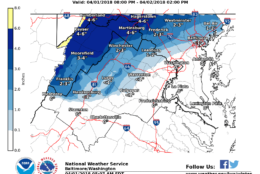
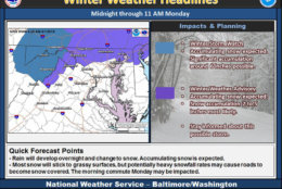
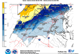
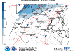
A winter weather advisory is in effect until 11 a.m. Monday for parts of Montgomery and Howard County in Maryland as well as Clarke County and parts of Loudoun County in Virginia, but Storm Team4 meteorologist Chuck Bell said everything should be over by around 10 a.m.

Storm Team 4’s Somara Theodore said the counties under the advisory can expect 1 to 2 inches of snow on grassy and elevated surfaces. Northern parts of Frederick County may see 2 to 3 inches of snow.

“If you live in upper Montgomery County, Frederick County, Loudoun and back toward the I-81 corridor, you could actually pick up accumulating snow,” said Theodore. “Those south of the District will probably just see rain. In the D.C. Metro area, we will get rain with some snow mixing in.”

Theodore said northern and western counties could see up to two inches of snow on grassy and some elevated areas, but all of it should melt by Monday afternoon.

The D.C. area has seen snow in April before, but it is relatively rare.

Measurable snow has only been recorded three times in the last 50 years at Reagan National Airport, most recently on April 7, 2007. The area also prior bouts of April snow in 1972 and 1990.

The latest recorded major snowfall, meaning four inches or more, happened on the April Fools’ Day Storm in 1924. D.C. got five inches of snow while Baltimore got more than nine inches during that storm.

The National Weather Service said the latest measurable snowfall ever in D.C. was on April 28, 1898 when half an inch fell in D.C. and .1 inches fell in Baltimore.

The latest snow was seen in D.C. was on May 10, 1906 when a trace fell.

WTOP’s Dave Dildine contributed to this report.

Federal News Network Logo
Log in to your WTOP account for notifications and alerts customized for you.

Sign up