WASHINGTON — Finally, it is beginning to feel like autumn across the region. After a very warm first half of October, residents can break out the jackets, boots and even hats as the cool air is moving back into the region.
Yes, it was abnormally warm earlier in the month. In fact, the average temperature from Oct. 1 to Oct. 15 this year was 69.9 degrees. That is 8.1 degrees warmer than the area’s average temperatures for the first part of October.
But don’t say goodbye to warm temperatures just yet. In fact, temperatures will begin a slow rise once again starting Wednesday afternoon; however, Wednesday morning will start off on a chilly note.
A frost advisory is posted for much of the region Tuesday evening, which is outlined for those areas in blue. Most counties that are influenced by the warm water in the Chesapeake Bay are not included in the frost advisory.
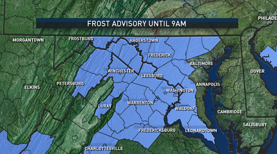
Generally, the National Weather Service will issue frost advisories for the area until the end of the growing season, which is marked by the first widespread freeze.
While D.C. itself will probably not bottom out in the 30s (the air temperature in D.C. is measured at Reagan National Airport, which tends to be slightly warmer this time of year due to its juxtaposition next to the water), there could be isolated spots inside the Capital Beltway that could fall into the 30s.
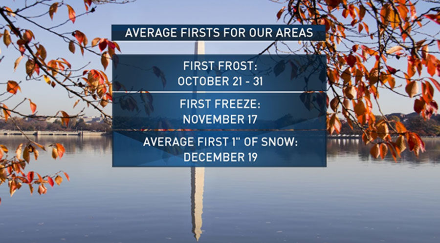
The area is just a touch early for the first frost to be posted but, again, this is an odd October. The first freeze for areas east of the Blue Ridge Mountains is generally in early to mid November, which will mark the end of the growing season.
For areas west of the Blue Ridge Mountains, the first freeze is, on average, mid to late October. In fact, a freeze warning is in place for much of the Central Shenandoah Valley, including Shenandoah County. A freeze occurred Tuesday morning for portions of West Virginia and western Maryland, so no more frost or freeze headlines will be posted for those locations, considering their growing season has officially ended.
After Wednesday, high pressure will slowly begin to slip south, helping to boost overnight lows and daytime highs. In fact, by Wednesday afternoon, temperatures will be a good 10 degrees higher than on Tuesday afternoon.
The gradual climb into the upper 70s will take place through the weekend before a cold front moves through the region on Monday and/or Tuesday, bringing rain and cooler temperatures toward the end of the next workweek.