Workweek weather: July ends pleasantly, August arrives with hotter weather

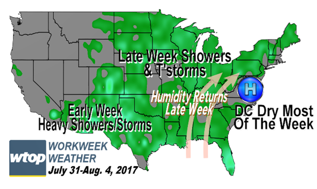
WASHINGTON — Monday starts out quite pleasant as the D.C. region heads back to work, but by the end of the week, summer returns. It’s a common pattern the area has had a lot this warm season: High pressure makes it nice before it moves away and pumps in the heat. However, the next round does not look like it will be too brutal.

(WTOP/Storm Team 4)

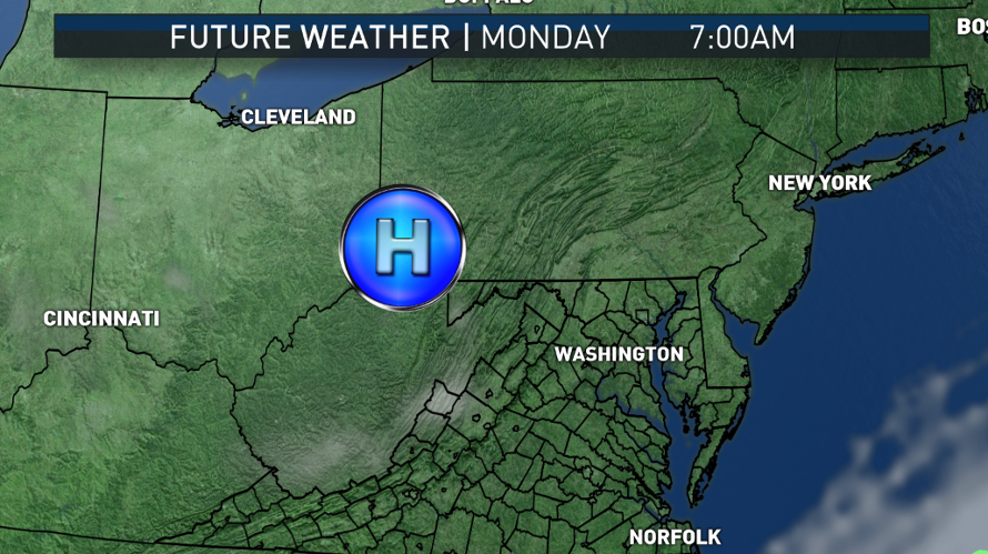
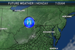
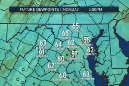
Clear skies, calm winds and remarkably dry air arrive for the last day of July. Monday will have some temperatures that will be downright cool, especially away from the “urban heat island” effects of the big cities. Monday morning lows will be 5 to 10 degrees below average across the area. The dry air and full sunshine for most of the morning will make for a quick warm up. High pressure will have the atmosphere mostly “sinking” or compressing, preventing much more than fair weather clouds forming.

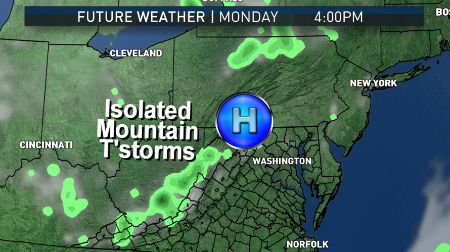
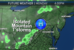
However, the ground is still saturated from the flooding rains of late last week. The ground will give some of that up to evaporation, and it may start feeling a bit stickier in the afternoon. In this type of scenario, we would be watching out toward the mountains for an isolated thunderstorm to pop up, areas which are heated unevenly because of the terrain. Other than that, there is not much of a chance for showers or storms in this setup.

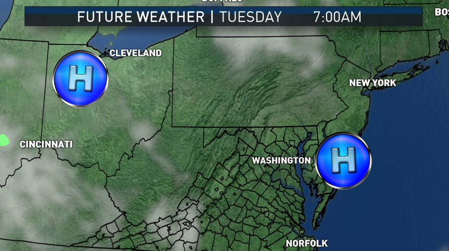
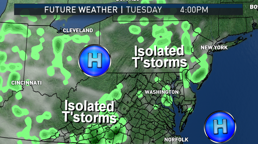
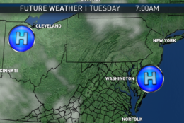
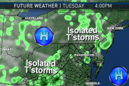
We have virtually the same scenario for Tuesday, as another piece of the high pressure system wedges down from the Great Lakes.

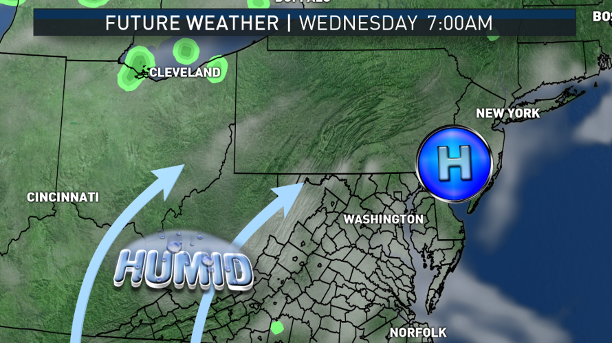
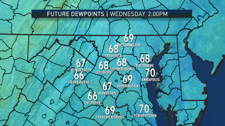
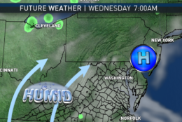
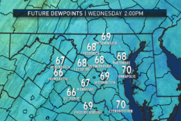
On Wednesday, the ridge of high pressure will start heading out to sea and we will get into the “return flow.” More of southerly and southwesterly wind flow in the low levels will start taking over, bringing in hotter temperatures and higher humidity levels. The big cities especially will have the potential to get into the low 90s and another heat wave, but humidity levels will only be on the low end of the muggy ranges — in other words, starting to feel uncomfortable again, but not too oppressive to most folks.

It’s really not until Friday that the chances for significant showers and thunderstorms begin to rise as a sharp dip in the jet stream will send a cold front toward the area. If we have an official heat wave ongoing at that time, it will break in time for the weekend.

(Data: The Weather Company. Graphics: Storm Team 4)
The following images are from a Sunday run of the RPM computer model, depicting the future satellite and radar. (High pressure centers added by this user.) Note the lack of activity through midweek, the extent of this run. The model does show the possibility of an isolated thunderstorm or two in the mountainous areas. The model always “over-depicts” the light activity, so we do not expect much to occur in this time period. By Wednesday, as the high moves away, the humidity significantly starts to increase.
(Data: The Weather Company. Graphics: Storm Team 4)
Also in this run of the RPM, we can see the gradually increasing dew points. Remember, the higher the dew point, the more moisture there is in the air. The humidity is the only thing that will be changing significantly through midweek while temperatures only become slightly hotter (which is why meteorologists talk about the dew points in the warmer months). On Sunday, dew points were in the 50s, being a very comfortable range for summer. By midweek, we will be getting close to the 70 mark, which is generally when it starts to feel muggy. (Data: The Weather Company. Graphics: Storm Team 4)
(1/8)
(Data: The Weather Company. Graphics: Storm Team 4)

Daily Weather Highlights

MONDAY
• Cool, crisp start
• Temperatures well below average in the morning but above record lows
• Abundant sunshine most of the day
• A few more clouds/a stray thunderstorm near the Appalachian Mountains
• Seasonably very warm but comfortable humidity

TUESDAY
• Not quite as cool to start
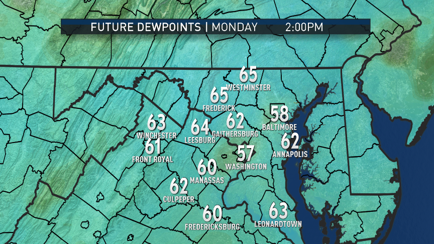
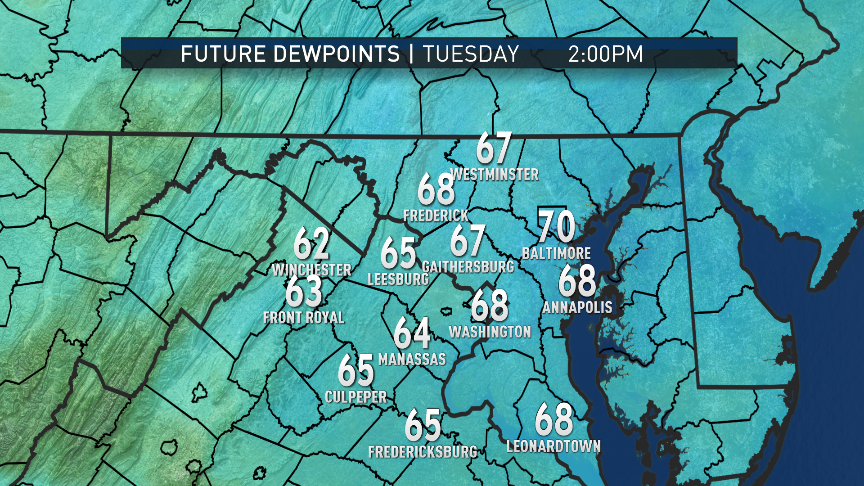
• Slightly higher humidity levels
• Abundant sunshine most of the day
• Possibly starting the next heat wave
• Again, just a stray thunderstorm possible near the higher elevations

WEDNESDAY
• Hot and starting to feel muggy
• Hazy skies with lots of fair weather clouds

THURSDAY
• Hazy, hot and humid
• Hottest day of the week

FRIDAY
• Very warm and muggy
• Increasing clouds
• Chance of scattered showers and thunderstorms, especially late in the day

Editor’s Note: The WTOP Workweek Weather Blog is intended as an in-depth yet plain language summary of the business week’s weather potential in the D.C. area along with an explanation of the contingencies and uncertainties that exist at the time of publication. For the latest actual Storm Team 4 forecast, check out the main WTOP Weather Page.

Federal News Network Logo
Log in to your WTOP account for notifications and alerts customized for you.

Sign up