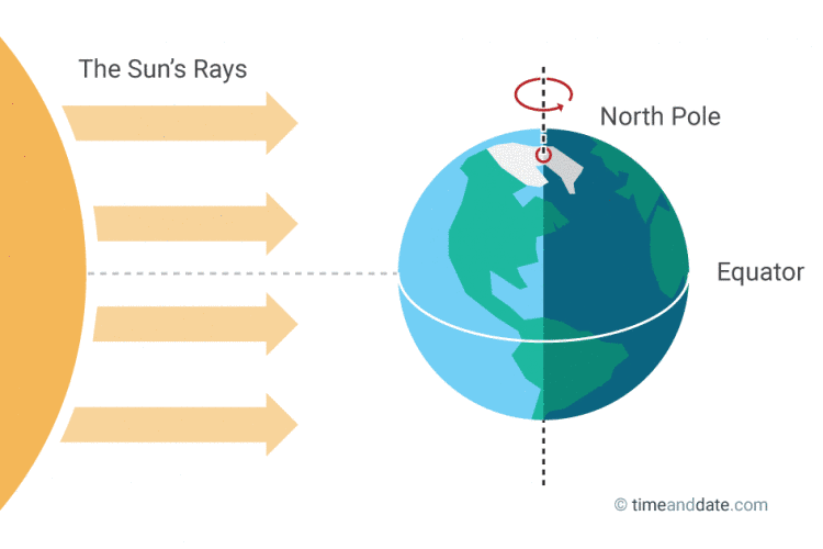
WASHINGTON — Spring arrives (arrived, depending on when you’re reading this) at 6:29 a.m. EDT Monday, according to the U.S. Naval Observatory. (Some sources say 6:28 a.m.)
Weather Galleries

That is the vernal equinox: The moment the sun is directly above the equator and starts heading back toward the Tropic of Cancer, which will be the summer solstice.
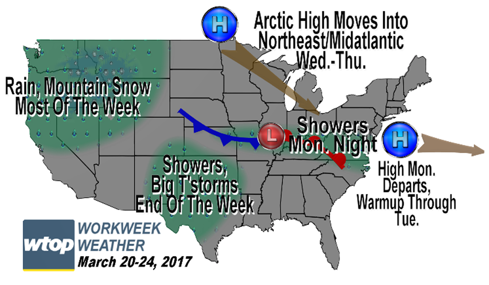
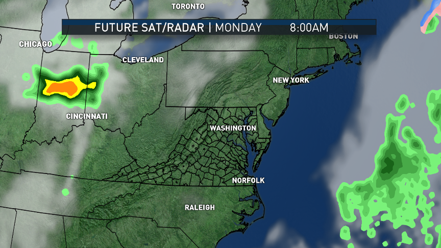
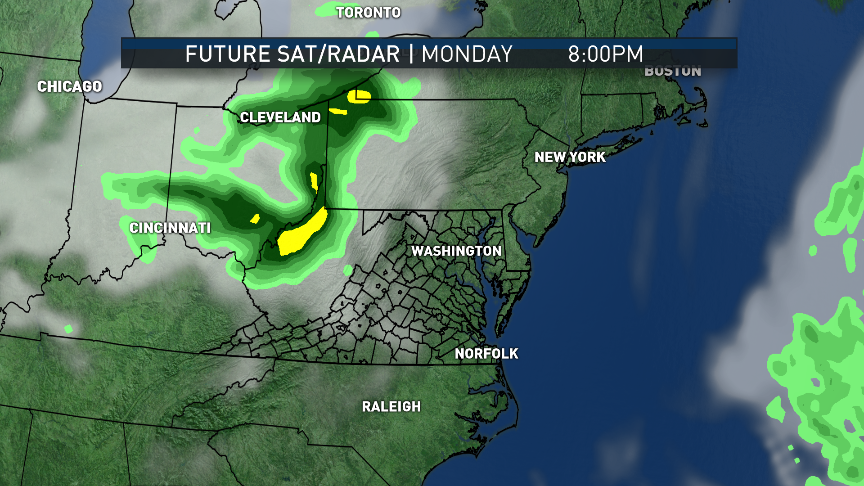
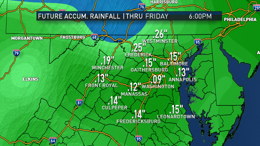
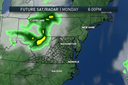
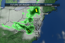
So, even though we’ve had plenty of previews so far this year, Monday is spring. And after a cool weekend, temperatures will be on the rebound. It’s only temporary, though. Chilly weather will return for midweek, only to rebound once again. In the process will be a cold frontal passage, bringing a chance for only some light rain Monday night.
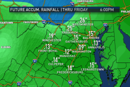
The storm last week produced a lot of needed moisture from the rain and snowmelt, but we still need more. This week, we won’t get it.

Daily weather highlights
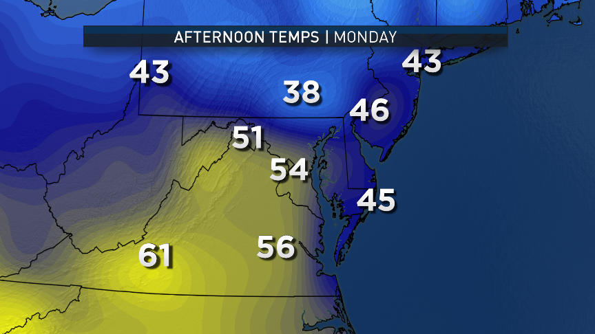
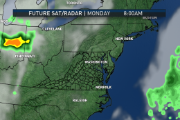
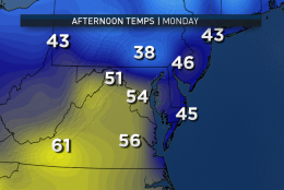
MONDAY
• Cold, mainly clear start
• Sun fading behind increasing cloud cover
• Seasonable high temperatures in the upper 50s to near 60
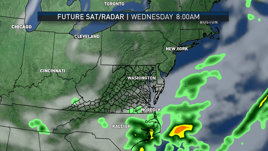
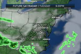
• Rain arriving after nightfall
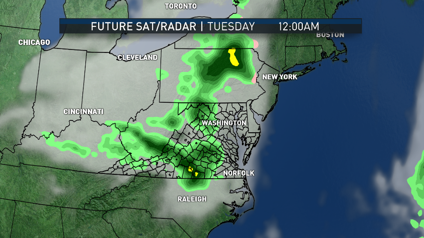
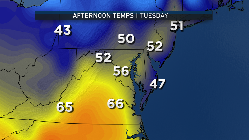
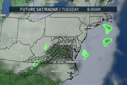
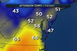
TUESDAY
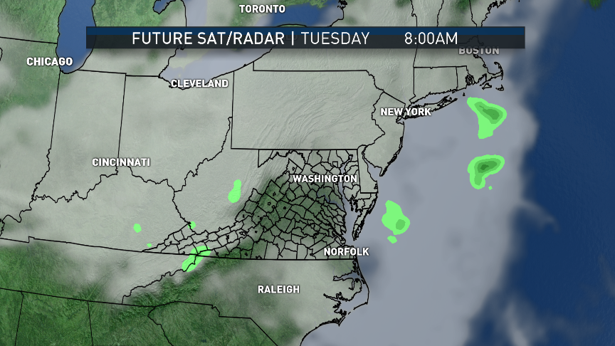
• Some lingering drizzle, damp roadways in the morning
• Mild in the morning, likely in the 40s
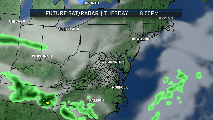
• Partial clearing, some temperatures end up warm in the afternoon
• Chillier air moves in with northerly winds in the evening and at night
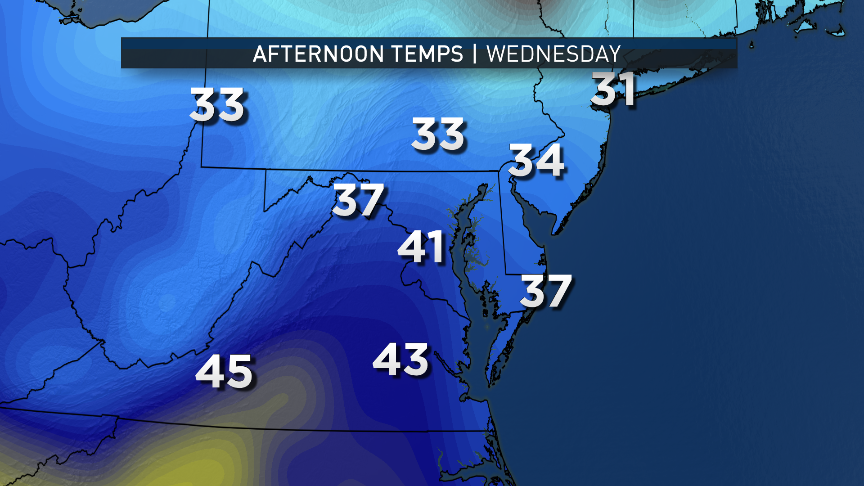
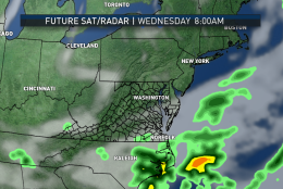
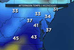
WEDNESDAY
• Breezy and chilly
• Temperatures below average, may actually fall through the day
• Clouds in the morning, becoming mostly sunny during the afternoon
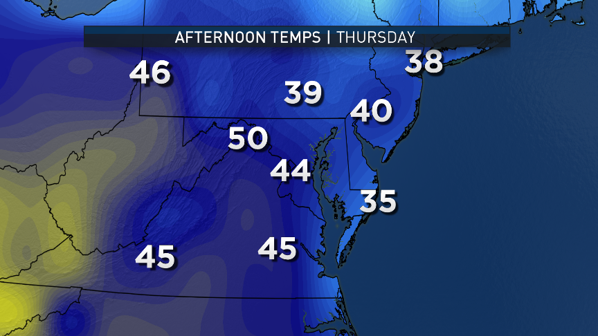
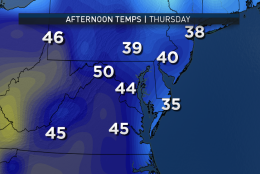
THURSDAY
• Freezing temperatures in the morning
• Near total sunshine, but unseasonably chilly
• Very dry air
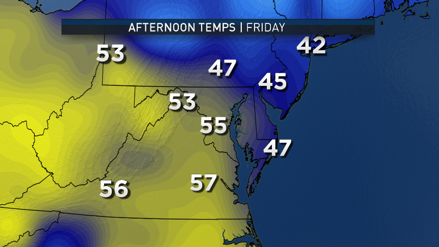
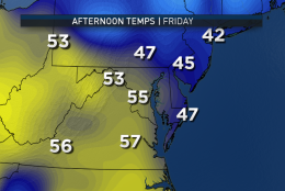
FRIDAY
• Very chilly start, some more freezing especially in the rural areas
• Mostly sunny; quick warm up
• Temperatures feeling like spring again during the afternoon