A study is underway to see if a plan to shore up a disappearing island in the middle of the Chesapeake Bay is feasible.
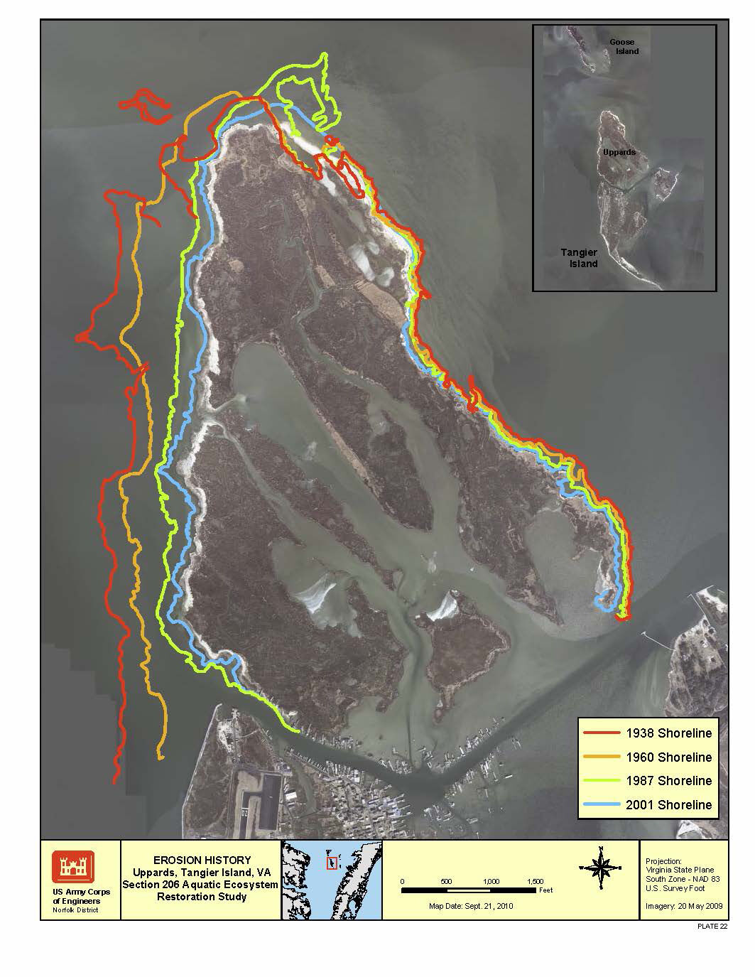
Tangier Island, Virginia, has lost about two-thirds of its land mass since 1850. Studies estimate what’s left will become uninhabitable wetlands around 2050 if nothing is done.
Two things are causing double trouble for over 400 residents of the island. Heavy ice age glaciers that once weighed down land to the north, caused land around the Chesapeake Bay to rise. Ever since the glaciers receded, the land that was once pushed up has been slowly sinking. On top of that, sea levels are rising, which adds to Tangier’s longtime problems with flooding and erosion.
Currently, material that the Army Corps of Engineers regularly dredges from around the island to allow for the safe passage of boats is left just offshore of an uninhabited part of the island called the Uppards. But that material eventually gets washed away.
Now, the Corps is beginning to study if it makes sense to build a permanent structure to hold that sediment in place.
“Once it’s constructed, it would immediately start providing benefits,” said Keith Lockwood, chief of the water resources division of the Norfolk District of the Army Corps of Engineers. “We’d have a place to put dredge material beneficially, and keep it there.”
Earlier this year, Democratic Sens. Tim Kaine and Mark Warner of Virginia secured $300,000 in federal money to conduct the study. As part of the effort, a drone was put to work last week.
“The team has gone out to Tangier to fly the drone over the Uppards, and gain the latest and greatest physical survey information,” Lockwood said.
The imagery is expected to be processed in the next few weeks to help determine exactly where a permanent structure should go, how big it should be, and what it should be made out of.
The hope is that the Corps can work on engineering, design and permitting for the structure in fiscal year 2024, and complete construction in fiscal year 2025.
“We’re looking at all opportunities available to us to provide protection for the future in the face of storms, and erosional forces,” said Lockwood.