A new study released by the Montgomery County, Maryland, Planning Department reveals a number of the county’s 11 Purple Line stations, as they are designed now, could do a lot more to become pedestrian-friendly.
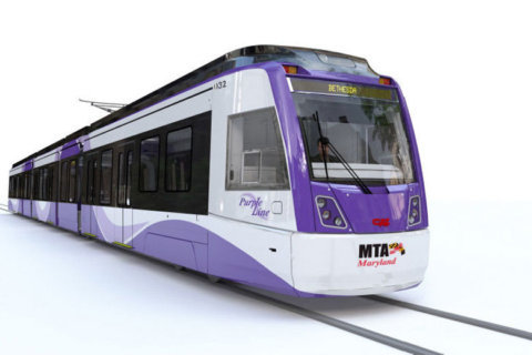
Metro’s Purple Line project aims to connect Prince George’s County from the New Carrollton station to Montgomery County’s Bethesda Station.
This is especially noteworthy because the majority of those stations are designed to be accessible without the use of cars.
The light rail line with more than 20 stations, including major transit hubs of College Park, Silver Spring and Bethesda, is scheduled to open in 2023. The project, however, is in jeopardy, as the firms, together known as Purple Line Transit Constructors, announced in May that they were pulling out of the project, citing the need for more than $500 million of extra funding due to legal problems.
The Planning Department began its survey before the PLTC said it wanted to leave the project.
For the most part, the stations already in locations with a high population density are pedestrian-friendly. The stations in slightly more remote areas, surrounded by higher-speed roads, are significantly less friendly.
The report rated the Montgomery County stations on how ready they are to be pedestrian-friendly upon the Purple Line’s opening, with recommended short-term improvements and after long-term improvements.
Only four stations scored in the first category: Bethesda, Lyttonsville, Silver Spring Transit Center and Silver Spring Library.
Short-term improvements would help Connecticut Avenue and Takoma-Langley Transit Center improve significantly.
The remainder of the stations, even in the long term, would have some trouble making pedestrians feel comfortable, the report found.
The key recommendations to help the stations become better suited to pedestrians in the near feature include:
- Reducing speed limits to 25 mph close to stations
- Enforcing speed with cameras
- Creating wider and safer pedestrian crossings
- Building designated bike lanes around the stations
The full report, which came out June 25, is available from the Planning Commission.