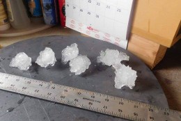

WASHINGTON — Shelly Rencher could feel her Clarksburg, Maryland, house shaking as gigantic hailstones torpedoed down on Tuesday, June 21.
Earlier that day, Rencher and her family were bombarded by a thunderstorm that went on to produce a weak tornado in Howard County, the National Weather Service later confirmed.
It was not the first storm, but a second, isolated thunderhead later in the afternoon that — after surging over Sugarloaf Mountain — dropped what could have been one of the largest hailstones ever observed in Maryland.
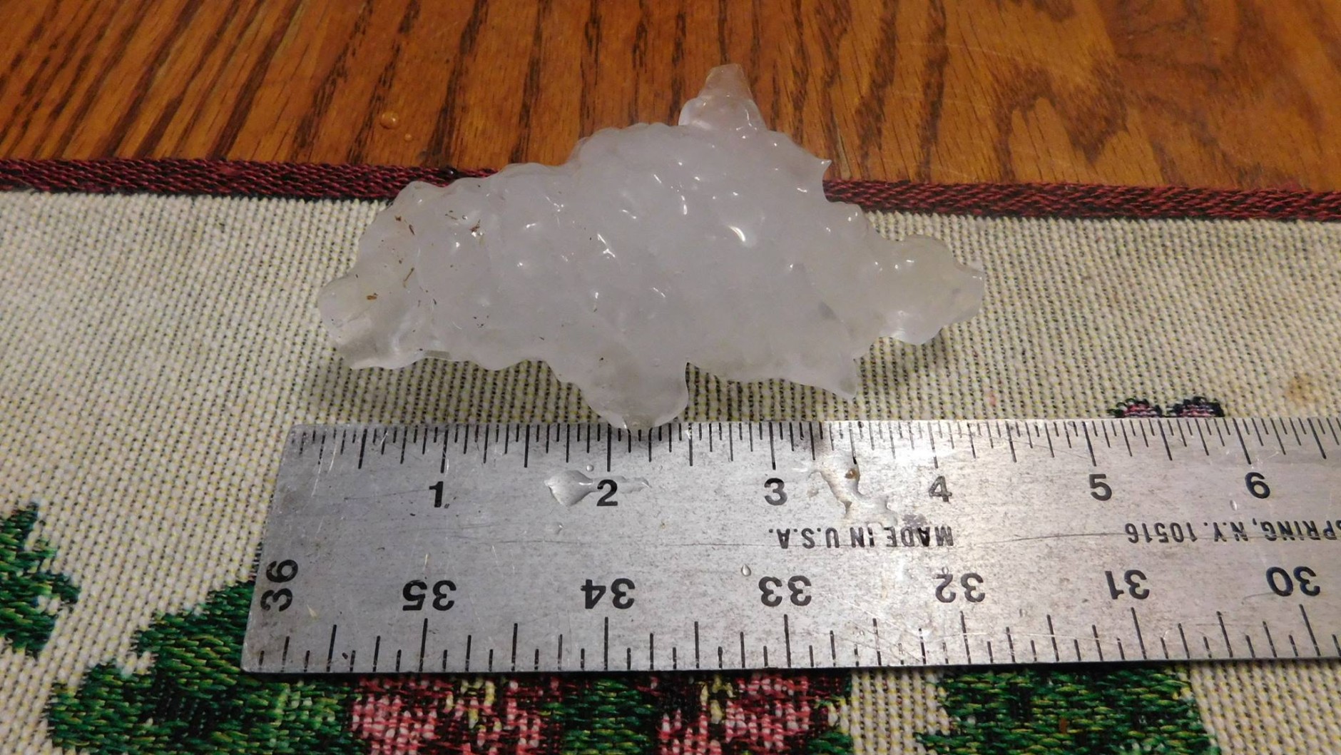
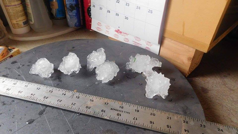
The family snapped a photo of a jagged hailstone measuring roughly 4.25 inches from spire to spire and sent it to WTOP. They immediately placed the hailstone in their freezer for safe keeping. The NWS said it will confirm the exact size of the hailstone in the coming week.
“It was extremely intense. You could feel [the hail] beating on the house. We’ve lived up there for about four years and that was the most intense storm we’ve seen ever,” Rencher said.
The cacophony spurred flashbacks of an Arkansas hailstorm that Rencher said totaled her car several years before she moved to Montgomery County. Much to her surprise, Tuesday’s storm produced no visible damage.
“I put a five gallon bucket over my head and ran out to check my car and we had no damage at all,” she added.
A worker at the Little Bennett Golf Course said that a few cars in the range’s parking lot had dents but that damage was otherwise minor.
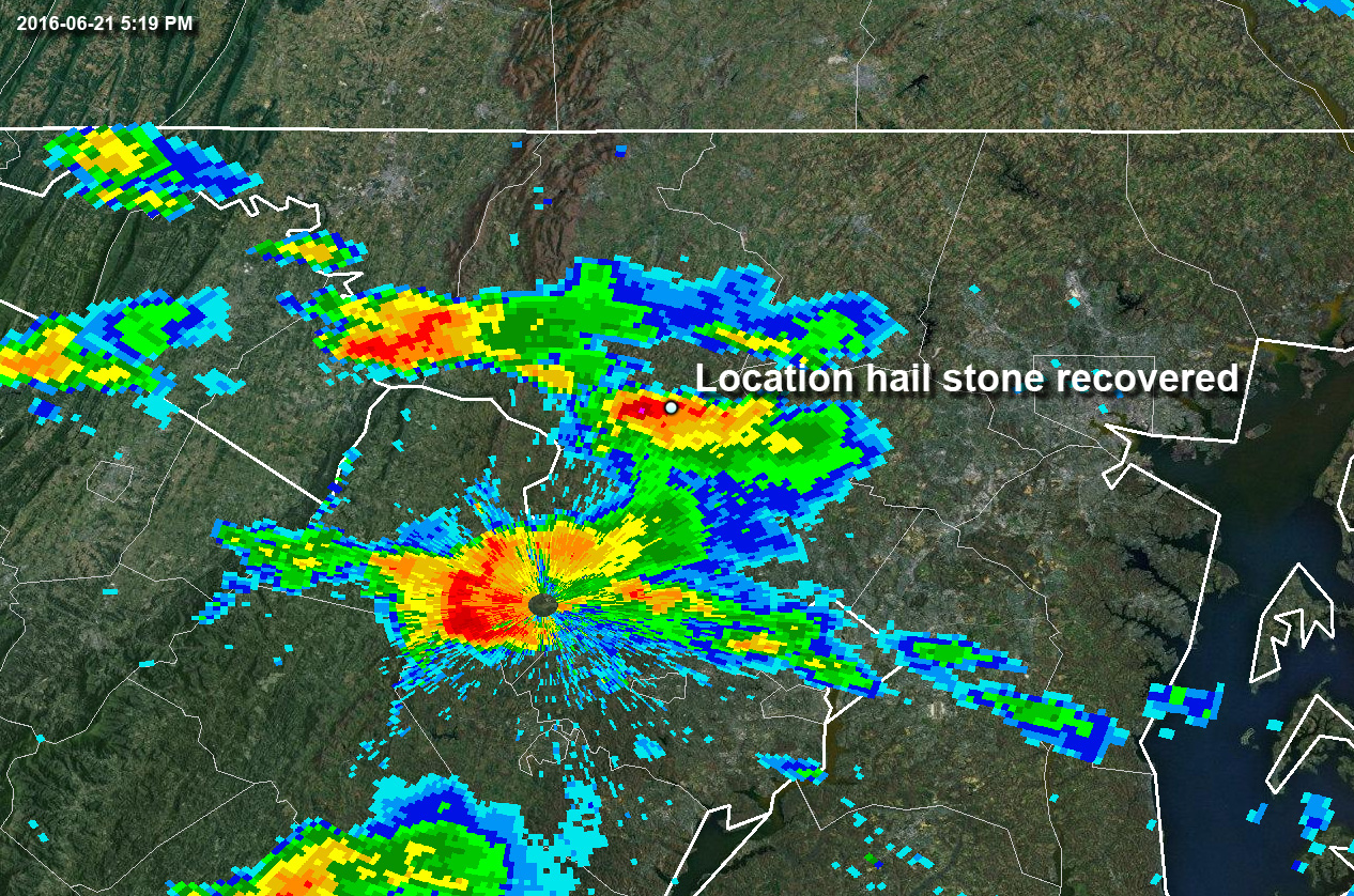
The small but robust storm originated over Winchester, Virginia, where a single storm split apart. The eastward moving cell inched across northern Loudoun County and into upper Montgomery County shortly after 5 p.m., unleashing huge hailstones larger than golf balls. The storm deviated from its original headway, moving left of its parent storm’s track, making a beeline straight for Little Bennett Regional Park. Left-moving storms such as the one to hit Clarksburg and Hyattstown are known to produce extremely large hailstones.
Matt Elliott with the NWS in Sterling, Virginia, said that there have been only a handful instances where hail larger than softballs has been reported locally. Between 1950 and 2015, four-inch-diameter hail or larger was documented four times in Maryland. A softball-sized hailstone was confirmed in Timonium last June. Hail up to the size of grapefruits was observed in the storm that produced the devastating La Plata tornado in April 2002. Grapefruit-sized hail was also observed in Baltimore in 1970.
“Hail is not super common here compared to other places. We’ve had some strong supercells this year and they’ve produced long hail,” Elliott said. These supercells — with their strong, spiraling updrafts — mold hailstones into irregular, often jagged shapes. The hail tumbles inside the storm, melting and refreezing as it rises and falls several thousand feet at a time.
Earlier this year, hail up to the size of baseballs fell in Rockville. Similar to Tuesday’s storm, the early May thundercloud was a left-mover, splitting from its parent cell in northern Virginia.
Elliott said there are only eight documented sightings of three-inch-diameter hail or larger in Maryland during the same period.
The largest hailstone ever observed in Virginia measured five inches from end to end — roughly the size of a cantaloupe — after it fell from a thunderstorm in July 1968.
Editor’s note: This story has been updated to reflect the correct year of the La Plata tornado.


