National Weather Service confirms 3 tornadoes in Maryland

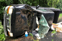
Three tornadoes struck two Maryland counties as Isaias battered the region Tuesday, the National Weather Service said.

Preliminary information from a National Weather Service survey concluded that two tornadoes touched down in St. Mary’s County and one hit Calvert County.

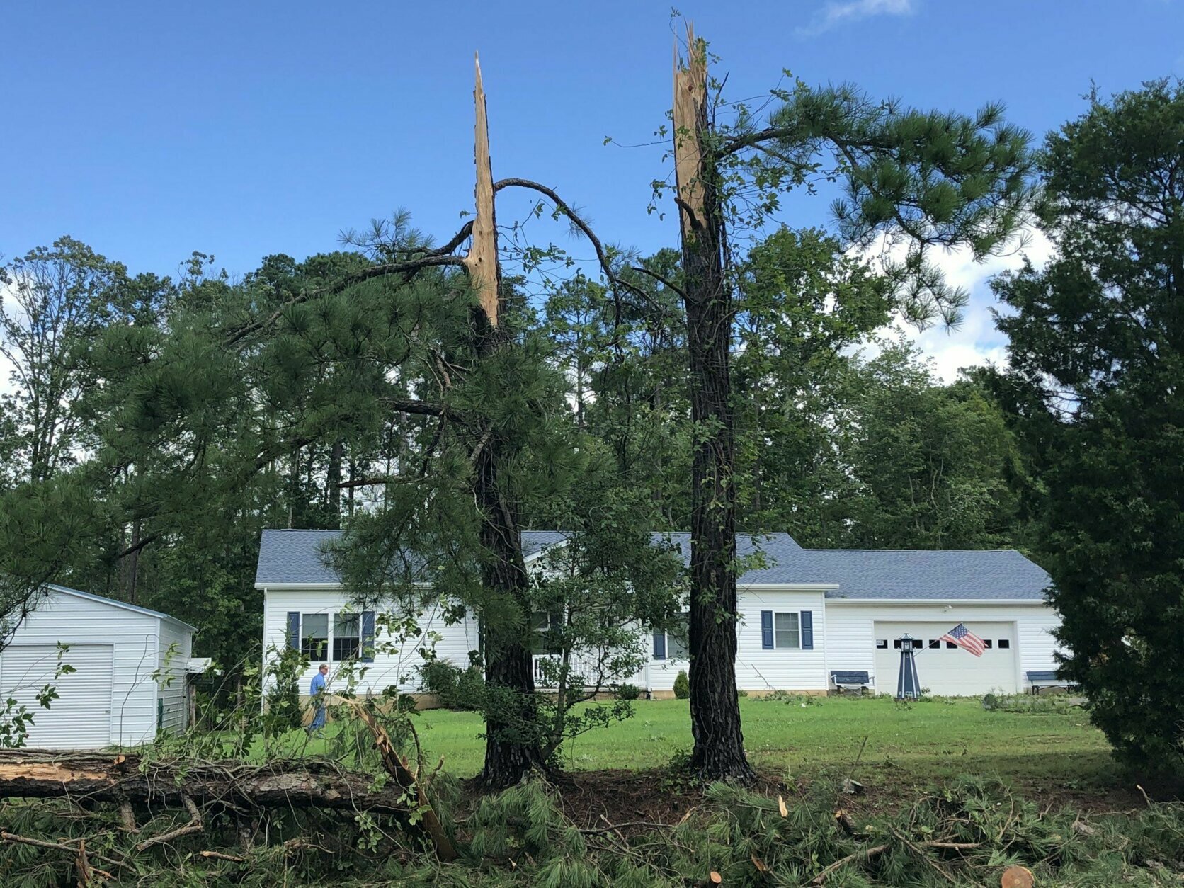
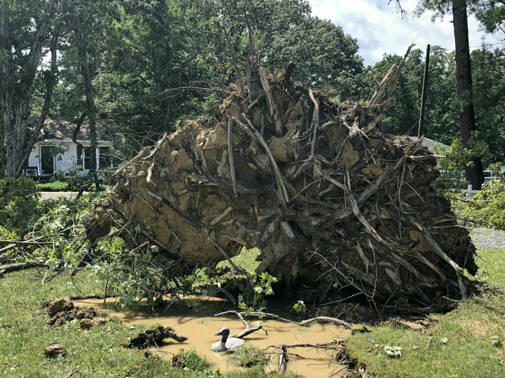
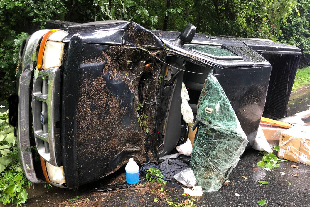
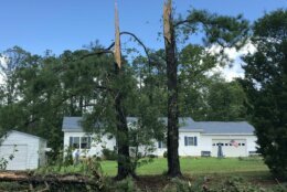
An EF-0 tornado was on the ground from 6:27 a.m. to 6:28 a.m. in the area of Ridge in St. Mary’s County. It had a peak wind of 80 mph, a path length of 0.91 miles and a width of 75 yards.

From 6:30 a.m. to 6:43 a.m., an EF-1 tornado struck a 7.3-mile path with a width of 100 yards in Piney Point, with a peak wind of 100 mph.

In Calvert County, an EF-1 tornado touched down in Dares Beach around 7:30 a.m. The tornado had a peak wind of 90 mph, a path length of 2.2 miles and a path width of 100 yards.

The National Weather Service will issue a detailed report Wednesday.

Abigail Constantino

Abigail Constantino started her journalism career writing for a local newspaper in Fairfax County, Virginia. She is a graduate of American University and The George Washington University.

More tree damage in Leonardtown, Maryland. (WTOP/Michelle Basch)
Sheared-off trees on Point Lookout Road, in Leonardstown, Maryland. (WTOP/Michelle Basch)
An overturned RV in Leonardtown, Maryland. (WTOP/Michelle Basch)
An uprooted tree in Leonardtown, Maryland, Aug. 4, 2020. (WTOP/Michelle Basch)
One of the many huge, uprooted trees near Charlie Mills’ home along Point Lookout Rd. in Leonardtown, Maryland, where the National Weather Service said a tornado was seen touching down Tuesday morning. (Michelle Basch/WTOP)
Windflowers (yes, that’s the common name) in the D.C. area survived Isaias. (Kate Ryan/WTOP)
A Pepco crew assesses a fallen oak tree on 27th Street Northwest, south of Military Road, on Tuesday, Aug. 4, 2020. (WTOP/Dave Dildine)
truck accident on West Lake Drive
On West Lake Drive near Tuckerman Lane in Montgomery County, a truck driver was struck by a falling tree. (Courtesy Montgomery Co. Fire and Rescue/Pete Piringer)
car travels through a puddle
A car passes through a deep puddle on flood-prone Broad Branch Road in Northwest D.C. (WTOP/Dave Dildine)
Main Street in Ellicott City looked good around 8 a.m. Tuesday morning but with several hours of rain still to come. If rain becomes torrential, new alarms can warn of flooding. (Neal Augenstein/WTOP)
Main Street in Ellicott City flows downhill to the Patuxent River. While a rising river after lots of rain is always a potential problem, in Ellicott City the 2016/2018 devastating floods were from torrential rain in short period of time. (Neal Augenstein/WTOP)
No Parking signs in place on Main Street. Many businesses in this stretch were devastated in 2018 and 2016 floods. (Neal Augenstein/WTOP)
Old Town Alexandria sandbags in front of a business
Sandbags are up against the doors of Old Town Books in Alexandria. Old Town is prone to flooding. (WTOP/Melissa Howell)
Old Town Alexandria is prone to flooding. The city ran out of sandbags when they were distributed on Aug. 3. (WTOP/Melissa Howell)
(1/19)
truck accident on West Lake Drive
car travels through a puddle
Old Town Alexandria sandbags in front of a business
Federal News Network Logo
Log in to your WTOP account for notifications and alerts customized for you.

Sign up