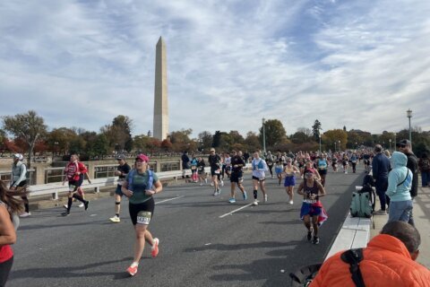
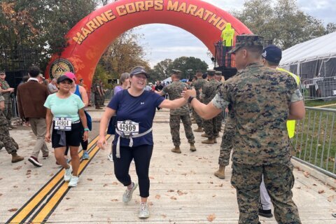
Thousands of people are running around some of the D.C.-area’s most iconic sights and landmarks this weekend for the 49th annual Marine Corps Marathon.
The 26.2-mile race began Sunday morning and road closures are in place for the one of the largest marathons in the U.S. and the world, earning it the nickname “The People’s Marathon.”
Here’s what you need to know.
- Q:
What roads will be closed along the race route in DC and Virginia?
- A:
At approximately 4 p.m. on Saturday, Oct. 26, southbound Route 110 will be closed from Washington Boulevard to Route 1 and will reopen at 5 p.m. on Sunday, Oct. 27.
The following road closures will take place in Arlington County on race day:
From approximately 3 a.m. until 6 p.m.
- Fort Myer Drive, from Eastbound Langston Boulevard to N. Meade Street
- N. Lynn Street, from 19th Street N. to N. Meade Street
- N. Moore Street, from 19th Street N. to Wilson Boulevard
- Wilson Boulevard, from N. Oak Street to Southbound Route 110
- 17th Street N., from Clarendon Boulevard to N. Lynn Street
- Northbound lanes of N. Oak Street, from Wilson Boulevard to 18th Street N.
- N. Oak Street, from Clarendon Boulevard to 17th Street N.
- N. Nash Street, from Wilson Boulevard to 17th Street N.
- N. Kent Street, from 1691 N. Kent Street to Wilson Boulevard
- Fairfax Drive, from N. Pierce Street to Fort Myer Drive
- N. Meade Street, from Fairfax Drive to N. Marshall Drive
- N. Marshall Drive, from N. Meade Street to Route 110
- Richmond Highway from I-66 to the 1200 block of Richmond Highway
- Southbound Route 110, from I-66 to Washington Boulevard
- Northbound Route 110, from Route 1 to I-66/Wilson Boulevard
- S. Fern Street, from 12th Street S. to Rotary Road
- S. Eads Street, from 12th Street S. to Rotary Road
- Army Navy Drive, from S. Hayes Street to 12th Street S.
- Washington Boulevard, from Route 27/Northbound I-395 split to George Washington Parkway/Boundary Channel
- I-395 South exit 8B, ramp to Route 110 North
- I-395 North slip ramp into I-395 North HOT lanes
- I-395 South HOT lanes at Route 1
- I-395 North HOT lanes at Seminary Road
- I-395 North Exit 8B to Pentagon/Route 27
- I-395 South Exit 8A to Pentagon South Parking
- Eastbound Washington Boulevard ramp to Eastbound Route 27
From approximately 6 a.m. until 11 a.m.
- 19th Street N., from N. Lynn Street to Fort Myer Drive
- N. Nash Street from Key Boulevard to Fort Myer Drive
- Fort Myer Drive, from Key Bridge to Westbound Langston Boulevard
- Fort Myer Drive, from 19th Street N. to Langston Boulevard
- N. Moore Street, from 19th Street N. to Langston Boulevard
- Langston Boulevard (Eastbound lanes only), from N. Lynn Street to N. Kirkwood Road
- Spout Run Parkway (Westbound lanes only), from Langston Boulevard to George Washington Parkway
- N. Lorcom Lane, from N. Edgewood Street to Spout Run Parkway
- N. Lynn Street, from 19th Street N. to Key Bridge
- N. Rhodes Street, from Key Boulevard to Eastbound Langston Boulevard
- N. Veitch Street, from 19th Street N. to Eastbound Langston Boulevard
From approximately 6 a.m. until noon
- Westbound 15th Street S., from S. Eads Street to S. Bell Street
- Ramp from Southbound Richmond Highway to 15th Street S.
- Ramp from Northbound Richmond Highway to 15th Street S.
- Ramp to Northbound Richmond Highway from 15th Street S.
- Southbound Richmond Highway, from Southbound I-395 to the 1200 block of Richmond Highway
From approximately 6 a.m. until 5 p.m.
- Fort Myer Drive, from Key Bridge to Eastbound Langston Boulevard
- N. Nash Street, from Westbound Langston Boulevard to Eastbound Langston Boulevard
- N. Moore Street from Langston Boulevard to 19th Street N.
- Long Bridge Drive, from Boundary Drive to 12th Street S.
- 6th Street S., from Long Bridge Drive to S. Ball Street
- S. Ball Street, from 6th Street S. to 10th Street S.
- 10th Street S., from Long Bridge Drive to S. Ball Street
- 12th Street S., from S. Eads Street to Crystal Drive
- Southbound Richmond Highway from I-395 Southbound to the 1200 block of Richmond Highway
- Crystal Drive, from 12th Street S. to 23rd Street S.
- 15th Street S., from S. Bell Street to Crystal Drive
- 18th Street S., from S. Bell Street to Crystal Drive
- 20th Street S., from S. Bell Street to Crystal Drive
- I-395 North Exit 10A to Boundary Channel Drive
- I-395 South Exit 10A to Boundary Channel Drive
- I-395 South Exit 9 to Clark Street
In D.C., the following roads will be closed:
From 3:45 a.m. to 2 p.m.
- Jefferson Drive SW from 3rd Street SW to 15th Street SW
- 7th Street NW from Constitution Avenue NW to Independence Avenue SW
- Madison Drive NW from 3rd Street NW to 15th St NW
- 4th Street NW from Constitution Avenue NW to Independence Avenue NW
From 5:30 a.m. to 10 a.m.
- Foxhall Road NW from MacArthur Boulevard NW to Canal Road NW
- Clark Place NW from Q Street NW to Canal Road NW
- Reservoir Road NW from MacArthur Boulevard NW to Canal Road NW
- Arizona Avenue NW from Carolina Place NW to Canal Road NW
- Georgetown Canal Road Entrance
- Canal Road NW from M St NW to Chain Bridge Drive
From 5:30 a.m. to 10:30 a.m.
- Francis Scott Key Bridge (all lanes)
- M Street NW from Canal Road NW to Wisconsin Avenue NW
- 35th Street NW from Prospect Place NW to M Street NW
- 34th Street NW from Prospect Place NW to Cady’s Alley
- Bank Alley from Prospect Place NW to M Street NW
- 33rd Street NW from Prospect Place NW to C&O Canal
- Potomac Street NW from Prospect Place NW to M Street NW
- Wisconsin Avenue from M Street NW to K Street NW
- Grace Street NW from Wisconsin Avenue NW to 33rd Street NW
From 5:30 a.m. to 11 a.m.
- 31st Street NW from Washington Harbor to South Street NW
- 30th Street NW from Washington Harbor to M Street NW
- 29th Street NW from K Street NW to M Street NW
- Whitehurst Freeway from M Street NW to K Street NW
- K Street NW from 34th Street NW to 25th Street NW
- 27th Street NW from K Street NW to I Street NW
- I Street NW from 27th Street NW to Virginia Ave NW
From 5:30 a.m. to 11:30 a.m.
- Waterside Drive NW from Massachusetts Avenue NW to Rock Creek Parkway and Potomac Parkway NW
From 5:30 a.m. to 11:45 a.m.
- Rock Creek and Potomac Parkway NW (northbound) to Beach Drive
- Rock Creek and Potomac Parkway NW (southbound) from Shoreham Drive NW
- Shoreham Drive NW (southbound) from Calvert Street to Rock Creek Parkway and Potomac Parkway NW
- Beach Drive NW from Rock Creek and Potomac Parkway NW to Calvert Street
- Virginia Avenue NW from New Hampshire Ave NW to Rock Creek Parkway and Potomac Parkway NW
From 5:30 a.m. to noon
- F Street NW from New Hampshire Ave NW to Rock Creek Parkway and Potomac Parkway NW
- 25th Street NW from F Street NW to Rock Creek Parkway and Potomac Parkway NW
- Rock Creek Parkway and Potomac Parkway NW from Beach and Shoreham Drives NW to Ohio Drive
- Parkway Drive closed from Rock Creek Parkway to Lincoln Circle
From 5:30 a.m. to 12:30 p.m.
- Independence Avenue SW from Maine Avenue SW to Ohio Drive
From 5:30 a.m. to 12:45 p.m.
- East Basin Drive from Maine Ave SW to Ohio Drive SW
- Buckeye Drive from I-395 ramps to Ohio Drive SW
From 5:30 a.m. to 1 p.m.
- 1st Street from Constitution Ave NW to Independence Ave SW
- Pennsylvania Avenue NW from 3rd Street NW to 1st Street NW
- Maryland Avenue SW from 1st Street SW to 3rd Street SW
- Lincoln Circle from 23rd Street NW to 23rd Street SW
- West Basin Drive from Independence Ave SW to Ohio Drive SW
- 17th Street from WWII Memorial to Independence Ave SW
- Ohio Drive SW from East Basin Drive SW to 23rd Street NW
From 5:30 a.m. to 1:15 p.m.
- Independence Avenue from 15th Street SW to 23rd Street SW
- Maine Avenue SW from East Basin Drive to Independence Avenue SW
From 5:30 a.m. to 2 p.m.
- 15th Street from Constitution Ave NW to Maine Avenue SW
- Independence Avenue from 4th Street SW to 15th Street SW
- 12th Street SW from Independence AVE SW to Jefferson Drive SW
- 12th Street NW from Madison Drive NW to Constitution Ave NW
- 14th Street NW/SW from Constitution Ave NW to I-395
- Q:
How will parking be affected in Arlington and DC?
- A:
There will be increased police presence in Arlington, and they are urging drivers to be mindful of the closures and to be alert for increased pedestrian traffic.
Motorists should be on the lookout for temporary “No Parking” signs, Arlington police said in a statement. Illegally parked vehicles will be ticketed or towed.
- Q:
How to get to the marathon
- A:
Race organizers have encouraged runners and spectators to ride on public transit to avoid the road closures.
Metro will open early at 5 a.m. on Sunday and there’s no scheduled track work to slow down trains from transporting runners, according to WMATA.
Riding Metro will cost $2.50 flat for a one-way trip.
The closest Metro station to the starting line is Pentagon station which can be used using the Blue and Yellow lines. To avoid the crowds, you may want to get off in Pentagon City instead.
The Arlington Cemetery station is closed until 8:30 a.m.
The trains will run on their normal weekend schedule.
Some Metrobus routes will be diverted to Pentagon City on Saturday and Sunday to accommodate the race and its related events.
Over the weekend, these Metrobus routes will be impacted: 7A, 10A, 16A, 16C, 16E, 22A.
On Sunday, all Metrobus service will be moved from the Rosslyn bus terminal to North Oak Street between Wilson Boulevard and North 18th Street.
These routes will be detoured Sunday: 4B, 7A, 10A, 22A, 23A, 23B, 16A, 16C, 16E, 38B, 32, 36 42, 43, 52, 64, 70, 74, 79, D6, MW1, P6, S2.
- Q:
What time will the Marathon begin?
- A:
Starting on Route 110 in Arlington, Virginia, the MCM50K kicks off at 7:15 a.m., the MCM at 7:55 a.m., while the MCM10K will start at 7:50 a.m. on the National Mall.
Runners and spectators will have to go through preliminary screening checkpoints and aren’t allowed to bring prohibited items like unauthorized backpacks or weapons.
The Runners Village in the North Pentagon parking lot is the starting point for race participants.
- Q:
Where to watch
- A:
Here are some locations where MCM recommended spectators gather to watch the race:
- MCM start line on Route 110 in Arlington — get there by Metro using Rosslyn or Pentagon stations
- Lincoln Memorial in D.C. to see runners from miles 10-16 — get there by walking across Arlington Memorial Drive
- National Mall in D.C. to see runners from miles 11-19 — get there by heading east on Independence Avenue, go past the Washington Monument
- Finish line at the Marine Corps War Memorial in Arlington — get there by taking Metro to Rosslyn or by MCM shuttle from 23rd Street
If you can’t make it in person to cheer a runner on, you can track their progress online in real-time.
- Q:
Where is the course?
- A:
There’s an interactive map of the course on MCM’s website.
The race starts and ends in Arlington County, Virginia. Runners will race through Rosslyn and the District, including the National Mall. The 20-mile journey ends at the Marine Corps War Memorial.
Get breaking news and daily headlines delivered to your email inbox by signing up here.
© 2024 WTOP. All Rights Reserved. This website is not intended for users located within the European Economic Area.