Starting Thursday, D.C. Water says it will use drones to assess the above-ground conditions along the 54-mile Potomac Interceptor, which carries wastewater from Loudoun and Fairfax counties, into Montgomery County and ultimately to the Blue Plains Advanced Wastewater Treatment Plant.
The goal of the drone assessments is to understand the topography along the sewer line, including areas where there may be rocks or boulders that need additional ground inspections
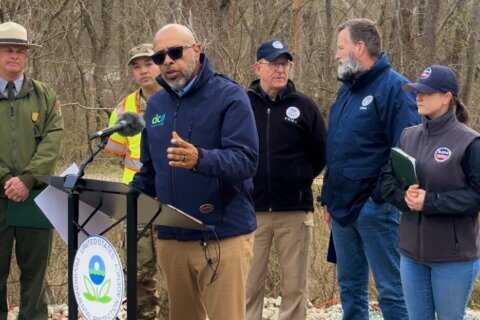
“We might say, ‘OK, we need to go back and look at these sections with ground penetrating radar, that will help determine if those areas have additional rocks or boulders,'” said Sherri Lewis, with D.C. Water.
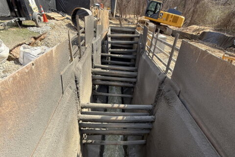
The data will support accurate mapping and strategic planning for D.C. Water’s ongoing 10-year, $625 million rehabilitation of the Potomac Interceptor.
During the Jan. 13 collapse of the sewer line along Clara Barton Parkway, large rocks and boulders that were excavated and used as backfill during the original construction of the Interceptor, in the 1960s, blocked the pipe, creating overflow that’s not normally seen when a pipe fails.
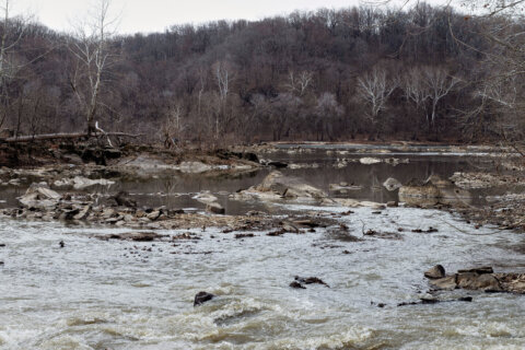
More than 240 million gallons of sewage flowed into the Potomac River over the next several days.
D.C. Water said the data collected during the drone flights, are scheduled for March 26 through April 3, on weekdays, between the hours of 8 a.m. and 3 p.m., depending on the weather.
“They’re going to be carrying lidar scanning equipment, so they’re going to be larger than the typical drone,” Lewis said. “They’ll fly between 300 and 350 feet, and they’re going to have numerous takeoffs and landings, so they can change batteries, and things like that.”
Lidar — light detection and ranging — scanning creates high-resolution, three-dimensional maps of buildings, vegetation and the ground surface.
Lewis said the drones will have flashing navigation lights.
“We’ve coordinated withe FAA, because this is restricted airspace along parts of the alignment,” inside the Beltway, Lewis said.
Lewis said people walking along the C&O Canal could see the drones overhead.
“We don’t want people to be alarmed, we want them to understand that this is routine inspections,” she said.
Lewis said D.C. Water will be placing yellow and black temporary ground markers throughout the area.
“Please don’t touch or move them, because they’re necessary to ensure the accuracy of the drone flights and the data we’re getting,” she said.
D.C. Water said the drones do not emit any harmful beams, or pose any risk to public health or safety.
Get breaking news and daily headlines delivered to your email inbox by signing up here.
© 2026 WTOP. All Rights Reserved. This website is not intended for users located within the European Economic Area.